Misumi West Port
A carefully engineered Meiji-era harbour of cut stone, with canals and quays, lies near the tip of the peninsula. It is one of the few ports of its era to survive largely intact.
Minimalistyczny plakat z mapą · Japonia
32.6222° N / 130.6618° E
A coastal city at the root of the Uto Peninsula, facing two inland seas with a Meiji-era stone port at its western tip.

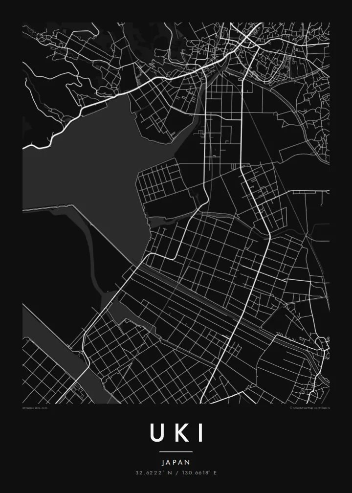


Jedno miasto, pięć nastrojów
Dotknij stylu, aby zobaczyć go na ścianie. Każdy styl kosztuje tyle samo — jako druk, w ramie lub pliki HD.
 Rzeczywiste piksele · plik do druku 24 × 36″
Ostrość do druku
To jest wycinek w skali 100% z prawdziwego pliku do druku. Każdy plakat — drukowany, oprawiony lub pobrany — jest renderowany na naszych serwerach w rozdzielczości 300 DPI, do 7,200 × 10,800 pikseli, dzięki czemu nawet najmniejsze ulice pozostają ostre na wydruku 24 × 36″.
Na ścianie


Mapa
Uki sits in Kumamoto Prefecture at the base of the Uto Peninsula, which reaches west toward the Amakusa islands. On a map the city stretches along the peninsula. The Ariake Sea lies to the north and the Yatsushiro Sea to the south, and small towns and fishing harbours are strung along both shores. Hills run down the centre of the peninsula, with farmland and orchards on their lower slopes.
At the western end lies Misumi West Port, a stone harbour built in the late nineteenth century to Dutch designs. It is now a UNESCO World Heritage site as part of the Sites of Japan's Meiji Industrial Revolution. The Yatsushiro Sea off Uki's coast is also associated with the shiranui, a rare optical phenomenon of flickering lights on the water described in local tradition.
A Uki map poster traces a long, narrow city defined by its shorelines. Coastal roads follow the edge of the land, while a railway runs out along the peninsula toward the port. Smaller settlements appear as clusters where valleys meet the sea. The water surrounding almost every side gives the map a strong, clean silhouette.
A carefully engineered Meiji-era harbour of cut stone, with canals and quays, lies near the tip of the peninsula. It is one of the few ports of its era to survive largely intact.
The Ariake Sea and the Yatsushiro Sea border the city on opposite sides. On the map the peninsula becomes a long strip of land between two open bodies of water.
Hills run along the centre of the peninsula, with roads and small valleys branching toward the coasts. This inland ridge divides the city's northern and southern shores.
Spersonalizuj
Dodaj datę, imię lub własny tekst, zmień styl, rozmiar lub orientację.
Darmowy podgląd ma niską rozdzielczość i znak wodny. Wydruki i pliki HD są renderowane w 300 DPI, do 7,200 × 10,800 px, bez znaku wodnego.
Dlaczego Uki
Uki is a place of coastal drives, fishing harbours and evenings looking across the water toward Amakusa. A map of the peninsula keeps that geography in view for residents, for visitors and for anyone with family roots in Kumamoto.
Choose Classic black & white, Noir, Paper, Blueprint or Sand, and add your own title, subtitle and coordinates. The free preview lets you check the framing first. HD files cost $9, and printed posters can ship from partners in more than 30 countries.
Zamów plakat Uki| Rozmiar wydruku | Rozdzielczość | Pliki |
|---|---|---|
| 30 × 40 cm (11.8 × 15.7″) | 3,543 × 4,724 px | PNG · PDF |
| 29.7 × 42 cm (A3, 11.7 × 16.5″) | 3,508 × 4,961 px | PNG · PDF |
| 42 × 59.4 cm (A2, 16.5 × 23.4″) | 4,961 × 7,016 px | PNG · PDF |
| 45.7 × 61 cm (18 × 24″) | 5,400 × 7,200 px | PNG · PDF |
| 50 × 70 cm (19.7 × 27.6″) | 5,906 × 8,268 px | PNG · PDF |
| 61 × 91.4 cm (24 × 36″) | 7,200 × 10,800 px | PNG · PDF |
Dla porównania: darmowy podgląd ma 900 px szerokości, znak wodny i jest przeznaczony na ekran. Pliki HD mają do 8× wyższą rozdzielczość w każdym kierunku i drukują się wyraźnie w pełnym rozmiarze plakatu.
Wybierz styl na górze strony, a następnie wybierz Plakat drukowany — rozmiar i opcjonalnie ramę — albo Pliki cyfrowe HD. Płatność zajmuje jeden krok, a strona zamówienia aktualizuje się od razu po jej zaksięgowaniu.
Jest drukowany na papierze matowym premium 200 g/m² w jednym z sześciu rozmiarów, od 30 × 40 cm do 24 × 36″. Drukowane plakaty zaczynają się od {printFrom}, z darmową wysyłką.
Tak. Wybierz ramę z litego drewna w kolorze czarnym, białym, naturalnego dębu lub ciemnego drewna. Zawiera nietłukące szkło i jest gotowa do powieszenia. Plakaty w ramach zaczynają się od {framedFrom}, z darmową wysyłką.
Wysyłka jest darmowa na całym świecie. Każdy plakat drukuje najbliższy z naszych partnerów drukarskich w ponad 30 krajach i zwykle dociera w 3–7 dni roboczych. Status i numer przesyłki znajdziesz w Moich zamówieniach.
Wyślij nam zdjęcie w ciągu 14 dni od dostawy, a bezpłatnie wydrukujemy go ponownie lub zwrócimy pieniądze.
Tak. W edytorze na tej stronie zmień tytuł, podtytuł i linię ze współrzędnymi na dowolne, po czym wybierz styl i rozmiar. Zamówienia drukowane, w ramie i cyfrowe zawsze odzwierciedlają dokładnie Twój projekt.
Za $9 otrzymujesz pliki PNG w 300 DPI oraz PDF gotowe do druku, we wszystkich sześciu rozmiarach, bez znaku wodnego, do wydruku w dowolnym miejscu. Nie masz pewności? Najpierw pobierz darmowy podgląd ze znakiem wodnym.
