Rhine and Main
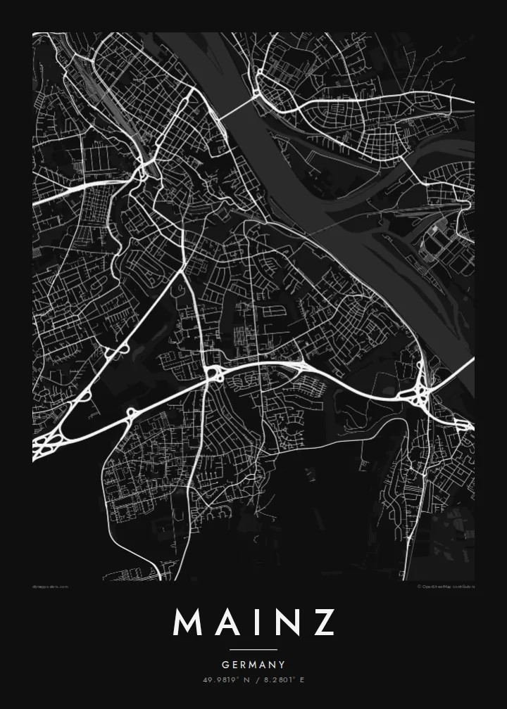
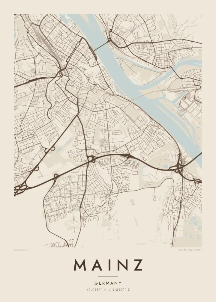
The Main joins the Rhine just opposite the city. On the map the two broad bands of water meet in a wide junction that frames Mainz on its eastern side.
Minimalistický mapový plagát · Nemecko
49.9819° N / 8.2801° E
An old Rhine city facing the mouth of the Main, with a cathedral core and a planned Neustadt to the north



Jedno mesto, päť nálad
Klepnutím na štýl si ho pozrite na stene. Všetky štýly stoja rovnako — tlačené, zarámované aj ako HD súbory.
 Skutočné pixely · tlačový súbor 24 × 36″
Ostré ako pri tlači
Toto je 100% výrez zo skutočného tlačového súboru. Každý plagát — tlačený, zarámovaný alebo stiahnutý — vykresľujeme na našich serveroch pri 300 DPI, až do 7,200 × 10,800 pixelov, takže aj tie najmenšie uličky zostanú ostré na tlači 24 × 36″.
Na stene


Mapa
Mainz stands on the left bank of the Rhine, directly opposite the point where the Main flows in from the east. That confluence is the key to the map: two rivers meet, bridges cross toward Wiesbaden and Kastel, and the city lines up along the western bank. The capital of Rhineland-Palatinate began as the Roman camp of Mogontiacum and has faced the river ever since.
The old town is a tight cluster of lanes around the red sandstone Cathedral of St Martin, with the market square beside it. North of the centre, the Neustadt follows a very different pattern: a planned grid of long, straight streets laid out in the late nineteenth century. Around both, the railway, the university campus and residential quarters spread toward the higher ground to the west.
Johannes Gutenberg developed printing with movable type in Mainz in the fifteenth century, and the university and a museum carry his name. A Mainz map poster, itself a printed sheet, suits that history. The city also takes its carnival season very seriously. On paper, though, what stands out is the river front and the contrast between the old lanes and the newer grid.
The Main joins the Rhine just opposite the city. On the map the two broad bands of water meet in a wide junction that frames Mainz on its eastern side.
The cathedral, begun more than a thousand years ago, sits at the centre of the old town. Irregular squares and narrow streets surround it, unlike the regular blocks further out.
A planned district north of the centre, built on a regular grid of long, parallel streets running toward the river. It is the most orderly part of the city and reads clearly from above.
Prispôsobte si ho
Pridajte dátum, meno alebo vlastný text, zmeňte štýl, veľkosť či orientáciu.
Bezplatný náhľad má nízke rozlíšenie a vodoznak. Tlače a HD súbory sa vykresľujú pri 300 DPI, až do 7,200 × 10,800 px, bez vodoznaku.
Prečo Mainz
Students of the Johannes Gutenberg University, people who moved to the Rhine-Main area for work and those born in Mainz all have reasons to keep this map. It shows the whole city, from the riverbank to the outer districts, in a form that suits any room.
Add your own title and subtitle, perhaps a year of study or a wedding date, and adjust the coordinates line. The five styles run from Classic black & white and Noir to the warmer Paper and Sand and the cool Blueprint. Download the files or order a print.
Objednať plagát Mainz| Veľkosť tlače | Rozlíšenie | Súbory |
|---|---|---|
| 30 × 40 cm (11.8 × 15.7″) | 3,543 × 4,724 px | PNG · PDF |
| 29.7 × 42 cm (A3, 11.7 × 16.5″) | 3,508 × 4,961 px | PNG · PDF |
| 42 × 59.4 cm (A2, 16.5 × 23.4″) | 4,961 × 7,016 px | PNG · PDF |
| 45.7 × 61 cm (18 × 24″) | 5,400 × 7,200 px | PNG · PDF |
| 50 × 70 cm (19.7 × 27.6″) | 5,906 × 8,268 px | PNG · PDF |
| 61 × 91.4 cm (24 × 36″) | 7,200 × 10,800 px | PNG · PDF |
Pre porovnanie: bezplatný náhľad má šírku 900 px, obsahuje vodoznak a je určený na obrazovky. HD súbory majú až 8× vyššie rozlíšenie v každom smere a čisto sa vytlačia aj vo veľkosti plagátu.
Vyberte si štýl v hornej časti stránky a potom zvoľte Tlačený plagát — veľkosť a prípadne rám — alebo Digitálne HD súbory. Objednávka prebehne na jeden krok a stránka objednávky sa aktualizuje hneď po spracovaní platby.
Tlačí sa na prémiový matný papier 200 g/m² v jednej zo šiestich veľkostí, od 30 × 40 cm až po 24 × 36″. Tlačené plagáty začínajú na $39, doprava v cene.
Áno. Vyberte si rám z masívneho dreva v čiernej, bielej, prírodnej dubovej alebo tmavej farbe. Súčasťou je nerozbitné sklo a je pripravený na zavesenie. Zarámované plagáty začínajú na $99, doprava v cene.
Doprava je zadarmo do celého sveta. Každý plagát vytlačí najbližší z našich tlačových partnerov v 30+ krajinách a zvyčajne dorazí do 3–7 pracovných dní. Stav objednávky a sledovanie zásielky nájdete v časti Moje objednávky. Do niektorých krajín trvá doručenie 2–5 týždňov a ak tam zatiaľ nedoručujeme, stránka vám to oznámi ešte pred platbou.
Pošlite nám fotografiu do 14 dní od doručenia a my ho zadarmo vytlačíme znova, alebo vám vrátime peniaze.
Áno. V editore na tejto stránke si podľa ľubovôle zmeňte nadpis, podnadpis aj riadok so súradnicami a vyberte štýl a veľkosť. Tlačené, zarámované aj digitálne objednávky použijú presne váš návrh.
Za $9 získate PNG súbory s rozlíšením 300 DPI a tlačovo pripravené PDF súbory vo všetkých šiestich veľkostiach, bez vodoznaku, na tlač kdekoľvek. Ešte si nie ste istí? Najprv si stiahnite bezplatný náhľad s vodoznakom.
