Central crossroads
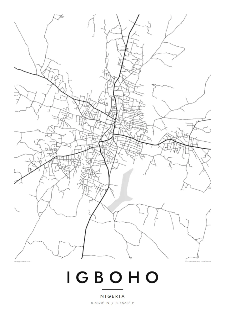
The main roads into town converge near the older core. This junction is the visual anchor of the map, and the rest of Igboho grows out from it in every direction.
Minimalističen plakat z zemljevidom · Nigerija
8.8378° N / 3.7563° E
A savanna town of red-earth roads and scattered compounds, its streets radiating loosely across the open Oke-Ogun plains.


Eno mesto, pet razpoloženj
Dotaknite se stila, da ga vidite na steni. Vsi stili stanejo enako — natisnjen, uokvirjen ali kot HD datoteke.
 Dejanski slikovni piki · datoteka za tisk 24 × 36″
Ostro za tisk
To je 100-odstotni izrez dejanske datoteke za tisk. Vsak poster — natisnjen, uokvirjen ali prenesen — izrišemo na naših strežnikih pri 300 DPI, do 7,200 × 10,800 slikovnih pik, tako da tudi najmanjše ulice ostanejo ostre na tisku 24 × 36″.
Na steni


Zemljevid
Igboho is in the Oke-Ogun area of northern Oyo State. Here the forest thins into open savanna, and the towns sit far apart along long, straight roads. From above, the town is a loose, organic spread rather than a planned grid. Main roads meet near the old centre, and around them clusters of compounds and smaller lanes fan out, gradually giving way to farmland and bush.
The town has a firm place in Yoruba history. When the Oyo kingdom was driven from its capital, Oyo-Ile, Igboho became the seat of the Alaafins for a period, and several of them are remembered as having been buried there. Today it is the headquarters of Oorelope Local Government Area, and it is a market and farming centre for the surrounding countryside.
An Igboho map poster shows a town that has grown outward from its crossroads. Seen from above, the roads cut clean diagonals across the plain, and the small streets between them form an irregular, hand-drawn texture. With so few large rivers or hills in the frame, the pattern of settlement itself becomes the subject, rendered in fine lines on open space.
The main roads into town converge near the older core. This junction is the visual anchor of the map, and the rest of Igboho grows out from it in every direction.
Between the main roads, short lanes and paths link family compounds in an irregular weave. It is a dense, organic texture that contrasts with the straight regional highways.
Beyond the built-up area the map opens into farmland and savanna. The surrounding space gives the town clear edges and a strong silhouette on the page.
Naj bo vaš
Dodajte datum, ime ali svoje besedilo, zamenjajte slog, velikost ali usmerjenost.
Brezplačen predogled je nizke ločljivosti in z vodnim žigom. Natisi in HD datoteke so izrisani pri 300 DPI, do 7,200 × 10,800 px, brez vodnega žiga.
Zakaj Igboho
For people from Igboho, and for its many families living elsewhere in Nigeria and abroad, a map of the town is a direct link to home, to the compound, the market and the roads that lead back to them.
Personalise the title, subtitle and coordinates line with a family name, a quarter or a meaningful date, and pick one of five styles: Classic black and white, Noir, Paper, Blueprint or Sand. Sand suits the warm savanna setting.
Naročite poster Igboho| Velikost tiska | Ločljivost | Datoteke |
|---|---|---|
| 30 × 40 cm (11.8 × 15.7″) | 3,543 × 4,724 px | PNG · PDF |
| 29.7 × 42 cm (A3, 11.7 × 16.5″) | 3,508 × 4,961 px | PNG · PDF |
| 42 × 59.4 cm (A2, 16.5 × 23.4″) | 4,961 × 7,016 px | PNG · PDF |
| 45.7 × 61 cm (18 × 24″) | 5,400 × 7,200 px | PNG · PDF |
| 50 × 70 cm (19.7 × 27.6″) | 5,906 × 8,268 px | PNG · PDF |
| 61 × 91.4 cm (24 × 36″) | 7,200 × 10,800 px | PNG · PDF |
Za primerjavo: brezplačni predogled je širok 900 px, ima vodni žig in je namenjen zaslonom. Datoteke HD imajo do 8-krat večjo ločljivost v vsako smer in se čisto natisnejo v polni velikosti plakata.
Izberite stil na vrhu strani, nato izberite Natisnjen poster — velikost in, če želite, okvir — ali Digitalne HD datoteke. Nakup je zaključen v enem koraku, stran naročila pa se posodobi takoj, ko je plačilo izvedeno.
Natisnjen je na premium mat papir 200 gsm v eni od šestih velikosti, od 30 × 40 cm do 24 × 36″. Natisnjeni posterji se začnejo pri {printFrom}, vključno s dostavo.
Da. Izberite okvir iz masivnega lesa v črni, beli, naravni hrastovi ali temni lesni barvi. Ima nezlomljivo steklo in je pripravljen za obešanje. Uokvirjeni posterji se začnejo pri {framedFrom}, vključno s dostavo.
Dostava je brezplačna po vsem svetu. Vsak poster natisne najbližji od naših tiskarskih partnerjev v več kot 30 državah in običajno prispe v 3–7 delovnih dneh. Stanje in sledenje lahko spremljate pod Moja naročila.
Pošljite nam fotografijo v 14 dneh po dostavi in ga bomo brezplačno ponovno natisnili ali vam povrnili denar.
Da. V urejevalniku na tej strani spremenite naslov, podnaslov in vrstico s koordinatami po želji ter izberite stil in velikost. Natisnjena, uokvirjena in digitalna naročila vsa uporabijo prav vaš dizajn.
Za $9 dobite PNG datoteke s 300 DPI in PDF datoteke, pripravljene za tisk, v vseh šestih velikostih, brez vodnega žiga, da jih lahko natisnete kjerkoli. Še niste prepričani? Najprej prenesite brezplačen predogled z vodnim žigom.
V bližini
