North Field
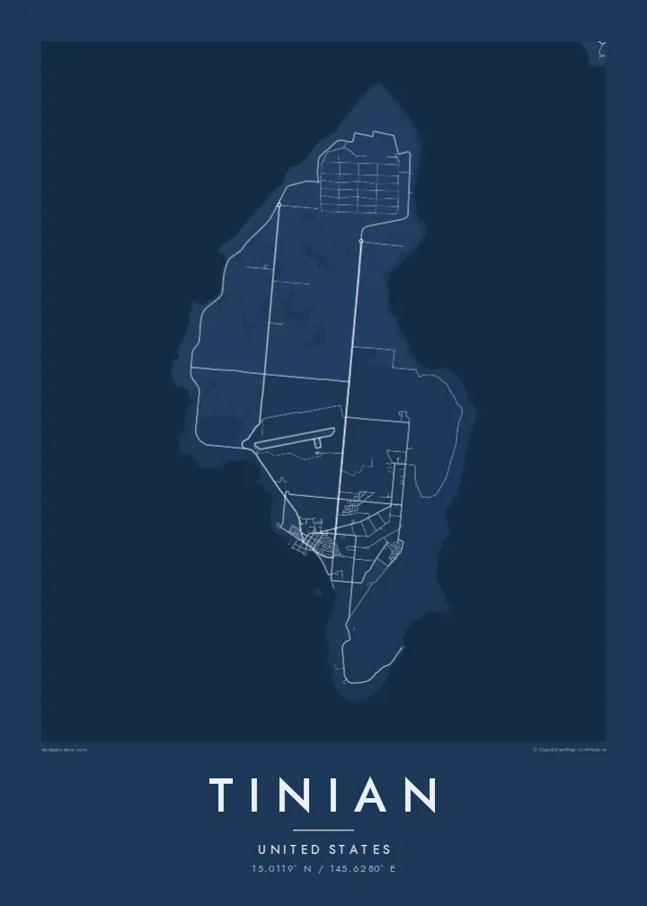
Four long, parallel runways cover the northern end of the island. Even today they form one of the most striking geometric patterns on any Pacific island map.
Minimalističen plakat z zemljevidom · Združene države Amerike
15.0119° N / 145.6280° E
A low, flat island in the Northern Marianas, marked by vast wartime runways and a street grid named after Manhattan.



Eno mesto, pet razpoloženj
Dotaknite se stila, da ga vidite na steni. Vsi stili stanejo enako — natisnjen, uokvirjen ali kot HD datoteke.
 Dejanski slikovni piki · datoteka za tisk 24 × 36″
Ostro za tisk
To je 100-odstotni izrez dejanske datoteke za tisk. Vsak poster — natisnjen, uokvirjen ali prenesen — izrišemo na naših strežnikih pri 300 DPI, do 7,200 × 10,800 slikovnih pik, tako da tudi najmanjše ulice ostanejo ostre na tisku 24 × 36″.
Na steni


Zemljevid
Tinian lies just south-west of Saipan in the Northern Mariana Islands. From above it is fairly flat and compact, longer from north to south, with a plateau ringed by cliffs and limestone terraces that step down toward the sea. The coast is mostly rugged, with only a few sandy beaches. Farmland and scrub cover much of the interior, and the island's one village sits near the harbour in the south-west.
The most remarkable feature is at the northern end: North Field, a wartime airbase whose long, parallel runways are still clearly visible. During the war, the island's roads were laid out in a rough grid. Because the island's outline was thought to resemble Manhattan, the roads were given names such as Broadway. A Tinian map poster makes these straight, deliberate lines stand out.
In 1945, the B-29 bombers that carried the atomic bombs to Hiroshima and Nagasaki took off from North Field, and the loading pits are now marked as a memorial. Long before that, Tinian was home to Chamorro communities. The large stone pillars of the House of Taga, in San Jose, are among the best-known ancient structures in the Marianas.
Four long, parallel runways cover the northern end of the island. Even today they form one of the most striking geometric patterns on any Pacific island map.
American planners laid out the island's roads in a wide grid and named them after New York streets, and the pattern is still visible across Tinian's interior.
The island's main village, near the harbour in the south-west, with a compact street pattern and the ancient latte stones of the House of Taga.
Naj bo vaš
Dodajte datum, ime ali svoje besedilo, zamenjajte slog, velikost ali usmerjenost.
Brezplačen predogled je nizke ločljivosti in z vodnim žigom. Natisi in HD datoteke so izrisani pri 300 DPI, do 7,200 × 10,800 px, brez vodnega žiga.
Zakaj Tinian
Tinian is a map for historians, veterans' families and people with Chamorro and Carolinian roots on the island. Its runways and grid give it a bold, surprisingly graphic look for such a small place in the Pacific.
You can personalise the title, subtitle and coordinates line to mark a family history or a visit, and choose from five styles. Printed posters on matte paper ship from print partners in more than 30 countries.
Naročite poster Tinian| Velikost tiska | Ločljivost | Datoteke |
|---|---|---|
| 30 × 40 cm (11.8 × 15.7″) | 3,543 × 4,724 px | PNG · PDF |
| 29.7 × 42 cm (A3, 11.7 × 16.5″) | 3,508 × 4,961 px | PNG · PDF |
| 42 × 59.4 cm (A2, 16.5 × 23.4″) | 4,961 × 7,016 px | PNG · PDF |
| 45.7 × 61 cm (18 × 24″) | 5,400 × 7,200 px | PNG · PDF |
| 50 × 70 cm (19.7 × 27.6″) | 5,906 × 8,268 px | PNG · PDF |
| 61 × 91.4 cm (24 × 36″) | 7,200 × 10,800 px | PNG · PDF |
Za primerjavo: brezplačni predogled je širok 900 px, ima vodni žig in je namenjen zaslonom. Datoteke HD imajo do 8-krat večjo ločljivost v vsako smer in se čisto natisnejo v polni velikosti plakata.
Izberite stil na vrhu strani, nato izberite Natisnjen poster — velikost in, če želite, okvir — ali Digitalne HD datoteke. Nakup je zaključen v enem koraku, stran naročila pa se posodobi takoj, ko je plačilo izvedeno.
Natisnjen je na premium mat papir 200 gsm v eni od šestih velikosti, od 30 × 40 cm do 24 × 36″. Natisnjeni posterji se začnejo pri {printFrom}, vključno s dostavo.
Da. Izberite okvir iz masivnega lesa v črni, beli, naravni hrastovi ali temni lesni barvi. Ima nezlomljivo steklo in je pripravljen za obešanje. Uokvirjeni posterji se začnejo pri {framedFrom}, vključno s dostavo.
Dostava je brezplačna po vsem svetu. Vsak poster natisne najbližji od naših tiskarskih partnerjev v več kot 30 državah in običajno prispe v 3–7 delovnih dneh. Stanje in sledenje lahko spremljate pod Moja naročila.
Pošljite nam fotografijo v 14 dneh po dostavi in ga bomo brezplačno ponovno natisnili ali vam povrnili denar.
Da. V urejevalniku na tej strani spremenite naslov, podnaslov in vrstico s koordinatami po želji ter izberite stil in velikost. Natisnjena, uokvirjena in digitalna naročila vsa uporabijo prav vaš dizajn.
Za $9 dobite PNG datoteke s 300 DPI in PDF datoteke, pripravljene za tisk, v vseh šestih velikostih, brez vodnega žiga, da jih lahko natisnete kjerkoli. Še niste prepričani? Najprej prenesite brezplačen predogled z vodnim žigom.
