Zlatni Rat
Near Bol, a narrow pebble spit projects into the sea from the south coast, creating one of the most recognisable small shapes in the Adriatic.
Bango la ramani la kisasa · Croatia
43.3239° N / 16.6538° E
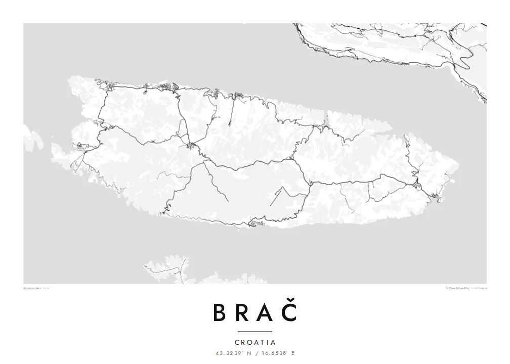
A broad, stony Adriatic island facing Split, with harbour villages on its edges and a famous spit of beach to the south


Mji mmoja, hisia tano
Gusa mtindo ili kuuona ukutani. Mitindo yote yana bei sawa — iliyochapishwa, yenye fremu au kama faili za HD.
 Pikseli halisi · faili la kuchapisha 24 × 36″
Makali ya kuchapisha
Hii ni sehemu ya 100% ya faili halisi la kuchapisha. Kila bango — likiwa limechapishwa, lenye fremu au lililopakuliwa — huundwa kwenye seva zetu kwa 300 DPI, hadi pikseli 7,200 × 10,800, ili hata njia ndogo kabisa zibaki wazi kwenye uchapishaji wa 24 × 36″.
Ukutani


Ramani
Brač is the largest island in Dalmatia and one of the largest in Croatia, lying just across a narrow channel from Split. Its main town, Supetar, on the north coast, is where most ferries from the mainland arrive. The island is known across the region for its white limestone, quarried here since antiquity and used in buildings around the Adriatic, including Diocletian's Palace in Split.
From above, Brač is a wide, elongated shape running east to west, with settlements mostly around its edges. Small harbour towns sit in coves along the north coast, while the interior is a high plateau of stone, pines, olive groves and dry-stone walls. Vidova Gora, near the south coast, is the highest point on any Adriatic island.
A Brač map poster also shows the island's most famous shape: Zlatni Rat, near the town of Bol on the southern coast. This beach extends into the sea as a long, narrow spit of pebbles whose tip shifts with the wind and currents. On a black-and-white print, it reads as a small, precise point on the island's outline.
Near Bol, a narrow pebble spit projects into the sea from the south coast, creating one of the most recognisable small shapes in the Adriatic.
Supetar and a string of smaller villages sit in coves along the north coast, looking across the channel towards Split.
The interior is a high, open landscape of limestone, olive groves and dry-stone walls, crossed by only a few roads.
Ifanye iwe yako
Ongeza tarehe, jina au maneno yako mwenyewe, badilisha mtindo, saizi au mkao.
Onyesho la bure lina ubora wa chini na alama ya maji. Machapisho na faili za HD huundwa kwa 300 DPI, hadi px 7,200 × 10,800, bila alama ya maji.
Kwa nini Brač
Brač is a summer island for many families, a first stop for travellers from Split and home to people with deep ties to its villages and quarries. A map of the island holds all of that in one clear, balanced shape.
Change the title, subtitle and coordinates line to mark a village, a boat or a summer, and choose from Classic black & white, Noir, Paper, Blueprint and Sand. Paper evokes the pale Brač stone especially well.
Agiza bango la Brač| Saizi ya kuchapisha | Ubora | Faili |
|---|---|---|
| 30 × 40 cm (11.8 × 15.7″) | 3,543 × 4,724 px | PNG · PDF |
| 29.7 × 42 cm (A3, 11.7 × 16.5″) | 3,508 × 4,961 px | PNG · PDF |
| 42 × 59.4 cm (A2, 16.5 × 23.4″) | 4,961 × 7,016 px | PNG · PDF |
| 45.7 × 61 cm (18 × 24″) | 5,400 × 7,200 px | PNG · PDF |
| 50 × 70 cm (19.7 × 27.6″) | 5,906 × 8,268 px | PNG · PDF |
| 61 × 91.4 cm (24 × 36″) | 7,200 × 10,800 px | PNG · PDF |
Kwa kulinganisha, hakikisho la bure lina upana wa px 900, lina alama ya maji na limekusudiwa kwa skrini. Faili za HD zina ubora hadi mara 8 zaidi kila upande na huchapishwa vizuri kwa saizi kamili ya bango.
Chagua mtindo juu ya ukurasa, kisha chagua Bango Lililochapishwa — ukubwa na, ukipenda, fremu — au Faili za Kidijitali za HD. Malipo huchukua hatua moja tu, na ukurasa wa agizo lako husasishwa mara malipo yanapokamilika.
Huchapishwa kwenye karatasi bora ya matte ya 200 gsm katika mojawapo ya ukubwa sita, kutoka 30 × 40 cm hadi 24 × 36″. Mabango yaliyochapishwa huanzia {printFrom}, ikijumuisha usafirishaji.
Ndiyo. Chagua fremu ya mbao thabiti katika rangi nyeusi, nyeupe, mwaloni wa asili au mbao nyeusi. Inakuja na kioo kisichovunjika na iko tayari kuning'inizwa. Mabango yenye fremu huanzia {framedFrom}, ikijumuisha usafirishaji.
Usafirishaji ni bure duniani kote. Kila bango huchapishwa na mshirika wetu wa uchapishaji aliye karibu zaidi katika nchi zaidi ya 30 na kwa kawaida hufika ndani ya siku 3–7 za kazi. Unaweza kufuatilia hali na ufuatiliaji chini ya Maagizo Yangu.
Tutumie picha ndani ya siku 14 baada ya kufika na tutalichapisha upya bila malipo au kukurejeshea pesa.
Ndiyo. Kwenye kihariri cha ukurasa huu, badilisha kichwa, kichwa kidogo na mstari wa kuratibu kuwa chochote unachopenda, kisha chagua mtindo na ukubwa. Maagizo yaliyochapishwa, yenye fremu na ya kidijitali yote hutumia muundo wako hasa.
Kwa $9 unapata faili za PNG za 300 DPI na PDF tayari kuchapishwa katika ukubwa wote sita, bila alama ya maji, ili uchapishe popote. Bado huna uhakika? Pakua kwanza onyesho la bure lenye alama ya maji.
Karibu
