Route Napoléon
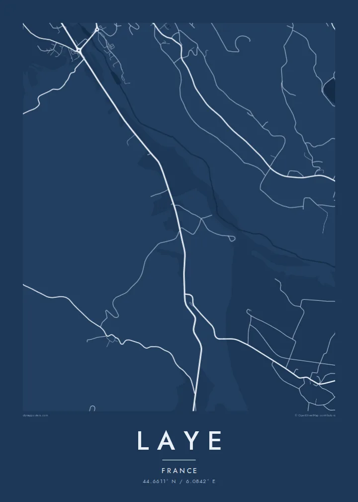
The historic road north from Gap runs through the commune toward the Col Bayard, giving the map a strong line that the smaller lanes branch away from.
Bango la ramani la kisasa · Ufaransa
44.6611° N / 6.0842° E
A small commune on the approach to the Col Bayard, where the Route Napoléon climbs north out of the Gap basin.



Mji mmoja, hisia tano
Gusa mtindo ili kuuona ukutani. Mitindo yote yana bei sawa — iliyochapishwa, yenye fremu au kama faili za HD.
 Pikseli halisi · faili la kuchapisha 24 × 36″
Makali ya kuchapisha
Hii ni sehemu ya 100% ya faili halisi la kuchapisha. Kila bango — likiwa limechapishwa, lenye fremu au lililopakuliwa — huundwa kwenye seva zetu kwa 300 DPI, hadi pikseli 7,200 × 10,800, ili hata njia ndogo kabisa zibaki wazi kwenye uchapishaji wa 24 × 36″.
Ukutani


Ramani
Laye sits in the Hautes-Alpes a short distance north of Gap, on the slopes leading up to the Col Bayard. The historic Route Napoléon passes through on its way over the pass toward the Champsaur and Grenoble, and on the map it appears as the main line crossing the commune, with smaller lanes branching off toward farms and hamlets.
The village is home to a small ski station, one of the closest to Gap, used mostly by local families and beginners. Its short runs and modest lifts make only a small mark on the landscape, surrounded by meadow, forest and the open ground around the pass. The whole commune covers about eleven square kilometres, so the map stays close and readable.
A Laye map poster is less about grandeur than about a familiar route: the road winding up from the city, a village on the slope, a few ski runs cut into the hillside. For people from Gap and the Champsaur who learned to ski here, or who cross the pass often, it is a very personal piece of geography.
The historic road north from Gap runs through the commune toward the Col Bayard, giving the map a strong line that the smaller lanes branch away from.
The small ski area sits close to the village, its short runs and lifts drawn as a few light strokes against the surrounding meadow and woodland.
Northward the terrain rises toward the Col Bayard, where the road crosses between the Gap basin and the Champsaur valley that opens out beyond it.
Ifanye iwe yako
Ongeza tarehe, jina au maneno yako mwenyewe, badilisha mtindo, saizi au mkao.
Onyesho la bure lina ubora wa chini na alama ya maji. Machapisho na faili za HD huundwa kwa 300 DPI, hadi px 7,200 × 10,800, bila alama ya maji.
Kwa nini Laye
Laye is the kind of place people know from childhood rather than from brochures: the nearby slope for a Sunday afternoon, the pass on the way to family. A clean map of it makes a quietly meaningful gift for anyone rooted in the southern Alps.
Change the title, subtitle and coordinates line to suit, perhaps with a name and a year, and choose one of five styles. Start with a free 900 px preview, then take the high-resolution files for $9 or a printed poster with an optional wooden frame.
Agiza bango la Laye| Saizi ya kuchapisha | Ubora | Faili |
|---|---|---|
| 30 × 40 cm (11.8 × 15.7″) | 3,543 × 4,724 px | PNG · PDF |
| 29.7 × 42 cm (A3, 11.7 × 16.5″) | 3,508 × 4,961 px | PNG · PDF |
| 42 × 59.4 cm (A2, 16.5 × 23.4″) | 4,961 × 7,016 px | PNG · PDF |
| 45.7 × 61 cm (18 × 24″) | 5,400 × 7,200 px | PNG · PDF |
| 50 × 70 cm (19.7 × 27.6″) | 5,906 × 8,268 px | PNG · PDF |
| 61 × 91.4 cm (24 × 36″) | 7,200 × 10,800 px | PNG · PDF |
Kwa kulinganisha, hakikisho la bure lina upana wa px 900, lina alama ya maji na limekusudiwa kwa skrini. Faili za HD zina ubora hadi mara 8 zaidi kila upande na huchapishwa vizuri kwa saizi kamili ya bango.
Chagua mtindo juu ya ukurasa, kisha chagua Bango Lililochapishwa — ukubwa na, ukipenda, fremu — au Faili za Kidijitali za HD. Malipo huchukua hatua moja tu, na ukurasa wa agizo lako husasishwa mara malipo yanapokamilika.
Huchapishwa kwenye karatasi bora ya matte ya 200 gsm katika mojawapo ya ukubwa sita, kutoka 30 × 40 cm hadi 24 × 36″. Mabango yaliyochapishwa huanzia {printFrom}, ikijumuisha usafirishaji.
Ndiyo. Chagua fremu ya mbao thabiti katika rangi nyeusi, nyeupe, mwaloni wa asili au mbao nyeusi. Inakuja na kioo kisichovunjika na iko tayari kuning'inizwa. Mabango yenye fremu huanzia {framedFrom}, ikijumuisha usafirishaji.
Usafirishaji ni bure duniani kote. Kila bango huchapishwa na mshirika wetu wa uchapishaji aliye karibu zaidi katika nchi zaidi ya 30 na kwa kawaida hufika ndani ya siku 3–7 za kazi. Unaweza kufuatilia hali na ufuatiliaji chini ya Maagizo Yangu.
Tutumie picha ndani ya siku 14 baada ya kufika na tutalichapisha upya bila malipo au kukurejeshea pesa.
Ndiyo. Kwenye kihariri cha ukurasa huu, badilisha kichwa, kichwa kidogo na mstari wa kuratibu kuwa chochote unachopenda, kisha chagua mtindo na ukubwa. Maagizo yaliyochapishwa, yenye fremu na ya kidijitali yote hutumia muundo wako hasa.
Kwa $9 unapata faili za PNG za 300 DPI na PDF tayari kuchapishwa katika ukubwa wote sita, bila alama ya maji, ili uchapishe popote. Bado huna uhakika? Pakua kwanza onyesho la bure lenye alama ya maji.
Karibu
