Diagonal outline
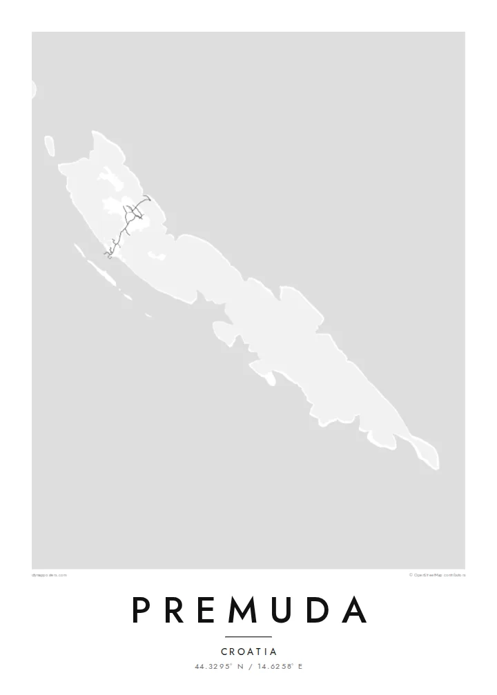
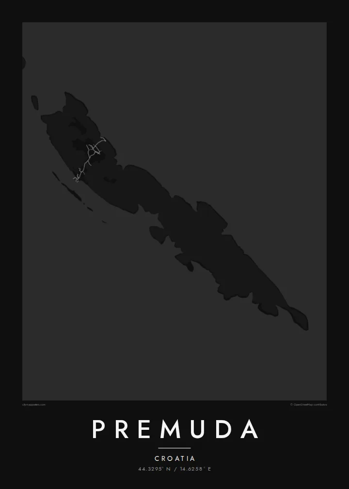
Premuda follows the northwest-to-southeast direction common to the Dalmatian islands, so its long shape crosses the poster at an angle.
Bango la ramani la kisasa · Croatia
44.3295° N / 14.6258° E
A slender limestone island on the outer edge of the Zadar archipelago, lying diagonally in the open Adriatic


Mji mmoja, hisia tano
Gusa mtindo ili kuuona ukutani. Mitindo yote yana bei sawa — iliyochapishwa, yenye fremu au kama faili za HD.
 Pikseli halisi · faili la kuchapisha 24 × 36″
Makali ya kuchapisha
Hii ni sehemu ya 100% ya faili halisi la kuchapisha. Kila bango — likiwa limechapishwa, lenye fremu au lililopakuliwa — huundwa kwenye seva zetu kwa 300 DPI, hadi pikseli 7,200 × 10,800, ili hata njia ndogo kabisa zibaki wazi kwenye uchapishaji wa 24 × 36″.
Ukutani


Ramani
Premuda is one of the outer islands of the Zadar archipelago in Croatia, facing the open Adriatic. On the map it is a narrow, elongated piece of land set on a diagonal, like many islands in this part of the coast. It has a single small settlement and very few roads. The coastline, with small coves and rocky points, provides most of the detail.
The sea around Premuda is known to divers for its underwater caves and rock formations. The island is also linked to a well-documented naval event: in June 1918, Italian torpedo boats sank the Austro-Hungarian battleship Szent István in the waters off Premuda.
A Premuda map poster is quiet and linear. The island runs across the frame, and neighbouring islands may appear near the edges, hinting at the parallel ridges that shape the Dalmatian coast. It is a good choice for people who prefer the less-visited islands of the Adriatic.
Premuda follows the northwest-to-southeast direction common to the Dalmatian islands, so its long shape crosses the poster at an angle.
The island's one settlement and its short roads form a small cluster of lines. The rest of the island stays nearly blank.
The western shore faces the open Adriatic with no islands beyond it, emphasising Premuda's position at the edge of the archipelago.
Ifanye iwe yako
Ongeza tarehe, jina au maneno yako mwenyewe, badilisha mtindo, saizi au mkao.
Onyesho la bure lina ubora wa chini na alama ya maji. Machapisho na faili za HD huundwa kwa 300 DPI, hadi px 7,200 × 10,800, bila alama ya maji.
Kwa nini Premuda
Premuda appeals to sailors, divers and anyone who has spent slow summers on the outer Croatian islands. The spare map suits a place without much traffic, where the shape of the land and the surrounding water are the main points of interest.
Personalise the title, subtitle and coordinates, perhaps with the name of a boat or a summer year. Choose from Classic black & white, Noir, Paper, Blueprint or Sand.
Agiza bango la Premuda| Saizi ya kuchapisha | Ubora | Faili |
|---|---|---|
| 30 × 40 cm (11.8 × 15.7″) | 3,543 × 4,724 px | PNG · PDF |
| 29.7 × 42 cm (A3, 11.7 × 16.5″) | 3,508 × 4,961 px | PNG · PDF |
| 42 × 59.4 cm (A2, 16.5 × 23.4″) | 4,961 × 7,016 px | PNG · PDF |
| 45.7 × 61 cm (18 × 24″) | 5,400 × 7,200 px | PNG · PDF |
| 50 × 70 cm (19.7 × 27.6″) | 5,906 × 8,268 px | PNG · PDF |
| 61 × 91.4 cm (24 × 36″) | 7,200 × 10,800 px | PNG · PDF |
Kwa kulinganisha, hakikisho la bure lina upana wa px 900, lina alama ya maji na limekusudiwa kwa skrini. Faili za HD zina ubora hadi mara 8 zaidi kila upande na huchapishwa vizuri kwa saizi kamili ya bango.
Chagua mtindo juu ya ukurasa, kisha chagua Bango Lililochapishwa — ukubwa na, ukipenda, fremu — au Faili za Kidijitali za HD. Malipo huchukua hatua moja tu, na ukurasa wa agizo lako husasishwa mara malipo yanapokamilika.
Huchapishwa kwenye karatasi bora ya matte ya 200 gsm katika mojawapo ya ukubwa sita, kutoka 30 × 40 cm hadi 24 × 36″. Mabango yaliyochapishwa huanzia {printFrom}, ikijumuisha usafirishaji.
Ndiyo. Chagua fremu ya mbao thabiti katika rangi nyeusi, nyeupe, mwaloni wa asili au mbao nyeusi. Inakuja na kioo kisichovunjika na iko tayari kuning'inizwa. Mabango yenye fremu huanzia {framedFrom}, ikijumuisha usafirishaji.
Usafirishaji ni bure duniani kote. Kila bango huchapishwa na mshirika wetu wa uchapishaji aliye karibu zaidi katika nchi zaidi ya 30 na kwa kawaida hufika ndani ya siku 3–7 za kazi. Unaweza kufuatilia hali na ufuatiliaji chini ya Maagizo Yangu.
Tutumie picha ndani ya siku 14 baada ya kufika na tutalichapisha upya bila malipo au kukurejeshea pesa.
Ndiyo. Kwenye kihariri cha ukurasa huu, badilisha kichwa, kichwa kidogo na mstari wa kuratibu kuwa chochote unachopenda, kisha chagua mtindo na ukubwa. Maagizo yaliyochapishwa, yenye fremu na ya kidijitali yote hutumia muundo wako hasa.
Kwa $9 unapata faili za PNG za 300 DPI na PDF tayari kuchapishwa katika ukubwa wote sita, bila alama ya maji, ili uchapishe popote. Bado huna uhakika? Pakua kwanza onyesho la bure lenye alama ya maji.
Karibu
