Village core
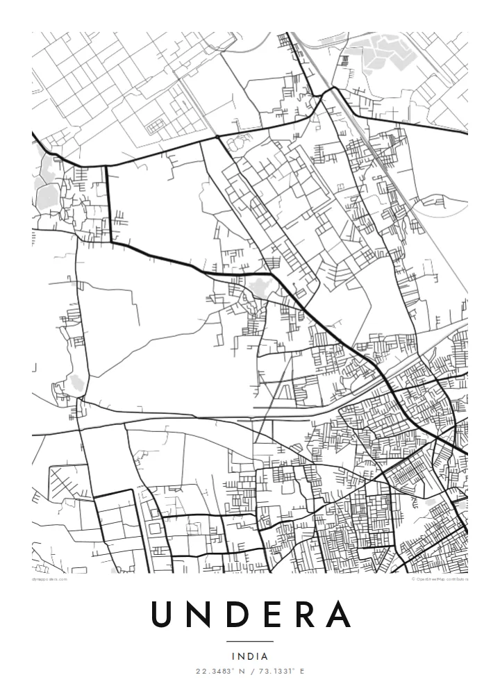
The older centre is a tight cluster of narrow, irregular lanes, the densest and most intricate part of the map.
Bango la ramani la kisasa · India
22.3483° N / 73.1331° E
A settlement on the edge of Vadodara, where village lanes meet new roads and open fields in the Gujarat plain



Mji mmoja, hisia tano
Gusa mtindo ili kuuona ukutani. Mitindo yote yana bei sawa — iliyochapishwa, yenye fremu au kama faili za HD.
 Pikseli halisi · faili la kuchapisha 24 × 36″
Makali ya kuchapisha
Hii ni sehemu ya 100% ya faili halisi la kuchapisha. Kila bango — likiwa limechapishwa, lenye fremu au lililopakuliwa — huundwa kwenye seva zetu kwa 300 DPI, hadi pikseli 7,200 × 10,800, ili hata njia ndogo kabisa zibaki wazi kwenye uchapishaji wa 24 × 36″.
Ukutani


Ramani
Undera lies on the outskirts of Vadodara in Gujarat, on the flat plain that surrounds the city. From above it looks like a place in transition. An older village core with narrow, irregular lanes sits alongside newer roads and housing developments pushing out from the city, and fields still fill the gaps.
The contrast is typical of settlements on the edge of growing Indian cities. The older part has tightly packed buildings and short, bending streets, while the newer areas are laid out in straighter lines and larger plots. Main roads link Undera to Vadodara and nearby villages, and the land between them is flat and mostly open.
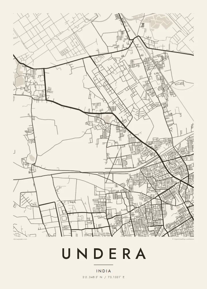
An Undera map poster captures that mix. A dense knot of old lanes, a looser grid of new streets and the empty farmland around them make an interesting study in contrasts. Classic black and white suits the detail, and Blueprint gives the composition a planned, architectural look that matches the area's changing shape.
The older centre is a tight cluster of narrow, irregular lanes, the densest and most intricate part of the map.
Newer residential streets are laid out in straighter, more regular patterns, showing clearly how the settlement is expanding toward the city.
Fields around Undera create broad open areas, framing the built-up parts and emphasising the flatness of the plain.
Ifanye iwe yako
Ongeza tarehe, jina au maneno yako mwenyewe, badilisha mtindo, saizi au mkao.
Onyesho la bure lina ubora wa chini na alama ya maji. Machapisho na faili za HD huundwa kwa 300 DPI, hadi px 7,200 × 10,800, bila alama ya maji.
Kwa nini Undera
For people who grew up in Undera and watched it change as Vadodara grew closer, the map records the place at a specific moment. It makes a thoughtful gift for relatives near or far.
Edit the title, subtitle and coordinates line to add names or dates. Choose Classic black & white, Noir, Paper, Blueprint or Sand, and download the $9 HD files or order a printed, optionally framed poster.
Agiza bango la Undera| Saizi ya kuchapisha | Ubora | Faili |
|---|---|---|
| 30 × 40 cm11.8 × 15.7″ | 3,543 × 4,724 px | PNG · PDF |
| 29.7 × 42 cm (A3)11.7 × 16.5″ | 3,508 × 4,961 px | PNG · PDF |
| 42 × 59.4 cm (A2)16.5 × 23.4″ | 4,961 × 7,016 px | PNG · PDF |
| 45.7 × 61 cm18 × 24″ | 5,400 × 7,200 px | PNG · PDF |
| 50 × 70 cm19.7 × 27.6″ | 5,906 × 8,268 px | PNG · PDF |
| 61 × 91.4 cm24 × 36″ | 7,200 × 10,800 px | PNG · PDF |
Kwa kulinganisha, hakikisho la bure lina upana wa px 900, lina alama ya maji na limekusudiwa kwa skrini. Faili za HD zina ubora hadi mara 8 zaidi kila upande na huchapishwa vizuri kwa saizi kamili ya bango.
Chagua mtindo juu ya ukurasa, kisha chagua Bango Lililochapishwa — ukubwa na, ukipenda, fremu — au Faili za Kidijitali za HD. Malipo huchukua hatua moja tu, na ukurasa wa agizo lako husasishwa mara malipo yanapokamilika.
Huchapishwa kwenye karatasi bora ya matte ya 200 gsm katika mojawapo ya ukubwa sita, kutoka 30 × 40 cm hadi 24 × 36″. Mabango yaliyochapishwa huanzia $39, ikijumuisha usafirishaji.
Ndiyo. Chagua fremu ya mbao thabiti katika rangi nyeusi, nyeupe, mwaloni wa asili au mbao nyeusi. Inakuja na kioo kisichovunjika na iko tayari kuning'inizwa. Mabango yenye fremu huanzia $99, ikijumuisha usafirishaji.
Usafirishaji ni bila malipo kwa nchi 60+. Kila bango huchapishwa na mshirika wetu wa uchapishaji aliye karibu zaidi nawe, kati ya nchi 30+, na kwa kawaida hufika ndani ya siku 3–7 za kazi. Unaweza kufuatilia hali na ufuatiliaji wa kifurushi katika Oda Zangu. Nchi chache huchukua wiki 2–5, na pale ambapo bado hatusafirishi, tovuti hukueleza kabla ya kulipa.
Tutumie picha ndani ya siku 14 baada ya kufika na tutalichapisha upya bila malipo au kukurejeshea pesa.
Ndiyo. Kwenye kihariri cha ukurasa huu, badilisha kichwa, kichwa kidogo na mstari wa kuratibu kuwa chochote unachopenda, kisha chagua mtindo na ukubwa. Maagizo yaliyochapishwa, yenye fremu na ya kidijitali yote hutumia muundo wako hasa.
Kwa $9 unapata faili za PNG za 300 DPI na PDF tayari kuchapishwa katika ukubwa wote sita, bila alama ya maji, ili uchapishe popote. Bado huna uhakika? Pakua kwanza onyesho la bure lenye alama ya maji.
Karibu
