Streets on the ridges
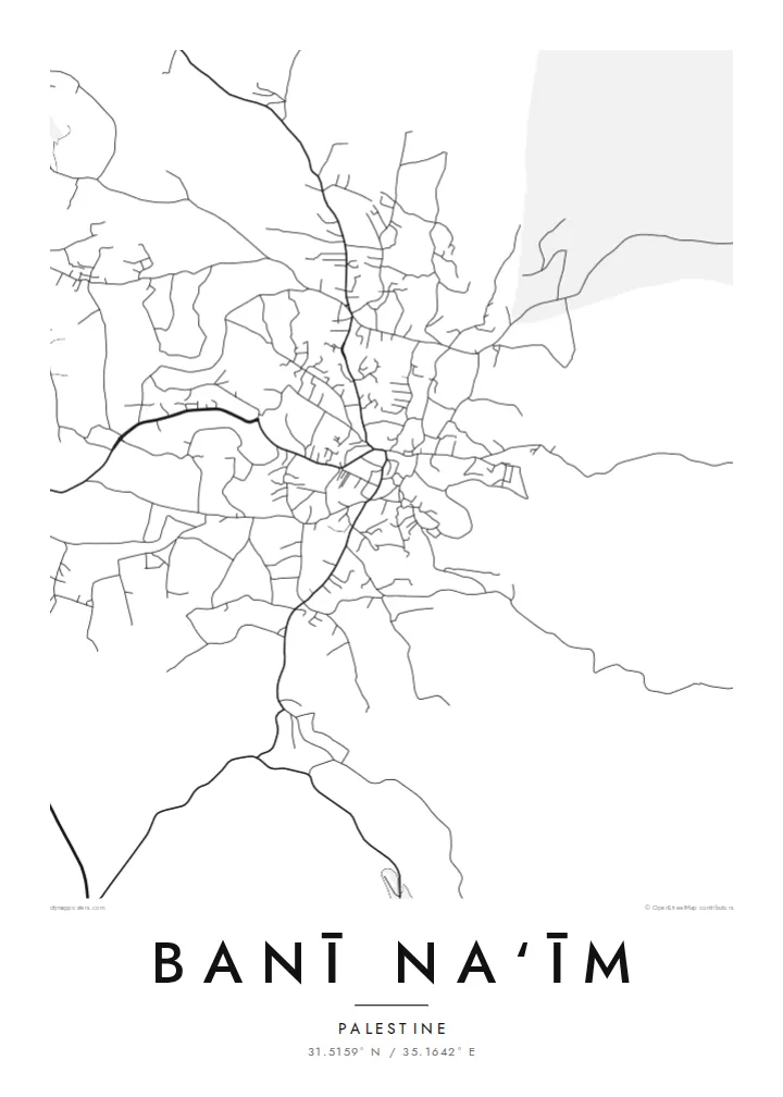
Roads follow the tops and flanks of the hills, bending with the terrain. From above they form a loose, branching pattern instead of a grid.
Póster mapa minimalista · Palestinian Territories
31.5159° N / 35.1642° E
A hilltop town east of Hebron, its streets spread over ridges that fall away towards the Judean desert


Sidade ida, estilu lima
Hili estilu ida atu haree oinsá nia sai iha didin. Estilu hotu-hotu iha folin hanesan — imprime, kaixa moldura ka arkivu HD.
 Pixel loloos · arkivu imprime 24 × 36″
Moos atu imprime
Ida ne'e mak crop 100% husi arkivu imprime loloos. Poster ida-idak — imprime, kaixa moldura ka download — ami halo iha ami-nia servidor ho 300 DPI, to'o 7,200 × 10,800 pixel, atu dalan ki'ik liu mós sai klaru iha imprime 24 × 36″.
Iha Parede


Mapa
Banī Na‘īm lies on high ground east of Hebron, in the southern West Bank. From above, the town spreads across a series of hills, with streets following the ridges and curving down the slopes instead of forming a regular grid. Houses cluster densely near the older core and loosen out towards the edges. Beyond them, the land drops away eastward into increasingly dry terrain.
The town is known for a mosque traditionally associated with the tomb of the prophet Lot, which has long made it a place of local religious significance. To the east the highlands give way to the Judean desert and, further on, the Dead Sea basin. On the map this shows up as a steady thinning of roads and buildings as the land becomes more arid.
A Banī Na‘īm map poster traces how the town fits its hills: winding roads, dense clusters of houses and the open ground around them. In black and white the contours of the settlement become clear, even without drawn topography. It suits people from the town and its many families abroad, who carry a strong attachment to its streets and its view towards the desert.
Roads follow the tops and flanks of the hills, bending with the terrain. From above they form a loose, branching pattern instead of a grid.
Near the traditional centre, around the mosque associated with Lot, buildings sit closely together and lanes become shorter and denser.
Eastward, the built area thins out and roads become sparse as the highlands descend towards the Judean desert and the Dead Sea basin.
Halo ita-nia póster rasik
Aumenta data, naran ka liafuan rasik, troka estilu, tamañu ka orientasaun.
Preview grátis nian rezolusaun ki'ik no iha marka bee. Imprime no arkivu HD ami halo ho 300 DPI, to'o 7,200 × 10,800 px, laiha marka bee.
Tanba sa Banī Na‘īm
For families from Banī Na‘īm, near or far, a map of the town is a way to keep its streets and hills in daily view. It makes a quiet, meaningful gift for a new home or a relative abroad.
Personalise the title and subtitle with a family name or date, and keep or edit the coordinates line. Choose Classic black & white, Noir, Paper, Blueprint or Sand. Sand suits the warm stone of the landscape.
Enkomenda poster Banī Na‘īm| Tamañu imprime | Rezolusaun | Arkivu |
|---|---|---|
| 30 × 40 cm11.8 × 15.7″ | 3,543 × 4,724 px | PNG · PDF |
| 29.7 × 42 cm (A3)11.7 × 16.5″ | 3,508 × 4,961 px | PNG · PDF |
| 42 × 59.4 cm (A2)16.5 × 23.4″ | 4,961 × 7,016 px | PNG · PDF |
| 45.7 × 61 cm18 × 24″ | 5,400 × 7,200 px | PNG · PDF |
| 50 × 70 cm19.7 × 27.6″ | 5,906 × 8,268 px | PNG · PDF |
| 61 × 91.4 cm24 × 36″ | 7,200 × 10,800 px | PNG · PDF |
Atu kompara, previzaun gratuita luan 900 px, iha marka d'água no ba ekrã de'it. Arkivu HD iha rezolusaun to'o dala 8 boot liu iha direksaun ida-idak no imprime moos iha tamañu póster kompletu.
Hili estilu ida iha leten pájina, depois hili Poster Imprime — hili tamañu ida no, se hakarak, moldura ida — ka Arkivu Digital HD. Pagamentu halo iha pasu ida deit, no pájina enkomenda sei update kedas hafoin pagamentu remata.
Ami imprime iha papel matte kualidade aas 200 gsm, iha tamañu neen, husi 30 × 40 cm to'o 24 × 36″. Poster imprime hahú husi $39, haruka livre.
Bele. Hili moldura kayu solidu kór metan, mutin, oak natural ka kayu nakukun. Mai ho vidru la-kilat no prontu atu kandu iha didin. Poster ho moldura hahú husi $99, haruka livre.
Entrega gratuita ba país 60+. Poster ida-idak ami-nia parseiru impresaun besik liu mak imprime iha país 30+ no normalmente to'o iha loron-servisu 3–7. Ita bele haree estatutu no rastreiu iha Ha'u-nia Enkomenda. Países balu presiza semana 2–5, no iha fatin ne'ebé ami seidauk entrega, site sei hatete ba ita molok selu.
Haruka foto ba ami iha loron 14 hafoin simu, no ami sei imprime fali ho grátis ka selu fila fali osan.
Bele. Iha editor iha pájina ne'e, troka titulu, subtitulu no liña koordenadas ba buat ne'ebé ita hakarak, depois hili estilu no tamañu. Enkomenda imprime, moldura ka digital hotu-hotu uza sasán ita-nia desain loloos.
Ho $9 ita simu arkivu PNG 300 DPI no PDF prontu-imprime iha tamañu neen hotu, laiha marka bee, atu imprime iha fatin ida-ida. Seidauk lai serteza? Download uluk preview grátis ho marka bee.
Besik
