Ginza grid
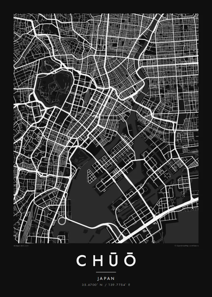
Ginza's regular blocks and main avenues form one of the most orderly street patterns in Tokyo. On the map it sits between former canal routes.
Póster mapa minimalista · Japan
35.6700° N / 139.7754° E
Tokyo's historic commercial heart between the Imperial moats and the Sumida, extending onto reclaimed islands in the bay



Sidade ida, estilu lima
Hili estilu ida atu haree oinsá nia sai iha didin. Estilu hotu-hotu iha folin hanesan — imprime, kaixa moldura ka arkivu HD.
 Pixel loloos · arkivu imprime 24 × 36″
Moos atu imprime
Ida ne'e mak crop 100% husi arkivu imprime loloos. Poster ida-idak — imprime, kaixa moldura ka download — ami halo iha ami-nia servidor ho 300 DPI, to'o 7,200 × 10,800 pixel, atu dalan ki'ik liu mós sai klaru iha imprime 24 × 36″.
Iha Parede


Mapa
Chūō is one of Tokyo's central wards, lying between the area around the Imperial Palace and Tokyo Bay. It includes Nihonbashi, the old merchant district, and Ginza, famous for department stores and shopping. In the Edo period, the Nihonbashi bridge was the starting point of the main roads out of the city, and road distances in Japan are still measured from a marker there.
The ward's map is shaped by water. The Sumida River runs along its eastern side, and canals and old moats once surrounded the commercial districts. Some of these are now covered by expressways. To the southeast, the islands of Tsukishima, Kachidoki and Harumi were built on reclaimed land in the bay and are now filled with apartment towers.
A Chūō map poster shows the tight grid of Ginza and Nihonbashi, the wide Sumida, and the geometric outlines of the reclaimed islands. Few parts of Tokyo show so clearly how the city has grown out into the water. It makes a precise and detailed print for anyone who has worked, shopped or lived in the centre of Tokyo.
Ginza's regular blocks and main avenues form one of the most orderly street patterns in Tokyo. On the map it sits between former canal routes.
The old merchant district around the famous bridge, which served as the Edo-period starting point for the main roads leading out of the city.
Tsukishima, Kachidoki and Harumi extend into Tokyo Bay as angular blocks of reclaimed land, connected to the rest of the city by long bridges.
Halo ita-nia póster rasik
Aumenta data, naran ka liafuan rasik, troka estilu, tamañu ka orientasaun.
Preview grátis nian rezolusaun ki'ik no iha marka bee. Imprime no arkivu HD ami halo ho 300 DPI, to'o 7,200 × 10,800 px, laiha marka bee.
Tanba sa Chūō
For many people, Chūō is the part of Tokyo where they worked, stayed or walked on their first visit. The map puts Ginza, Nihonbashi and the Sumida together in one clear view.
You can personalise the title, subtitle and coordinates, for example with an office address or the year of a trip. Choose one of five styles: Classic black & white, Noir, Paper, Blueprint or Sand. Noir suits the dense grid especially well.
Enkomenda poster Chūō| Tamañu imprime | Rezolusaun | Arkivu |
|---|---|---|
| 30 × 40 cm11.8 × 15.7″ | 3,543 × 4,724 px | PNG · PDF |
| 29.7 × 42 cm (A3)11.7 × 16.5″ | 3,508 × 4,961 px | PNG · PDF |
| 42 × 59.4 cm (A2)16.5 × 23.4″ | 4,961 × 7,016 px | PNG · PDF |
| 45.7 × 61 cm18 × 24″ | 5,400 × 7,200 px | PNG · PDF |
| 50 × 70 cm19.7 × 27.6″ | 5,906 × 8,268 px | PNG · PDF |
| 61 × 91.4 cm24 × 36″ | 7,200 × 10,800 px | PNG · PDF |
Atu kompara, previzaun gratuita luan 900 px, iha marka d'água no ba ekrã de'it. Arkivu HD iha rezolusaun to'o dala 8 boot liu iha direksaun ida-idak no imprime moos iha tamañu póster kompletu.
Hili estilu ida iha leten pájina, depois hili Poster Imprime — hili tamañu ida no, se hakarak, moldura ida — ka Arkivu Digital HD. Pagamentu halo iha pasu ida deit, no pájina enkomenda sei update kedas hafoin pagamentu remata.
Ami imprime iha papel matte kualidade aas 200 gsm, iha tamañu neen, husi 30 × 40 cm to'o 24 × 36″. Poster imprime hahú husi $39, haruka livre.
Bele. Hili moldura kayu solidu kór metan, mutin, oak natural ka kayu nakukun. Mai ho vidru la-kilat no prontu atu kandu iha didin. Poster ho moldura hahú husi $99, haruka livre.
Entrega gratuita ba país 60+. Poster ida-idak ami-nia parseiru impresaun besik liu mak imprime iha país 30+ no normalmente to'o iha loron-servisu 3–7. Ita bele haree estatutu no rastreiu iha Ha'u-nia Enkomenda. Países balu presiza semana 2–5, no iha fatin ne'ebé ami seidauk entrega, site sei hatete ba ita molok selu.
Haruka foto ba ami iha loron 14 hafoin simu, no ami sei imprime fali ho grátis ka selu fila fali osan.
Bele. Iha editor iha pájina ne'e, troka titulu, subtitulu no liña koordenadas ba buat ne'ebé ita hakarak, depois hili estilu no tamañu. Enkomenda imprime, moldura ka digital hotu-hotu uza sasán ita-nia desain loloos.
Ho $9 ita simu arkivu PNG 300 DPI no PDF prontu-imprime iha tamañu neen hotu, laiha marka bee, atu imprime iha fatin ida-ida. Seidauk lai serteza? Download uluk preview grátis ho marka bee.
