Portoferraio harbour
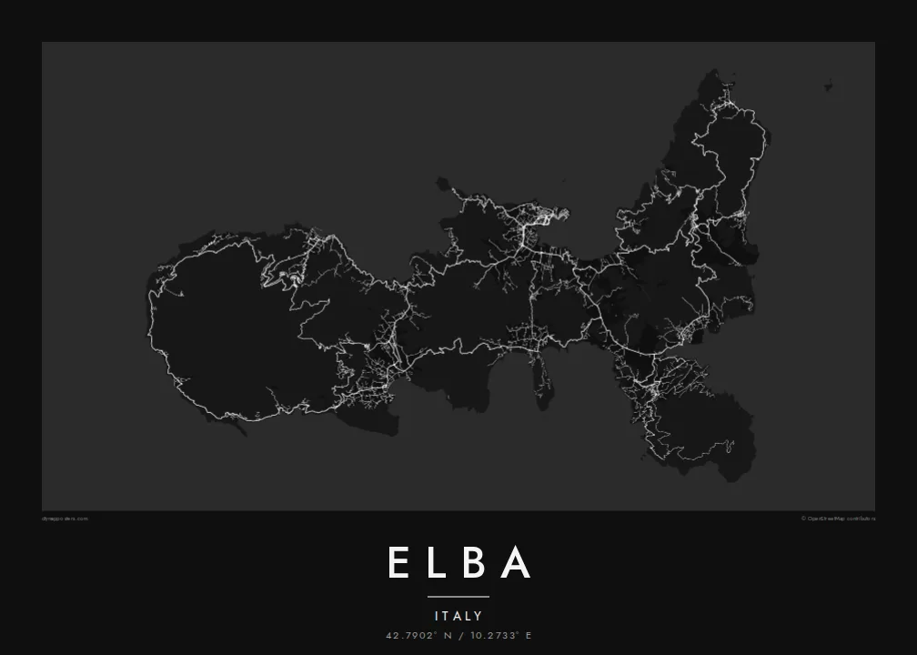
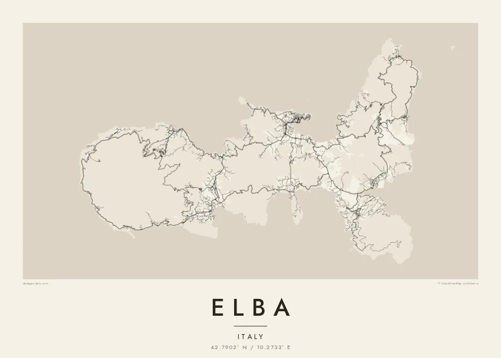
A curved bay on the north coast shelters the island's main port, and the fortified old town on its promontory is the densest street pattern on the map.
Póster mapa minimalista · Italy
42.7902° N / 10.2733° E
A jagged Tuscan island of deep bays and headlands, with a granite peak in the west and iron mines in the east.



Sidade ida, estilu lima
Hili estilu ida atu haree oinsá nia sai iha didin. Estilu hotu-hotu iha folin hanesan — imprime, kaixa moldura ka arkivu HD.
 Pixel loloos · arkivu imprime 24 × 36″
Moos atu imprime
Ida ne'e mak crop 100% husi arkivu imprime loloos. Poster ida-idak — imprime, kaixa moldura ka download — ami halo iha ami-nia servidor ho 300 DPI, to'o 7,200 × 10,800 pixel, atu dalan ki'ik liu mós sai klaru iha imprime 24 × 36″.
Iha Parede


Mapa
Elba is the largest island of the Tuscan Archipelago and the third largest in Italy, lying about ten kilometres off the mainland at Piombino. Its outline is unusually irregular, a chain of headlands and deep, rounded bays that make the coastline far longer than the island's size suggests. Monte Capanne, a granite massif, dominates the west, while the east is lower and more broken.
Portoferraio, the main town, sits on a promontory above a sheltered bay on the north coast, enclosed by fortifications laid out under the Medici in the sixteenth century. On an Elba map poster its harbour, walls and bastions form a compact, angular knot, and roads leave it to climb over the hills toward Marciana, Porto Azzurro and Capoliveri.
Napoleon was exiled to Elba in 1814 and ruled the island for about ten months before escaping to France. Long before that, its iron ore was worked by the Etruscans and the Romans, and mining continued in the east into the twentieth century. The old mine workings and the coves between them still mark the eastern shore.
A curved bay on the north coast shelters the island's main port, and the fortified old town on its promontory is the densest street pattern on the map.
The island's highest peak rises in the west, and villages sit on its lower slopes, linked by a winding road that circles the massif close to the coast.
The coastline turns in and out constantly, with wide gulfs such as those at Procchio, Lacona and Porto Azzurro, giving the poster an intricate, lace-like edge.
Halo ita-nia póster rasik
Aumenta data, naran ka liafuan rasik, troka estilu, tamañu ka orientasaun.
Preview grátis nian rezolusaun ki'ik no iha marka bee. Imprime no arkivu HD ami halo ho 300 DPI, to'o 7,200 × 10,800 px, laiha marka bee.
Tanba sa Elba
Elba is a summer island for many Italians and a sailing destination for people from across Europe. Its intricate coastline gives the poster a great deal to look at, and the whole island fits comfortably in a single frame.
Add a title, a subtitle for the year of a summer or the name of a bay, and your own coordinates line. Five styles are available, with Paper and Sand for a warmer print and Blueprint for a nautical feel. The $9 files cover six print sizes.
Enkomenda poster Elba| Tamañu imprime | Rezolusaun | Arkivu |
|---|---|---|
| 30 × 40 cm (11.8 × 15.7″) | 3,543 × 4,724 px | PNG · PDF |
| 29.7 × 42 cm (A3, 11.7 × 16.5″) | 3,508 × 4,961 px | PNG · PDF |
| 42 × 59.4 cm (A2, 16.5 × 23.4″) | 4,961 × 7,016 px | PNG · PDF |
| 45.7 × 61 cm (18 × 24″) | 5,400 × 7,200 px | PNG · PDF |
| 50 × 70 cm (19.7 × 27.6″) | 5,906 × 8,268 px | PNG · PDF |
| 61 × 91.4 cm (24 × 36″) | 7,200 × 10,800 px | PNG · PDF |
Atu kompara, previzaun gratuita luan 900 px, iha marka d'água no ba ekrã de'it. Arkivu HD iha rezolusaun to'o dala 8 boot liu iha direksaun ida-idak no imprime moos iha tamañu póster kompletu.
Hili estilu ida iha leten pájina, depois hili Poster Imprime — hili tamañu ida no, se hakarak, moldura ida — ka Arkivu Digital HD. Pagamentu halo iha pasu ida deit, no pájina enkomenda sei update kedas hafoin pagamentu remata.
Ami imprime iha papel matte kualidade aas 200 gsm, iha tamañu neen, husi 30 × 40 cm to'o 24 × 36″. Poster imprime hahú husi $39, haruka livre.
Bele. Hili moldura kayu solidu kór metan, mutin, oak natural ka kayu nakukun. Mai ho vidru la-kilat no prontu atu kandu iha didin. Poster ho moldura hahú husi $99, haruka livre.
Entrega gratuita ba mundu tomak. Poster ida-idak imprime husi ami-nia parseiru impresaun ne'ebé besik liu iha nasaun 30+ no normalmente to'o iha loron servisu 3–7. Ita bele haree estadu no tracking iha Ha'u-nia Pedidu. Nasaun balu foti semana 2–5, no iha nasaun ne'ebé ami seidauk entrega, sítiu hatudu ba ita molok selu.
Haruka foto ba ami iha loron 14 hafoin simu, no ami sei imprime fali ho grátis ka selu fila fali osan.
Bele. Iha editor iha pájina ne'e, troka titulu, subtitulu no liña koordenadas ba buat ne'ebé ita hakarak, depois hili estilu no tamañu. Enkomenda imprime, moldura ka digital hotu-hotu uza sasán ita-nia desain loloos.
Ho $9 ita simu arkivu PNG 300 DPI no PDF prontu-imprime iha tamañu neen hotu, laiha marka bee, atu imprime iha fatin ida-ida. Seidauk lai serteza? Download uluk preview grátis ho marka bee.
