Udi escarpment
The high ground at the edge of the city limits growth in that direction, so streets thin out and curve as the terrain rises toward the hills where coal was once mined.
Póster mapa minimalista · Nigeria
6.4413° N / 7.4988° E
A city spread across rolling land at the foot of an escarpment, cut by river valleys and wide layouts


Sidade ida, estilu lima
Hili estilu ida atu haree oinsá nia sai iha didin. Estilu hotu-hotu iha folin hanesan — imprime, kaixa moldura ka arkivu HD.
 Pixel loloos · arkivu imprime 24 × 36″
Moos atu imprime
Ida ne'e mak crop 100% husi arkivu imprime loloos. Poster ida-idak — imprime, kaixa moldura ka download — ami halo iha ami-nia servidor ho 300 DPI, to'o 7,200 × 10,800 pixel, atu dalan ki'ik liu mós sai klaru iha imprime 24 × 36″.
Iha Parede


Mapa
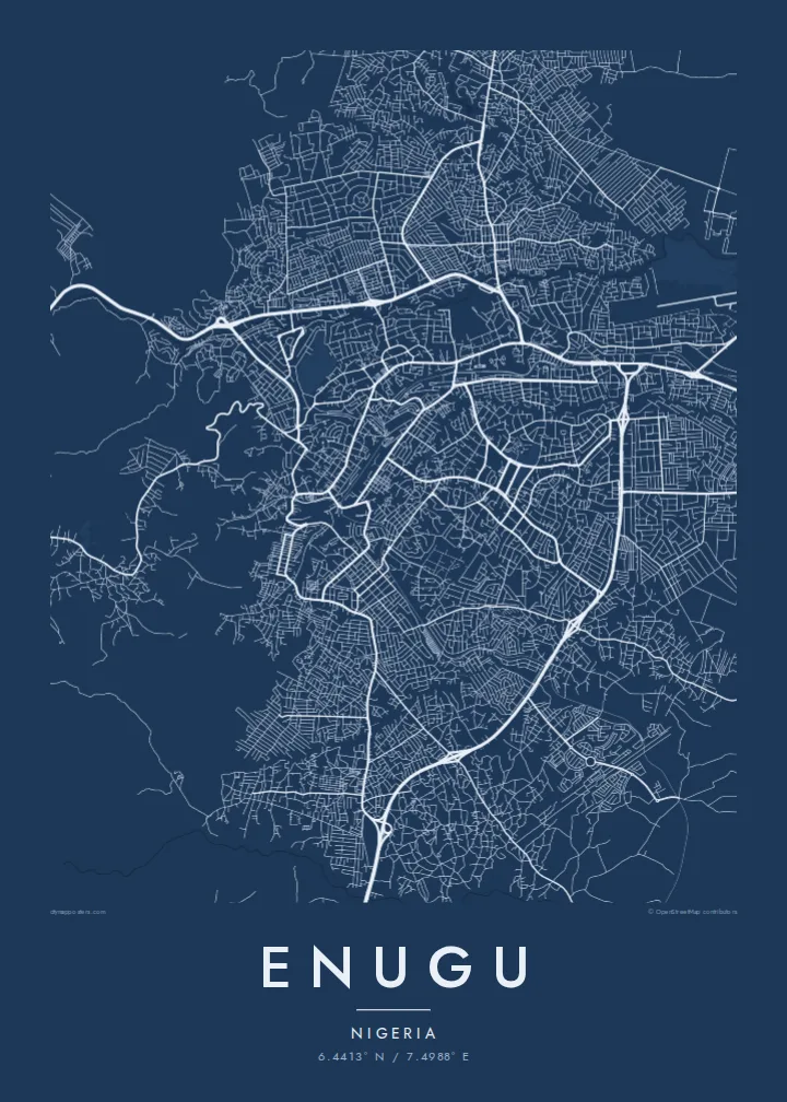
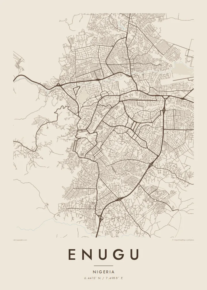
Enugu sits at the base of the Udi escarpment, and its map reflects that setting. The street pattern is uneven, bending around low ridges and dropping into valleys. The Ekulu River and its tributaries run through the city, leaving gaps and green corridors between neighbourhoods. In places the plan becomes more regular, where planned residential layouts were drawn out in grids and loops.
The city grew around coal. Deposits were found in the nearby hills in the early twentieth century, a railway followed to carry the coal south to the coast, and a town took shape around the mines. That origin gave Enugu its lasting nickname, the Coal City, and it later became an important administrative centre for the region.
An Enugu map poster traces the city across uneven ground, showing how roads follow valleys and ridgelines rather than a single axis. The eastern hills create a natural edge, while the city fans outward on gentler land to the west and south. It is a map shaped as much by terrain as by planning.
The high ground at the edge of the city limits growth in that direction, so streets thin out and curve as the terrain rises toward the hills where coal was once mined.
The river and its small tributaries wind through the urban area, opening green, unbuilt corridors that divide the city into clearly separated districts on the map.
Several residential areas were laid out with regular grids, crescents and looping roads, giving parts of the map a more geometric texture than the older, organic quarters.
Halo ita-nia póster rasik
Aumenta data, naran ka liafuan rasik, troka estilu, tamañu ka orientasaun.
Preview grátis nian rezolusaun ki'ik no iha marka bee. Imprime no arkivu HD ami halo ho 300 DPI, to'o 7,200 × 10,800 px, laiha marka bee.
Tanba sa Enugu
Enugu matters to people who grew up there, studied there or keep family ties to the region. Its irregular street pattern and river valleys give the map a textured, handmade quality that works well on a wall at home or in an office.
Add a custom title, subtitle and coordinates, perhaps a family name or a year. Pick from Classic black & white, Noir, Paper, Blueprint or Sand. Digital files include six print sizes, and printed posters ship from partners in more than 30 countries.
Enkomenda poster Enugu| Tamañu imprime | Rezolusaun | Arkivu |
|---|---|---|
| 30 × 40 cm11.8 × 15.7″ | 3,543 × 4,724 px | PNG · PDF |
| 29.7 × 42 cm (A3)11.7 × 16.5″ | 3,508 × 4,961 px | PNG · PDF |
| 42 × 59.4 cm (A2)16.5 × 23.4″ | 4,961 × 7,016 px | PNG · PDF |
| 45.7 × 61 cm18 × 24″ | 5,400 × 7,200 px | PNG · PDF |
| 50 × 70 cm19.7 × 27.6″ | 5,906 × 8,268 px | PNG · PDF |
| 61 × 91.4 cm24 × 36″ | 7,200 × 10,800 px | PNG · PDF |
Atu kompara, previzaun gratuita luan 900 px, iha marka d'água no ba ekrã de'it. Arkivu HD iha rezolusaun to'o dala 8 boot liu iha direksaun ida-idak no imprime moos iha tamañu póster kompletu.
Hili estilu ida iha leten pájina, depois hili Poster Imprime — hili tamañu ida no, se hakarak, moldura ida — ka Arkivu Digital HD. Pagamentu halo iha pasu ida deit, no pájina enkomenda sei update kedas hafoin pagamentu remata.
Ami imprime iha papel matte kualidade aas 200 gsm, iha tamañu neen, husi 30 × 40 cm to'o 24 × 36″. Poster imprime hahú husi $39, haruka livre.
Bele. Hili moldura kayu solidu kór metan, mutin, oak natural ka kayu nakukun. Mai ho vidru la-kilat no prontu atu kandu iha didin. Poster ho moldura hahú husi $99, haruka livre.
Entrega gratuita ba país 60+. Poster ida-idak ami-nia parseiru impresaun besik liu mak imprime iha país 30+ no normalmente to'o iha loron-servisu 3–7. Ita bele haree estatutu no rastreiu iha Ha'u-nia Enkomenda. Países balu presiza semana 2–5, no iha fatin ne'ebé ami seidauk entrega, site sei hatete ba ita molok selu.
Haruka foto ba ami iha loron 14 hafoin simu, no ami sei imprime fali ho grátis ka selu fila fali osan.
Bele. Iha editor iha pájina ne'e, troka titulu, subtitulu no liña koordenadas ba buat ne'ebé ita hakarak, depois hili estilu no tamañu. Enkomenda imprime, moldura ka digital hotu-hotu uza sasán ita-nia desain loloos.
Ho $9 ita simu arkivu PNG 300 DPI no PDF prontu-imprime iha tamañu neen hotu, laiha marka bee, atu imprime iha fatin ida-ida. Seidauk lai serteza? Download uluk preview grátis ho marka bee.
