Harbour mouth
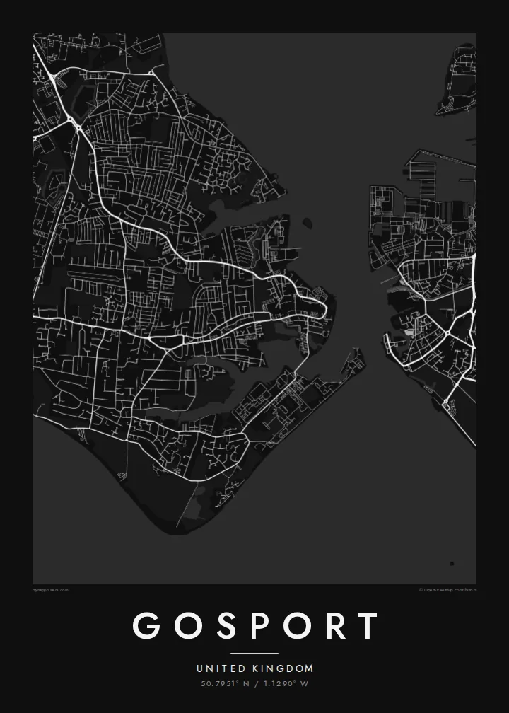
The narrow entrance to Portsmouth Harbour separates Gosport from Old Portsmouth. The short ferry crossing between them is one of the defining lines on the map.
Póster mapa minimalista · United Kingdom
50.7951° N / 1.1290° W
A low peninsula between Portsmouth Harbour and the Solent, edged with forts, creeks, shingle and naval yards.



Sidade ida, estilu lima
Hili estilu ida atu haree oinsá nia sai iha didin. Estilu hotu-hotu iha folin hanesan — imprime, kaixa moldura ka arkivu HD.
 Pixel loloos · arkivu imprime 24 × 36″
Moos atu imprime
Ida ne'e mak crop 100% husi arkivu imprime loloos. Poster ida-idak — imprime, kaixa moldura ka download — ami halo iha ami-nia servidor ho 300 DPI, to'o 7,200 × 10,800 pixel, atu dalan ki'ik liu mós sai klaru iha imprime 24 × 36″.
Iha Parede


Mapa
Gosport sits on a peninsula on the western side of Portsmouth Harbour, facing the city across a narrow stretch of water. On a map the town is framed almost entirely by sea: the harbour to the east, the Solent and Stokes Bay to the south, and tidal creeks cutting into its western edge. Much of its shoreline has long belonged to the Royal Navy.
The street pattern shows that history. The old town and ferry pontoon crowd the harbour mouth. Large institutional sites, including the former Royal Hospital Haslar and a string of Victorian forts, take up blocks that no ordinary street runs through. Beyond them, twentieth-century housing spreads west toward Fareham in looser curves and cul-de-sacs.
A Gosport map poster suits anyone who has served here, grown up here, or crossed on the Gosport Ferry more times than they can count. It also works as a companion print to Portsmouth, because the two towns share a harbour and read best side by side. The Submarine Museum on the waterfront is one of the town's best-known sights.
The narrow entrance to Portsmouth Harbour separates Gosport from Old Portsmouth. The short ferry crossing between them is one of the defining lines on the map.
The southern coast runs as a long, gentle curve of shingle facing the Isle of Wight. It gives the lower edge of the poster a clean, open line.
Victorian forts and former naval sites show up as large enclosed shapes among the terraced streets, a pattern that is typical of a garrison town.
Halo ita-nia póster rasik
Aumenta data, naran ka liafuan rasik, troka estilu, tamañu ka orientasaun.
Preview grátis nian rezolusaun ki'ik no iha marka bee. Imprime no arkivu HD ami halo ho 300 DPI, to'o 7,200 × 10,800 px, laiha marka bee.
Tanba sa Gosport
Gosport is a place many people pass through with the navy and remember for good. A map of the peninsula, harbour and all, suits a hallway, a study or the wall of anyone whose family story includes these docks.
You can change the title, subtitle and coordinates, for example to add a ship's name, a posting or a date. Choose from Classic black & white, Noir, Paper, Blueprint or Sand. Blueprint suits the naval shoreline particularly well.
Enkomenda poster Gosport| Tamañu imprime | Rezolusaun | Arkivu |
|---|---|---|
| 30 × 40 cm11.8 × 15.7″ | 3,543 × 4,724 px | PNG · PDF |
| 29.7 × 42 cm (A3)11.7 × 16.5″ | 3,508 × 4,961 px | PNG · PDF |
| 42 × 59.4 cm (A2)16.5 × 23.4″ | 4,961 × 7,016 px | PNG · PDF |
| 45.7 × 61 cm18 × 24″ | 5,400 × 7,200 px | PNG · PDF |
| 50 × 70 cm19.7 × 27.6″ | 5,906 × 8,268 px | PNG · PDF |
| 61 × 91.4 cm24 × 36″ | 7,200 × 10,800 px | PNG · PDF |
Atu kompara, previzaun gratuita luan 900 px, iha marka d'água no ba ekrã de'it. Arkivu HD iha rezolusaun to'o dala 8 boot liu iha direksaun ida-idak no imprime moos iha tamañu póster kompletu.
Hili estilu ida iha leten pájina, depois hili Poster Imprime — hili tamañu ida no, se hakarak, moldura ida — ka Arkivu Digital HD. Pagamentu halo iha pasu ida deit, no pájina enkomenda sei update kedas hafoin pagamentu remata.
Ami imprime iha papel matte kualidade aas 200 gsm, iha tamañu neen, husi 30 × 40 cm to'o 24 × 36″. Poster imprime hahú husi $39, haruka livre.
Bele. Hili moldura kayu solidu kór metan, mutin, oak natural ka kayu nakukun. Mai ho vidru la-kilat no prontu atu kandu iha didin. Poster ho moldura hahú husi $99, haruka livre.
Entrega gratuita ba país 60+. Poster ida-idak ami-nia parseiru impresaun besik liu mak imprime iha país 30+ no normalmente to'o iha loron-servisu 3–7. Ita bele haree estatutu no rastreiu iha Ha'u-nia Enkomenda. Países balu presiza semana 2–5, no iha fatin ne'ebé ami seidauk entrega, site sei hatete ba ita molok selu.
Haruka foto ba ami iha loron 14 hafoin simu, no ami sei imprime fali ho grátis ka selu fila fali osan.
Bele. Iha editor iha pájina ne'e, troka titulu, subtitulu no liña koordenadas ba buat ne'ebé ita hakarak, depois hili estilu no tamañu. Enkomenda imprime, moldura ka digital hotu-hotu uza sasán ita-nia desain loloos.
Ho $9 ita simu arkivu PNG 300 DPI no PDF prontu-imprime iha tamañu neen hotu, laiha marka bee, atu imprime iha fatin ida-ida. Seidauk lai serteza? Download uluk preview grátis ho marka bee.
