Oval old town
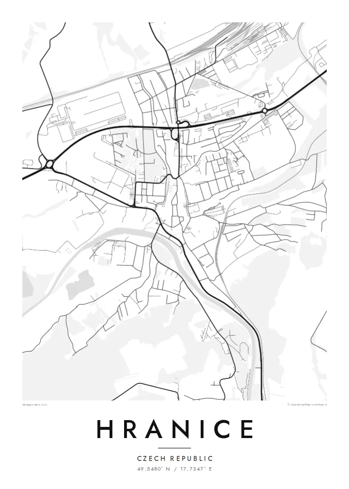
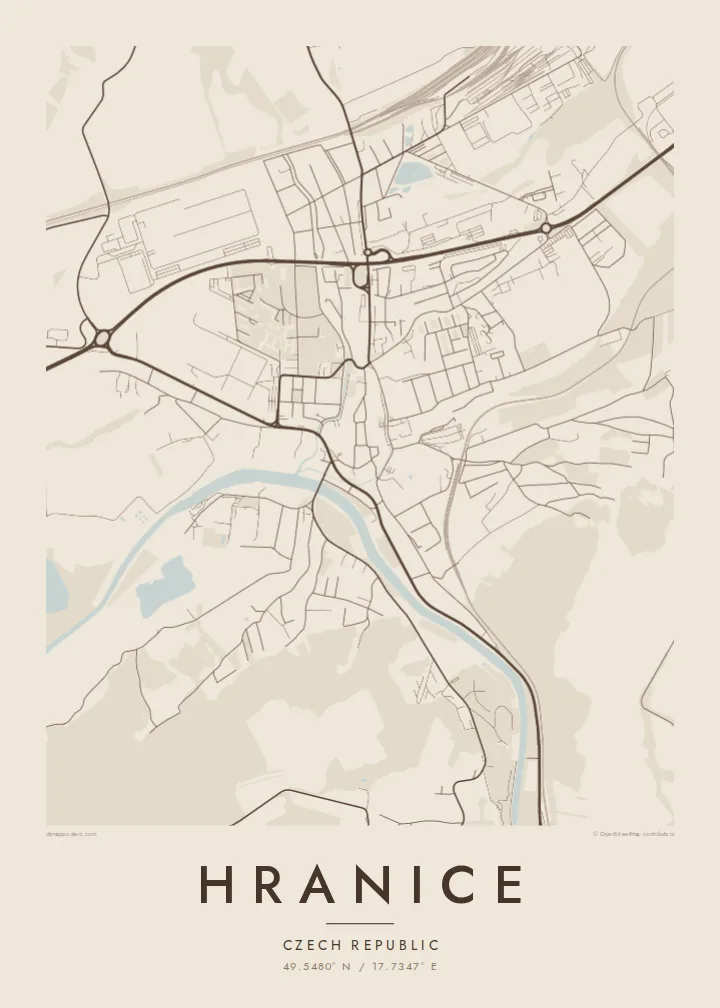
The historic centre forms a compact oval around a main square. Its outline follows the course of the former town walls.
Póster mapa minimalista · Czechia
49.5480° N / 17.7347° E
A Moravian town on the Bečva river, with a walled old core and the Moravian Gate valley around it


Sidade ida, estilu lima
Hili estilu ida atu haree oinsá nia sai iha didin. Estilu hotu-hotu iha folin hanesan — imprime, kaixa moldura ka arkivu HD.
 Pixel loloos · arkivu imprime 24 × 36″
Moos atu imprime
Ida ne'e mak crop 100% husi arkivu imprime loloos. Poster ida-idak — imprime, kaixa moldura ka download — ami halo iha ami-nia servidor ho 300 DPI, to'o 7,200 × 10,800 pixel, atu dalan ki'ik liu mós sai klaru iha imprime 24 × 36″.
Iha Parede


Mapa
Hranice lies in eastern Moravia, in the Moravian Gate, a lowland corridor between the Carpathians and the Sudetes that has served as a route for trade and travel for centuries. The Bečva river runs past the town. The old centre sits on higher ground above it, compact and roughly oval, with a main square and streets that still follow the line of its old walls.
Just outside town is the Hranice Abyss, a limestone chasm with a flooded cave measured as the deepest of its kind in the world. On the map, it appears only as a patch of woodland near the river, a small area that hides remarkable depths below. Railway lines and main roads follow the valley past the town.
A Hranice map poster shows a town shaped by its position. There is the tight historic core, the river curving below, and the transport lines running through the gap between the mountains. The black-and-white rendering makes the oval of the old town especially clear, set against the more scattered pattern of the newer districts.
The historic centre forms a compact oval around a main square. Its outline follows the course of the former town walls.
The river curves below the old town, with bridges crossing to the other bank. It gives the map a clear flowing line.
Railways and roads run through the valley past Hranice, marking the historic route between the mountain ranges.
Halo ita-nia póster rasik
Aumenta data, naran ka liafuan rasik, troka estilu, tamañu ka orientasaun.
Preview grátis nian rezolusaun ki'ik no iha marka bee. Imprime no arkivu HD ami halo ho 300 DPI, to'o 7,200 × 10,800 px, laiha marka bee.
Tanba sa Hranice
Hranice appeals to people who grew up in Moravia, studied here, or came to see the Abyss and stayed with the town in their memory. The clear oval of the old centre gives the print a strong focal point, and it looks good even in the smallest size.
Change the title, subtitle and coordinates line to your own text. Choose Classic black & white, Noir, Paper, Blueprint or Sand. There is a free 900 px watermarked preview to check the result, and the full HD files cost $9.
Enkomenda poster Hranice| Tamañu imprime | Rezolusaun | Arkivu |
|---|---|---|
| 30 × 40 cm11.8 × 15.7″ | 3,543 × 4,724 px | PNG · PDF |
| 29.7 × 42 cm (A3)11.7 × 16.5″ | 3,508 × 4,961 px | PNG · PDF |
| 42 × 59.4 cm (A2)16.5 × 23.4″ | 4,961 × 7,016 px | PNG · PDF |
| 45.7 × 61 cm18 × 24″ | 5,400 × 7,200 px | PNG · PDF |
| 50 × 70 cm19.7 × 27.6″ | 5,906 × 8,268 px | PNG · PDF |
| 61 × 91.4 cm24 × 36″ | 7,200 × 10,800 px | PNG · PDF |
Atu kompara, previzaun gratuita luan 900 px, iha marka d'água no ba ekrã de'it. Arkivu HD iha rezolusaun to'o dala 8 boot liu iha direksaun ida-idak no imprime moos iha tamañu póster kompletu.
Hili estilu ida iha leten pájina, depois hili Poster Imprime — hili tamañu ida no, se hakarak, moldura ida — ka Arkivu Digital HD. Pagamentu halo iha pasu ida deit, no pájina enkomenda sei update kedas hafoin pagamentu remata.
Ami imprime iha papel matte kualidade aas 200 gsm, iha tamañu neen, husi 30 × 40 cm to'o 24 × 36″. Poster imprime hahú husi $39, haruka livre.
Bele. Hili moldura kayu solidu kór metan, mutin, oak natural ka kayu nakukun. Mai ho vidru la-kilat no prontu atu kandu iha didin. Poster ho moldura hahú husi $99, haruka livre.
Entrega gratuita ba país 60+. Poster ida-idak ami-nia parseiru impresaun besik liu mak imprime iha país 30+ no normalmente to'o iha loron-servisu 3–7. Ita bele haree estatutu no rastreiu iha Ha'u-nia Enkomenda. Países balu presiza semana 2–5, no iha fatin ne'ebé ami seidauk entrega, site sei hatete ba ita molok selu.
Haruka foto ba ami iha loron 14 hafoin simu, no ami sei imprime fali ho grátis ka selu fila fali osan.
Bele. Iha editor iha pájina ne'e, troka titulu, subtitulu no liña koordenadas ba buat ne'ebé ita hakarak, depois hili estilu no tamañu. Enkomenda imprime, moldura ka digital hotu-hotu uza sasán ita-nia desain loloos.
Ho $9 ita simu arkivu PNG 300 DPI no PDF prontu-imprime iha tamañu neen hotu, laiha marka bee, atu imprime iha fatin ida-ida. Seidauk lai serteza? Download uluk preview grátis ho marka bee.
