The border river
The Itararé river runs along the state line and gives the map a natural western edge between São Paulo and Paraná.
Póster mapa minimalista · Brazil
24.1125° S / 49.3317° W
A frontier town on the São Paulo–Paraná border, laid out in a grid beside the river that gave it its name



Sidade ida, estilu lima
Hili estilu ida atu haree oinsá nia sai iha didin. Estilu hotu-hotu iha folin hanesan — imprime, kaixa moldura ka arkivu HD.
 Pixel loloos · arkivu imprime 24 × 36″
Moos atu imprime
Ida ne'e mak crop 100% husi arkivu imprime loloos. Poster ida-idak — imprime, kaixa moldura ka download — ami halo iha ami-nia servidor ho 300 DPI, to'o 7,200 × 10,800 pixel, atu dalan ki'ik liu mós sai klaru iha imprime 24 × 36″.
Iha Parede


Mapa
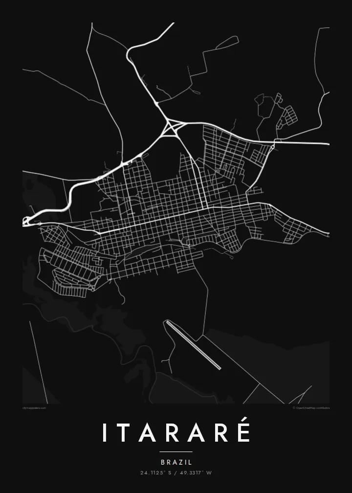
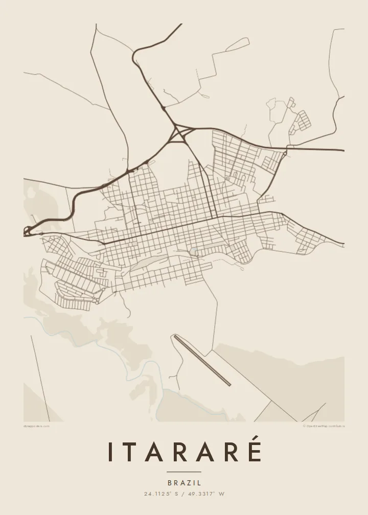
Itararé sits in the far south of São Paulo state, right at the border with Paraná. The Itararé river marks the boundary between the two states. On the map, the town forms a fairly regular grid of blocks on rolling upland, with roads leaving in several directions towards farmland and neighbouring towns. The river valley to the west is cut into the landscape.
The name comes from Tupi and is usually translated as stone carved by water, which fits the eroded river gorges in the region. Itararé is also famous in Brazilian history for the battle that never happened. In 1930, government and revolutionary forces were expected to clash near the town, but the fighting was called off before it started.
An Itararé map poster shows a border town in its simplest form: a compact grid, a few long approach roads and the line of a river that divides two states. The humorist Apparício Torelly took his pen name, Barão de Itararé, from the non-battle, and that story gives this quiet map a wry footnote.
The Itararé river runs along the state line and gives the map a natural western edge between São Paulo and Paraná.
The central blocks are laid out regularly on gently rolling ground, and a small number of main roads carry traffic in and out of town.
Highways leave the town towards both São Paulo and Paraná, drawing long lines that show its position as a crossing point.
Halo ita-nia póster rasik
Aumenta data, naran ka liafuan rasik, troka estilu, tamañu ka orientasaun.
Preview grátis nian rezolusaun ki'ik no iha marka bee. Imprime no arkivu HD ami halo ho 300 DPI, to'o 7,200 × 10,800 px, laiha marka bee.
Tanba sa Itararé
People hang Itararé for family ties, for a childhood in the interior or for its odd place in the history of 1930. The simple grid next to the border river makes a clean, balanced picture on the wall.
The title, subtitle and coordinates line are all editable, so the poster can carry a name, a date or a private joke about the battle that never was. Pick from five styles: Classic black & white, Noir, Paper, Blueprint or Sand.
Enkomenda poster Itararé| Tamañu imprime | Rezolusaun | Arkivu |
|---|---|---|
| 30 × 40 cm (11.8 × 15.7″) | 3,543 × 4,724 px | PNG · PDF |
| 29.7 × 42 cm (A3, 11.7 × 16.5″) | 3,508 × 4,961 px | PNG · PDF |
| 42 × 59.4 cm (A2, 16.5 × 23.4″) | 4,961 × 7,016 px | PNG · PDF |
| 45.7 × 61 cm (18 × 24″) | 5,400 × 7,200 px | PNG · PDF |
| 50 × 70 cm (19.7 × 27.6″) | 5,906 × 8,268 px | PNG · PDF |
| 61 × 91.4 cm (24 × 36″) | 7,200 × 10,800 px | PNG · PDF |
Atu kompara, previzaun gratuita luan 900 px, iha marka d'água no ba ekrã de'it. Arkivu HD iha rezolusaun to'o dala 8 boot liu iha direksaun ida-idak no imprime moos iha tamañu póster kompletu.
Hili estilu ida iha leten pájina, depois hili Poster Imprime — hili tamañu ida no, se hakarak, moldura ida — ka Arkivu Digital HD. Pagamentu halo iha pasu ida deit, no pájina enkomenda sei update kedas hafoin pagamentu remata.
Ami imprime iha papel matte kualidade aas 200 gsm, iha tamañu neen, husi 30 × 40 cm to'o 24 × 36″. Poster imprime hahú husi $39, haruka livre.
Bele. Hili moldura kayu solidu kór metan, mutin, oak natural ka kayu nakukun. Mai ho vidru la-kilat no prontu atu kandu iha didin. Poster ho moldura hahú husi $99, haruka livre.
Entrega gratuita ba mundu tomak. Poster ida-idak imprime husi ami-nia parseiru impresaun ne'ebé besik liu iha nasaun 30+ no normalmente to'o iha loron servisu 3–7. Ita bele haree estadu no tracking iha Ha'u-nia Pedidu. Nasaun balu foti semana 2–5, no iha nasaun ne'ebé ami seidauk entrega, sítiu hatudu ba ita molok selu.
Haruka foto ba ami iha loron 14 hafoin simu, no ami sei imprime fali ho grátis ka selu fila fali osan.
Bele. Iha editor iha pájina ne'e, troka titulu, subtitulu no liña koordenadas ba buat ne'ebé ita hakarak, depois hili estilu no tamañu. Enkomenda imprime, moldura ka digital hotu-hotu uza sasán ita-nia desain loloos.
Ho $9 ita simu arkivu PNG 300 DPI no PDF prontu-imprime iha tamañu neen hotu, laiha marka bee, atu imprime iha fatin ida-ida. Seidauk lai serteza? Download uluk preview grátis ho marka bee.
