Two framing rivers
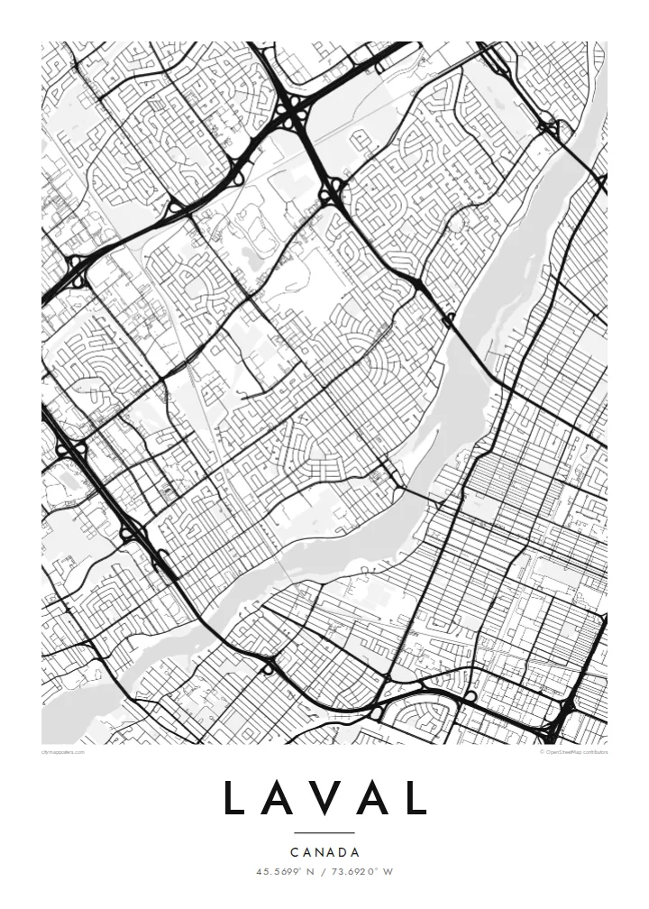
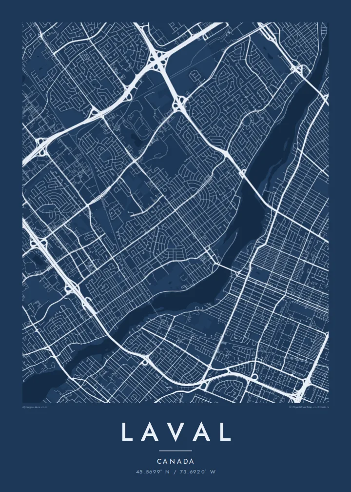
The Rivière des Prairies and the Rivière des Mille Îles wrap around the island. Their many small islands and inlets create a detailed, lacy edge on both sides.
Póster mapa minimalista · Canada
45.5699° N / 73.6920° W
An island city ringed by two rivers, with highways, suburban crescents and the metro's reach across the water.



Sidade ida, estilu lima
Hili estilu ida atu haree oinsá nia sai iha didin. Estilu hotu-hotu iha folin hanesan — imprime, kaixa moldura ka arkivu HD.
 Pixel loloos · arkivu imprime 24 × 36″
Moos atu imprime
Ida ne'e mak crop 100% husi arkivu imprime loloos. Poster ida-idak — imprime, kaixa moldura ka download — ami halo iha ami-nia servidor ho 300 DPI, to'o 7,200 × 10,800 pixel, atu dalan ki'ik liu mós sai klaru iha imprime 24 × 36″.
Iha Parede


Mapa
Laval covers all of Île Jésus, a large island north of Montreal. It is bounded by the Rivière des Prairies to the south and the Rivière des Mille Îles to the north. On a map it is one of the most clearly defined city shapes in Canada: an elongated island outline, fully built up in places, with both riverbanks traced by roads and small islands.
Inside that outline, Laval is a patchwork of suburban neighbourhoods. You see curving crescents and cul-de-sacs, older village cores along the rivers, and big commercial areas next to highway interchanges. Autoroutes 13, 15, 19 and 440 cut straight lines across the island, and bridges fan out to Montreal and to the North Shore.
The modern city was formed in 1965, when fourteen municipalities on the island merged. In 2007 Montreal's Orange Line crossed the river and three metro stations opened in Laval, including Montmorency. A Laval map poster shows the whole island at once, so the rivers frame the city like a border drawn by nature.
The Rivière des Prairies and the Rivière des Mille Îles wrap around the island. Their many small islands and inlets create a detailed, lacy edge on both sides.
Straight highways cross the island north to south and east to west. They meet in large cloverleaf interchanges that stand out clearly against the finer residential streets.
Along the riverbanks, older settlements such as Sainte-Rose and Saint-Vincent-de-Paul keep their small, irregular street patterns, unlike the planned suburbs inland.
Halo ita-nia póster rasik
Aumenta data, naran ka liafuan rasik, troka estilu, tamañu ka orientasaun.
Preview grátis nian rezolusaun ki'ik no iha marka bee. Imprime no arkivu HD ami halo ho 300 DPI, to'o 7,200 × 10,800 px, laiha marka bee.
Tanba sa Laval
People who grew up in Laval often feel it gets overlooked next to Montreal. This poster puts the island's own shape at the centre, and it makes a fitting gift for a first home, a family move or a return after years away.
The title, subtitle and coordinates line can all be changed. You could use a neighbourhood name, a street or a year. Choose from Classic black & white, Noir, Paper, Blueprint and Sand. The island shape reads well in each, and Paper suits a softer interior.
Enkomenda poster Laval| Tamañu imprime | Rezolusaun | Arkivu |
|---|---|---|
| 30 × 40 cm (11.8 × 15.7″) | 3,543 × 4,724 px | PNG · PDF |
| 29.7 × 42 cm (A3, 11.7 × 16.5″) | 3,508 × 4,961 px | PNG · PDF |
| 42 × 59.4 cm (A2, 16.5 × 23.4″) | 4,961 × 7,016 px | PNG · PDF |
| 45.7 × 61 cm (18 × 24″) | 5,400 × 7,200 px | PNG · PDF |
| 50 × 70 cm (19.7 × 27.6″) | 5,906 × 8,268 px | PNG · PDF |
| 61 × 91.4 cm (24 × 36″) | 7,200 × 10,800 px | PNG · PDF |
Atu kompara, previzaun gratuita luan 900 px, iha marka d'água no ba ekrã de'it. Arkivu HD iha rezolusaun to'o dala 8 boot liu iha direksaun ida-idak no imprime moos iha tamañu póster kompletu.
Hili estilu ida iha leten pájina, depois hili Poster Imprime — hili tamañu ida no, se hakarak, moldura ida — ka Arkivu Digital HD. Pagamentu halo iha pasu ida deit, no pájina enkomenda sei update kedas hafoin pagamentu remata.
Ami imprime iha papel matte kualidade aas 200 gsm, iha tamañu neen, husi 30 × 40 cm to'o 24 × 36″. Poster imprime hahú husi $39, haruka livre.
Bele. Hili moldura kayu solidu kór metan, mutin, oak natural ka kayu nakukun. Mai ho vidru la-kilat no prontu atu kandu iha didin. Poster ho moldura hahú husi $99, haruka livre.
Entrega gratuita ba mundu tomak. Poster ida-idak imprime husi ami-nia parseiru impresaun ne'ebé besik liu iha nasaun 30+ no normalmente to'o iha loron servisu 3–7. Ita bele haree estadu no tracking iha Ha'u-nia Pedidu. Nasaun balu foti semana 2–5, no iha nasaun ne'ebé ami seidauk entrega, sítiu hatudu ba ita molok selu.
Haruka foto ba ami iha loron 14 hafoin simu, no ami sei imprime fali ho grátis ka selu fila fali osan.
Bele. Iha editor iha pájina ne'e, troka titulu, subtitulu no liña koordenadas ba buat ne'ebé ita hakarak, depois hili estilu no tamañu. Enkomenda imprime, moldura ka digital hotu-hotu uza sasán ita-nia desain loloos.
Ho $9 ita simu arkivu PNG 300 DPI no PDF prontu-imprime iha tamañu neen hotu, laiha marka bee, atu imprime iha fatin ida-ida. Seidauk lai serteza? Download uluk preview grátis ho marka bee.
Besik
