Temple-centred core
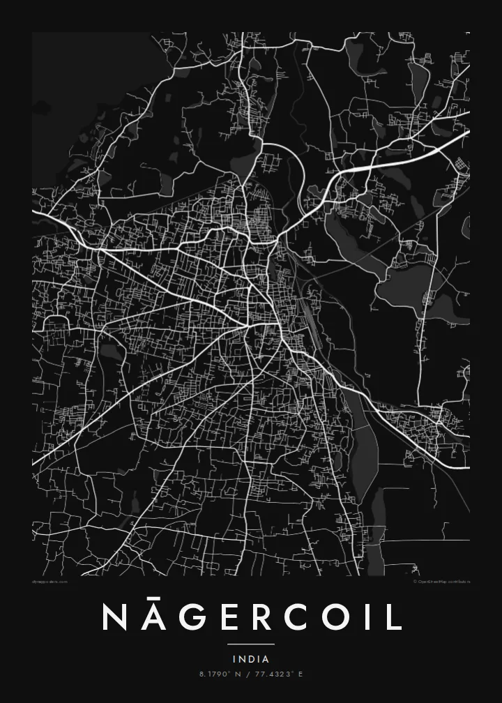
The older town gathers around the Nagaraja Temple and nearby market streets. It is the densest part of the map, and main roads spread out from it.
Póster mapa minimalista · India
8.1790° N / 77.4323° E
India's southern tip, where a temple town meets paddy fields, coconut groves and the last hills of the Western Ghats



Sidade ida, estilu lima
Hili estilu ida atu haree oinsá nia sai iha didin. Estilu hotu-hotu iha folin hanesan — imprime, kaixa moldura ka arkivu HD.
 Pixel loloos · arkivu imprime 24 × 36″
Moos atu imprime
Ida ne'e mak crop 100% husi arkivu imprime loloos. Poster ida-idak — imprime, kaixa moldura ka download — ami halo iha ami-nia servidor ho 300 DPI, to'o 7,200 × 10,800 pixel, atu dalan ki'ik liu mós sai klaru iha imprime 24 × 36″.
Iha Parede


Mapa
Nāgercoil is the administrative centre of Kanyakumari district, near the southern end of the Indian peninsula. The town sits in a green basin with the last ridges of the Western Ghats rising to the north and west. On a map, a compact core of busy streets gives way quickly to paddy fields, tanks and coconut plantations, which fill the gaps between neighbouring villages.
The name is linked to the Nagaraja Temple, dedicated to the serpent king, which remains a central landmark. Main roads leave the centre toward Thiruvananthapuram in the northwest, Tirunelveli in the northeast and Kanyakumari, the cape where three seas meet, a short drive to the south. Irrigation channels and water tanks appear across the surrounding plain as small blue shapes.
A Nāgercoil map poster shows a town closely bound to its landscape. Streets fan out from the old centre, water tanks are scattered through the fields, and the terrain begins to rise toward the hills. It is a map of the far south, where the continent narrows and runs out.
The older town gathers around the Nagaraja Temple and nearby market streets. It is the densest part of the map, and main roads spread out from it.
Irrigation tanks and channels dot the surrounding plain. On the poster they appear as scattered, rounded shapes among the fields and roads.
Main roads lead south toward Kanyakumari and north toward the Kerala border. They make clear lines through the green basin at the tip of India.
Halo ita-nia póster rasik
Aumenta data, naran ka liafuan rasik, troka estilu, tamañu ka orientasaun.
Preview grátis nian rezolusaun ki'ik no iha marka bee. Imprime no arkivu HD ami halo ho 300 DPI, to'o 7,200 × 10,800 px, laiha marka bee.
Tanba sa Nāgercoil
Nāgercoil is home for many people who work in Kerala, Chennai or the Gulf. A poster of its streets and tanks is a quiet link to the southern tip, and it makes a good wedding or housewarming gift.
Write your own title and subtitle, such as a family name or a date, and adjust the coordinates. Then pick Classic black & white, Noir, Paper, Blueprint or Sand.
Enkomenda poster Nāgercoil| Tamañu imprime | Rezolusaun | Arkivu |
|---|---|---|
| 30 × 40 cm11.8 × 15.7″ | 3,543 × 4,724 px | PNG · PDF |
| 29.7 × 42 cm (A3)11.7 × 16.5″ | 3,508 × 4,961 px | PNG · PDF |
| 42 × 59.4 cm (A2)16.5 × 23.4″ | 4,961 × 7,016 px | PNG · PDF |
| 45.7 × 61 cm18 × 24″ | 5,400 × 7,200 px | PNG · PDF |
| 50 × 70 cm19.7 × 27.6″ | 5,906 × 8,268 px | PNG · PDF |
| 61 × 91.4 cm24 × 36″ | 7,200 × 10,800 px | PNG · PDF |
Atu kompara, previzaun gratuita luan 900 px, iha marka d'água no ba ekrã de'it. Arkivu HD iha rezolusaun to'o dala 8 boot liu iha direksaun ida-idak no imprime moos iha tamañu póster kompletu.
Hili estilu ida iha leten pájina, depois hili Poster Imprime — hili tamañu ida no, se hakarak, moldura ida — ka Arkivu Digital HD. Pagamentu halo iha pasu ida deit, no pájina enkomenda sei update kedas hafoin pagamentu remata.
Ami imprime iha papel matte kualidade aas 200 gsm, iha tamañu neen, husi 30 × 40 cm to'o 24 × 36″. Poster imprime hahú husi $39, haruka livre.
Bele. Hili moldura kayu solidu kór metan, mutin, oak natural ka kayu nakukun. Mai ho vidru la-kilat no prontu atu kandu iha didin. Poster ho moldura hahú husi $99, haruka livre.
Entrega gratuita ba país 60+. Poster ida-idak ami-nia parseiru impresaun besik liu mak imprime iha país 30+ no normalmente to'o iha loron-servisu 3–7. Ita bele haree estatutu no rastreiu iha Ha'u-nia Enkomenda. Países balu presiza semana 2–5, no iha fatin ne'ebé ami seidauk entrega, site sei hatete ba ita molok selu.
Haruka foto ba ami iha loron 14 hafoin simu, no ami sei imprime fali ho grátis ka selu fila fali osan.
Bele. Iha editor iha pájina ne'e, troka titulu, subtitulu no liña koordenadas ba buat ne'ebé ita hakarak, depois hili estilu no tamañu. Enkomenda imprime, moldura ka digital hotu-hotu uza sasán ita-nia desain loloos.
Ho $9 ita simu arkivu PNG 300 DPI no PDF prontu-imprime iha tamañu neen hotu, laiha marka bee, atu imprime iha fatin ida-ida. Seidauk lai serteza? Download uluk preview grátis ho marka bee.
