Kamanashi River
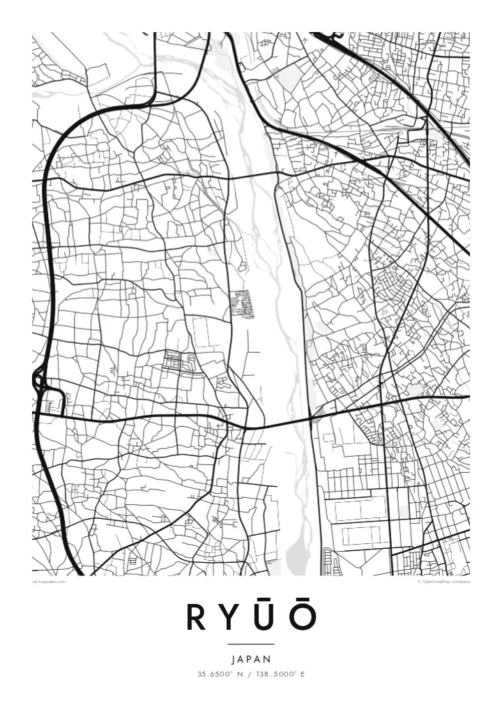
A broad river channel runs along the western side of Ryūō. Its wide, braided bed contrasts with the small blocks of houses next to it.
Póster mapa minimalista · Japan
35.6500° N / 138.5000° E
A flat district on the floor of the Kōfu Basin, crossed by a railway and edged by an old river levee


Sidade ida, estilu lima
Hili estilu ida atu haree oinsá nia sai iha didin. Estilu hotu-hotu iha folin hanesan — imprime, kaixa moldura ka arkivu HD.
 Pixel loloos · arkivu imprime 24 × 36″
Moos atu imprime
Ida ne'e mak crop 100% husi arkivu imprime loloos. Poster ida-idak — imprime, kaixa moldura ka download — ami halo iha ami-nia servidor ho 300 DPI, to'o 7,200 × 10,800 pixel, atu dalan ki'ik liu mós sai klaru iha imprime 24 × 36″.
Iha Parede


Mapa
Ryūō is in the western part of the Kōfu Basin in Yamanashi Prefecture. It was once a town of its own and is now part of the city of Kai. The land here is almost completely flat, surrounded by mountain ranges on all sides, and on a map the flatness shows as a close mix of houses, roads and remaining farmland.
The Chūō Main Line passes through, with a station named Ryūō, and the Kamanashi River lies along the western side. This stretch of river is linked with the Shingen Tsutsumi, a flood-control levee traditionally credited to the warlord Takeda Shingen. It is one of the best-known early engineering projects in Japan, and the river and levee give the map a strong edge on one side.
A Ryūō map poster shows a quiet part of the basin, on a map with few landmarks and a lot of fine texture. Smaller streets wind between plots, and larger roads cut straight across them. The result looks almost like an engraving in monochrome. Looking toward the south, the basin is also known for its views of Mount Fuji.
A broad river channel runs along the western side of Ryūō. Its wide, braided bed contrasts with the small blocks of houses next to it.
The historic levee system along the Kamanashi is traditionally linked with Takeda Shingen. It is a notable piece of flood engineering in this part of the basin.
The railway cuts a straight line across the district, and Ryūō Station sits on it. It is one of the few long, clean lines in an otherwise closely packed map.
Halo ita-nia póster rasik
Aumenta data, naran ka liafuan rasik, troka estilu, tamañu ka orientasaun.
Preview grátis nian rezolusaun ki'ik no iha marka bee. Imprime no arkivu HD ami halo ho 300 DPI, to'o 7,200 × 10,800 px, laiha marka bee.
Tanba sa Ryūō
For people from Yamanashi, Ryūō is a specific home rather than just a point on the way to Kōfu. A drawing of its streets, the river and the railway keeps that specific place on the wall. It suits a calm interior, where fine lines can be looked at up close.
Add a title in Latin or Japanese script, a subtitle or a special date, and edit the coordinates line if you wish. Choose Classic black & white, Noir, Paper, Blueprint or Sand. HD files are $9, and a free 900 px preview shows the result before you buy.
Enkomenda poster Ryūō| Tamañu imprime | Rezolusaun | Arkivu |
|---|---|---|
| 30 × 40 cm11.8 × 15.7″ | 3,543 × 4,724 px | PNG · PDF |
| 29.7 × 42 cm (A3)11.7 × 16.5″ | 3,508 × 4,961 px | PNG · PDF |
| 42 × 59.4 cm (A2)16.5 × 23.4″ | 4,961 × 7,016 px | PNG · PDF |
| 45.7 × 61 cm18 × 24″ | 5,400 × 7,200 px | PNG · PDF |
| 50 × 70 cm19.7 × 27.6″ | 5,906 × 8,268 px | PNG · PDF |
| 61 × 91.4 cm24 × 36″ | 7,200 × 10,800 px | PNG · PDF |
Atu kompara, previzaun gratuita luan 900 px, iha marka d'água no ba ekrã de'it. Arkivu HD iha rezolusaun to'o dala 8 boot liu iha direksaun ida-idak no imprime moos iha tamañu póster kompletu.
Hili estilu ida iha leten pájina, depois hili Poster Imprime — hili tamañu ida no, se hakarak, moldura ida — ka Arkivu Digital HD. Pagamentu halo iha pasu ida deit, no pájina enkomenda sei update kedas hafoin pagamentu remata.
Ami imprime iha papel matte kualidade aas 200 gsm, iha tamañu neen, husi 30 × 40 cm to'o 24 × 36″. Poster imprime hahú husi $39, haruka livre.
Bele. Hili moldura kayu solidu kór metan, mutin, oak natural ka kayu nakukun. Mai ho vidru la-kilat no prontu atu kandu iha didin. Poster ho moldura hahú husi $99, haruka livre.
Entrega gratuita ba país 60+. Poster ida-idak ami-nia parseiru impresaun besik liu mak imprime iha país 30+ no normalmente to'o iha loron-servisu 3–7. Ita bele haree estatutu no rastreiu iha Ha'u-nia Enkomenda. Países balu presiza semana 2–5, no iha fatin ne'ebé ami seidauk entrega, site sei hatete ba ita molok selu.
Haruka foto ba ami iha loron 14 hafoin simu, no ami sei imprime fali ho grátis ka selu fila fali osan.
Bele. Iha editor iha pájina ne'e, troka titulu, subtitulu no liña koordenadas ba buat ne'ebé ita hakarak, depois hili estilu no tamañu. Enkomenda imprime, moldura ka digital hotu-hotu uza sasán ita-nia desain loloos.
Ho $9 ita simu arkivu PNG 300 DPI no PDF prontu-imprime iha tamañu neen hotu, laiha marka bee, atu imprime iha fatin ida-ida. Seidauk lai serteza? Download uluk preview grátis ho marka bee.
