Chongchon estuary
The lower Chongchon spreads wide as it approaches the Yellow Sea, with sandbanks and tidal ground giving the river an irregular, layered outline on the poster.
Póster mapa minimalista · North Korea
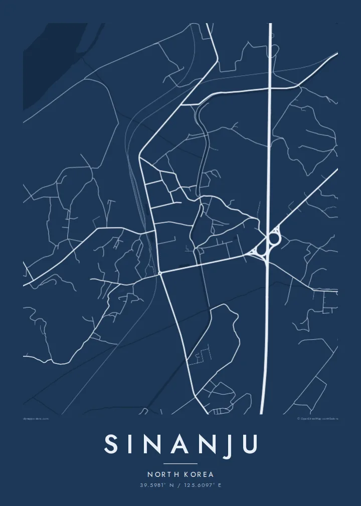
39.5981° N / 125.6097° E
A river town on the lower Chongchon, where rail and road bridges cross just before the estuary opens to the Yellow Sea.



Sidade ida, estilu lima
Hili estilu ida atu haree oinsá nia sai iha didin. Estilu hotu-hotu iha folin hanesan — imprime, kaixa moldura ka arkivu HD.
 Pixel loloos · arkivu imprime 24 × 36″
Moos atu imprime
Ida ne'e mak crop 100% husi arkivu imprime loloos. Poster ida-idak — imprime, kaixa moldura ka download — ami halo iha ami-nia servidor ho 300 DPI, to'o 7,200 × 10,800 pixel, atu dalan ki'ik liu mós sai klaru iha imprime 24 × 36″.
Iha Parede


Mapa
Sinanju sits on the lower Chongchon River in South Pyongan Province, close to where the river widens into its estuary and meets the Yellow Sea. On the map the river dominates: a broad band of water and tidal flats curving past the town, with low farmland and scattered settlements spreading across the flat ground on either bank.
The town has long been a crossing point. The main railway between Pyongyang and the northwest border runs through here, and its bridges over the Chongchon form some of the strongest straight lines in the whole frame. Roads converge on the same crossing, giving Sinanju a clear role as a knot in the regional transport network.
Because of that position, the lower Chongchon saw heavy fighting during the Korean War. A Sinanju map poster shows the geography behind that history in plain lines: the wide river, the bridges, the grid of fields and embankments, and the coastline beginning to open out toward the sea.
The lower Chongchon spreads wide as it approaches the Yellow Sea, with sandbanks and tidal ground giving the river an irregular, layered outline on the poster.
Rail and road bridges span the river near the town, straight lines cutting across the water that mark Sinanju's long-standing importance as a crossing point.
Flat farmland, embankments and field divisions surround the town, creating a finely ruled background that contrasts with the broad curves of the river.
Halo ita-nia póster rasik
Aumenta data, naran ka liafuan rasik, troka estilu, tamañu ka orientasaun.
Preview grátis nian rezolusaun ki'ik no iha marka bee. Imprime no arkivu HD ami halo ho 300 DPI, to'o 7,200 × 10,800 px, laiha marka bee.
Tanba sa Sinanju
This is a map for people with a family connection to the region, historians of the Korean War, or collectors of rarely mapped places. The strong line of the river and its crossings makes a composition that is both graphic and quietly thought-provoking.
The title, subtitle and coordinates line can be edited, so you can add a family name, a date or a short note. Choose from five styles, Classic black & white, Noir, Paper, Blueprint and Sand, as $9 HD files or a printed poster with an optional wooden frame.
Enkomenda poster Sinanju| Tamañu imprime | Rezolusaun | Arkivu |
|---|---|---|
| 30 × 40 cm11.8 × 15.7″ | 3,543 × 4,724 px | PNG · PDF |
| 29.7 × 42 cm (A3)11.7 × 16.5″ | 3,508 × 4,961 px | PNG · PDF |
| 42 × 59.4 cm (A2)16.5 × 23.4″ | 4,961 × 7,016 px | PNG · PDF |
| 45.7 × 61 cm18 × 24″ | 5,400 × 7,200 px | PNG · PDF |
| 50 × 70 cm19.7 × 27.6″ | 5,906 × 8,268 px | PNG · PDF |
| 61 × 91.4 cm24 × 36″ | 7,200 × 10,800 px | PNG · PDF |
Atu kompara, previzaun gratuita luan 900 px, iha marka d'água no ba ekrã de'it. Arkivu HD iha rezolusaun to'o dala 8 boot liu iha direksaun ida-idak no imprime moos iha tamañu póster kompletu.
Hili estilu ida iha leten pájina, depois hili Poster Imprime — hili tamañu ida no, se hakarak, moldura ida — ka Arkivu Digital HD. Pagamentu halo iha pasu ida deit, no pájina enkomenda sei update kedas hafoin pagamentu remata.
Ami imprime iha papel matte kualidade aas 200 gsm, iha tamañu neen, husi 30 × 40 cm to'o 24 × 36″. Poster imprime hahú husi $39, haruka livre.
Bele. Hili moldura kayu solidu kór metan, mutin, oak natural ka kayu nakukun. Mai ho vidru la-kilat no prontu atu kandu iha didin. Poster ho moldura hahú husi $99, haruka livre.
Entrega gratuita ba país 60+. Poster ida-idak ami-nia parseiru impresaun besik liu mak imprime iha país 30+ no normalmente to'o iha loron-servisu 3–7. Ita bele haree estatutu no rastreiu iha Ha'u-nia Enkomenda. Países balu presiza semana 2–5, no iha fatin ne'ebé ami seidauk entrega, site sei hatete ba ita molok selu.
Haruka foto ba ami iha loron 14 hafoin simu, no ami sei imprime fali ho grátis ka selu fila fali osan.
Bele. Iha editor iha pájina ne'e, troka titulu, subtitulu no liña koordenadas ba buat ne'ebé ita hakarak, depois hili estilu no tamañu. Enkomenda imprime, moldura ka digital hotu-hotu uza sasán ita-nia desain loloos.
Ho $9 ita simu arkivu PNG 300 DPI no PDF prontu-imprime iha tamañu neen hotu, laiha marka bee, atu imprime iha fatin ida-ida. Seidauk lai serteza? Download uluk preview grátis ho marka bee.
