Minato Mirai 21
A modern waterfront district built on reclaimed land, with tall towers, open plazas and a large Ferris wheel forming a clean, planned edge along the bay.
Póster mapa minimalista · Japan
35.4333° N / 139.6500° E
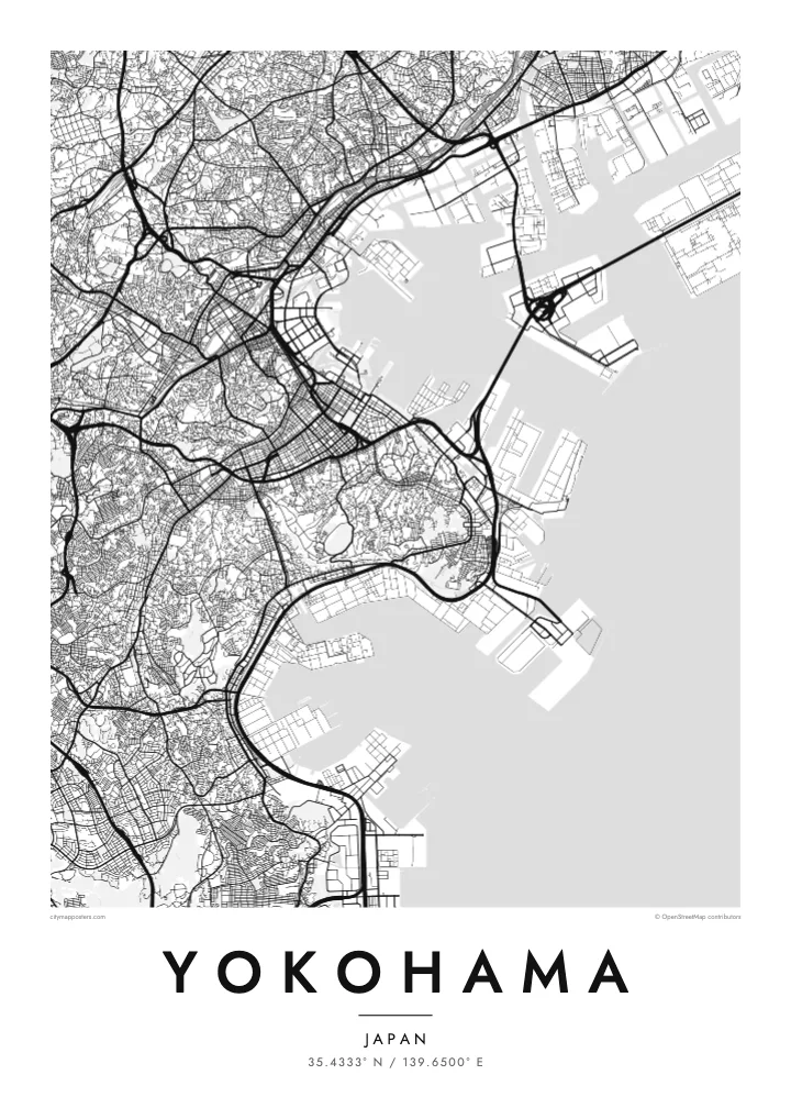
A port city on Tokyo Bay, with a waterfront of piers and reclaimed land and hills rising just behind the harbour.


Sidade ida, estilu lima
Hili estilu ida atu haree oinsá nia sai iha didin. Estilu hotu-hotu iha folin hanesan — imprime, kaixa moldura ka arkivu HD.
 Pixel loloos · arkivu imprime 24 × 36″
Moos atu imprime
Ida ne'e mak crop 100% husi arkivu imprime loloos. Poster ida-idak — imprime, kaixa moldura ka download — ami halo iha ami-nia servidor ho 300 DPI, to'o 7,200 × 10,800 pixel, atu dalan ki'ik liu mós sai klaru iha imprime 24 × 36″.
Iha Parede


Mapa
Yokohama faces Tokyo Bay, and from above its waterfront is a line of piers, reclaimed land and container terminals. The older city centre sits close to the harbour, with Yamashita Park running along the shore, while behind it the land climbs quickly into wooded hills. Further inland, residential districts spread across a rolling landscape of valleys and ridges.
The port opened to foreign trade in 1859, and the city grew from a small fishing village into one of the largest cities in Japan. The hill known as the Bluff, or Yamate, became home to foreign residents, and below it Chinatown, the largest in Japan, still fills a tight grid of streets with gates marking its edges.
Minato Mirai 21 added a new waterfront district of towers, museums and a large Ferris wheel on reclaimed land. A Yokohama map poster shows how the harbour, old town, Chinatown and new waterfront sit together, while the Bay Bridge crosses the entrance to the inner port as one of the most graphic lines on the map.
A modern waterfront district built on reclaimed land, with tall towers, open plazas and a large Ferris wheel forming a clean, planned edge along the bay.
The largest Chinatown in Japan fills a compact grid of streets near the harbour, framed by decorative gates that mark its entrances.
A long cable-stayed bridge crosses the harbour entrance, visible on the map as a thin straight line joining piers and industrial land across the water.
Halo ita-nia póster rasik
Aumenta data, naran ka liafuan rasik, troka estilu, tamañu ka orientasaun.
Preview grátis nian rezolusaun ki'ik no iha marka bee. Imprime no arkivu HD ami halo ho 300 DPI, to'o 7,200 × 10,800 px, laiha marka bee.
Tanba sa Yokohama
Yokohama is a city many people know from years of work or study near Tokyo, or from weekends on the harbour. A map poster keeps its waterfront and hills in view long after leaving, and it sits well beside a Tokyo print.
Write your own title and subtitle, add coordinates or a date, and pick a style: Classic black & white, Noir, Paper, Blueprint or Sand. The $9 HD files cover six sizes, including A3 and A2, each without a watermark.
Enkomenda poster Yokohama| Tamañu imprime | Rezolusaun | Arkivu |
|---|---|---|
| 30 × 40 cm11.8 × 15.7″ | 3,543 × 4,724 px | PNG · PDF |
| 29.7 × 42 cm (A3)11.7 × 16.5″ | 3,508 × 4,961 px | PNG · PDF |
| 42 × 59.4 cm (A2)16.5 × 23.4″ | 4,961 × 7,016 px | PNG · PDF |
| 45.7 × 61 cm18 × 24″ | 5,400 × 7,200 px | PNG · PDF |
| 50 × 70 cm19.7 × 27.6″ | 5,906 × 8,268 px | PNG · PDF |
| 61 × 91.4 cm24 × 36″ | 7,200 × 10,800 px | PNG · PDF |
Atu kompara, previzaun gratuita luan 900 px, iha marka d'água no ba ekrã de'it. Arkivu HD iha rezolusaun to'o dala 8 boot liu iha direksaun ida-idak no imprime moos iha tamañu póster kompletu.
Hili estilu ida iha leten pájina, depois hili Poster Imprime — hili tamañu ida no, se hakarak, moldura ida — ka Arkivu Digital HD. Pagamentu halo iha pasu ida deit, no pájina enkomenda sei update kedas hafoin pagamentu remata.
Ami imprime iha papel matte kualidade aas 200 gsm, iha tamañu neen, husi 30 × 40 cm to'o 24 × 36″. Poster imprime hahú husi $39, haruka livre.
Bele. Hili moldura kayu solidu kór metan, mutin, oak natural ka kayu nakukun. Mai ho vidru la-kilat no prontu atu kandu iha didin. Poster ho moldura hahú husi $99, haruka livre.
Entrega gratuita ba país 60+. Poster ida-idak ami-nia parseiru impresaun besik liu mak imprime iha país 30+ no normalmente to'o iha loron-servisu 3–7. Ita bele haree estatutu no rastreiu iha Ha'u-nia Enkomenda. Países balu presiza semana 2–5, no iha fatin ne'ebé ami seidauk entrega, site sei hatete ba ita molok selu.
Haruka foto ba ami iha loron 14 hafoin simu, no ami sei imprime fali ho grátis ka selu fila fali osan.
Bele. Iha editor iha pájina ne'e, troka titulu, subtitulu no liña koordenadas ba buat ne'ebé ita hakarak, depois hili estilu no tamañu. Enkomenda imprime, moldura ka digital hotu-hotu uza sasán ita-nia desain loloos.
Ho $9 ita simu arkivu PNG 300 DPI no PDF prontu-imprime iha tamañu neen hotu, laiha marka bee, atu imprime iha fatin ida-ida. Seidauk lai serteza? Download uluk preview grátis ho marka bee.
