Oval old town
The historic centre forms a compact oval around a main square. Its outline follows the course of the former town walls.
Minimalistik karta plakaty · Çehiýa
49.5480° N / 17.7347° E
A Moravian town on the Bečva river, with a walled old core and the Moravian Gate valley around it


Bir şäher, bäş keýp
Diwarda nähili görünjegini görmek üçin stile basyň. Ähli stiller bir bahadan — çap edilen, çarçuwaly ýa-da HD faýl görnüşinde.
 Hakyky pikseller · 24 × 36″ çap faýly
Çapda aýdyň
Bu hakyky çap faýlynyň 100% kesigi. Her poster — çap edilen, çarçuwaly ýa-da ýüklenen — serwerlerimizde 300 DPI, 7,200 × 10,800 piksele çenli işlenip taýýarlanýar, şonuň üçin iň kiçi köçeler hem 24 × 36″ çapda arassa görünýär.
Diwarda


Karta
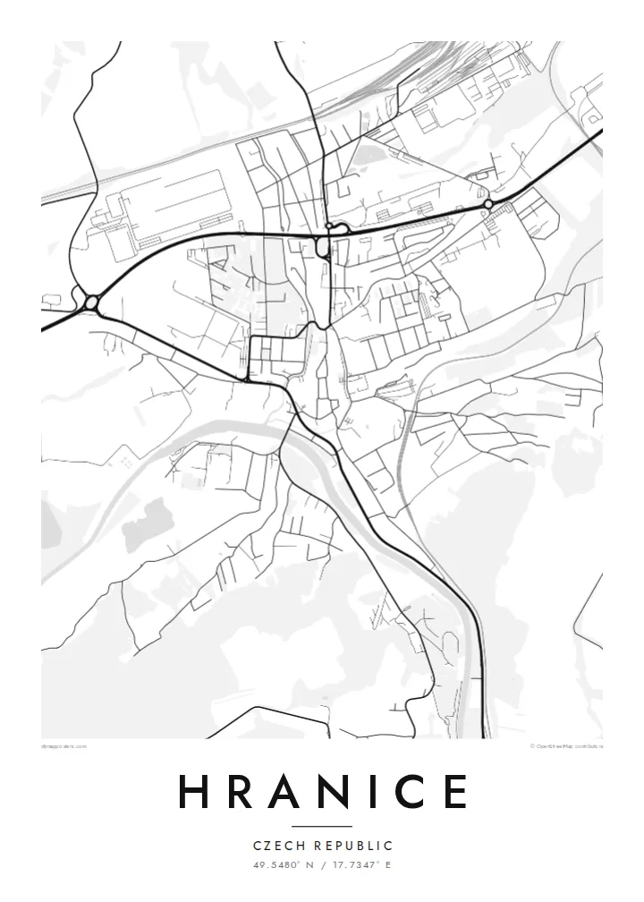
Hranice lies in eastern Moravia, in the Moravian Gate, a lowland corridor between the Carpathians and the Sudetes that has served as a route for trade and travel for centuries. The Bečva river runs past the town. The old centre sits on higher ground above it, compact and roughly oval, with a main square and streets that still follow the line of its old walls.
Just outside town is the Hranice Abyss, a limestone chasm with a flooded cave measured as the deepest of its kind in the world. On the map, it appears only as a patch of woodland near the river, a small area that hides remarkable depths below. Railway lines and main roads follow the valley past the town.
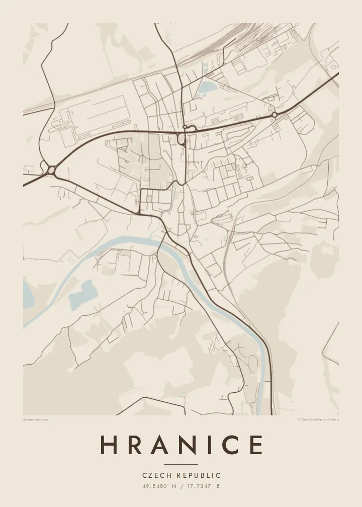
A Hranice map poster shows a town shaped by its position. There is the tight historic core, the river curving below, and the transport lines running through the gap between the mountains. The black-and-white rendering makes the oval of the old town especially clear, set against the more scattered pattern of the newer districts.
The historic centre forms a compact oval around a main square. Its outline follows the course of the former town walls.
The river curves below the old town, with bridges crossing to the other bank. It gives the map a clear flowing line.
Railways and roads run through the valley past Hranice, marking the historic route between the mountain ranges.
Özüňiziňki ediň
Sene, at ýa-da öz setiriňizi goşuň, stili, ölçegi ýa-da ugry üýtgediň.
Mugt deslapky görnüş pes durulykda we suw belgili. Çaplar we HD faýllar suw belgisiz, 300 DPI, 7,200 × 10,800 px çenli işlenip taýýarlanýar.
Näme üçin Hranice
Hranice appeals to people who grew up in Moravia, studied here, or came to see the Abyss and stayed with the town in their memory. The clear oval of the old centre gives the print a strong focal point, and it looks good even in the smallest size.
Change the title, subtitle and coordinates line to your own text. Choose Classic black & white, Noir, Paper, Blueprint or Sand. There is a free 900 px watermarked preview to check the result, and the full HD files cost $9.
Hranice posterini sargyt ediň| Çap ölçegi | Çözgüt | Faýllar |
|---|---|---|
| 30 × 40 cm (11.8 × 15.7″) | 3,543 × 4,724 px | PNG · PDF |
| 29.7 × 42 cm (A3, 11.7 × 16.5″) | 3,508 × 4,961 px | PNG · PDF |
| 42 × 59.4 cm (A2, 16.5 × 23.4″) | 4,961 × 7,016 px | PNG · PDF |
| 45.7 × 61 cm (18 × 24″) | 5,400 × 7,200 px | PNG · PDF |
| 50 × 70 cm (19.7 × 27.6″) | 5,906 × 8,268 px | PNG · PDF |
| 61 × 91.4 cm (24 × 36″) | 7,200 × 10,800 px | PNG · PDF |
Deňeşdirmek üçin: mugt nusga 900 px giňlikde, suw belgili we ekranlar üçin niýetlenen. HD faýllaryň çözgüdi her tarapa 8 esse çenli ýokary we doly plakat ölçeginde arassa çap edilýär.
Sahypanyň ýokarsyndan stili saýlaň, soňra Çap edilen Poster — ölçegini we isleseňiz çarçuwasyny — ýa-da Sanly HD Faýllary saýlaň. Töleg bir ädimde amala aşyrylýar, tölegiňiz geçen dessine sargyt sahypaňyz täzelenýär.
Ol ýokary hilli 200 gsm mat kagyza, alty ölçegiň birinde, 30 × 40 sm-den 24 × 36″-a çenli çap edilýär. Çap edilen posterler $39-dan başlaýar, eltip bermek bahasy girýär.
Hawa. Gara, ak, tebigy dub ýa-da garaňky agaç reňkinde tutuş agaç çarçuwany saýlaň. Ol döwülmeýän aýna bilen gelýär we asmaga taýýar. Çarçuwaly posterler $99-dan başlaýar, eltip bermek bahasy girýär.
Eltip getirmek dünýäniň hemme ýerine mugt. Her plakat 30-dan gowrak ýurtdaky çap hyzmatdaşlarymyzyň iň ýakynynda çap edilýär we adatça 3–7 iş gününde gelýär. Ýagdaýyny we yzarlaýyş maglumatyny «Meniň sargytlarym» bölüminde görüp bilersiňiz. Käbir ýurtlara 2–5 hepde gerek bolýar, entek eltip bermeýän ýurtlarymyz üçin bolsa sagdyn töleginden öň sahypada habar berilýär.
Eltilenden soň 14 günüň dowamynda bize surat iberiň, biz ony mugt gaýtadan çap ederis ýa-da puluňyzy yzyna gaýtararys.
Hawa. Bu sahypadaky redaktorda ady, kiçi ady we koordinatlar setirini islän zadyňyza üýtgediň, soňra stil we ölçeg saýlaň. Çap edilen, çarçuwaly we sanly sargytlaryň ählisi siziň dizaýnyňyzy takyk ulanýar.
$9 üçin ähli alty ölçegde, suw belgisiz, islendik ýerde çap edip bolýan 300 DPI PNG we çap etmäge taýyn PDF faýllaryny alýarsyňyz. Entek gutarnykly karara gelmediňizmi? Ilki mugt, suw belgili deslapky görnüşi göçürip alyň.
Golaýda
