Rounded outline
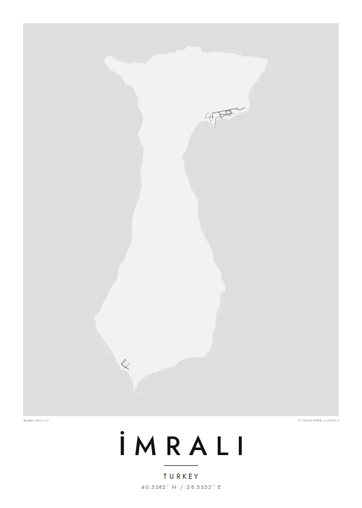
The island's coast is smooth and only lightly indented. The map shows a compact, soft-edged form surrounded by a wide stretch of open water.
Minimalistik karta plakaty · Türkiýe
40.5382° N / 28.5352° E
A compact, hilly island in the southern Sea of Marmara, with a smooth coastline and few marked features.


Bir şäher, bäş keýp
Diwarda nähili görünjegini görmek üçin stile basyň. Ähli stiller bir bahadan — çap edilen, çarçuwaly ýa-da HD faýl görnüşinde.
 Hakyky pikseller · 24 × 36″ çap faýly
Çapda aýdyň
Bu hakyky çap faýlynyň 100% kesigi. Her poster — çap edilen, çarçuwaly ýa-da ýüklenen — serwerlerimizde 300 DPI, 7,200 × 10,800 piksele çenli işlenip taýýarlanýar, şonuň üçin iň kiçi köçeler hem 24 × 36″ çapda arassa görünýär.
Diwarda


Karta
İmralı lies in the southern Sea of Marmara, near the mouth of the Gulf of Gemlik and within sight of the Bursa coastline. On a map it is a small, rounded island with a gently curving outline and a hilly interior. It has almost no marked roads or settlements. Its shape is simple, closer to a pebble than to the jagged islands of the Aegean.
The island has served as a prison since the 1930s, and access has long been limited to the authorities. Since 1999 it has held Abdullah Öcalan, which has made the name widely known in Turkey and abroad. The island therefore stays largely closed to visitors, and maps show few details of its interior.
From the Marmara coast it sits low on the horizon between the mainland and open water. An İmralı map poster treats the island purely as geography: a clean outline in the sea, with the surrounding coast and water giving scale to a place better known by name than by sight.
The island's coast is smooth and only lightly indented. The map shows a compact, soft-edged form surrounded by a wide stretch of open water.
The island lies near the mouth of the Gulf of Gemlik, between the southern coast and the open sea, which frames it clearly on the page.
Access is restricted and there has been little development, so the interior carries few roads or buildings. The hills alone define the map.
Özüňiziňki ediň
Sene, at ýa-da öz setiriňizi goşuň, stili, ölçegi ýa-da ugry üýtgediň.
Mugt deslapky görnüş pes durulykda we suw belgili. Çaplar we HD faýllar suw belgisiz, 300 DPI, 7,200 × 10,800 px çenli işlenip taýýarlanýar.
Näme üçin İmralı
Some people want the island for its place in modern Turkish history, others simply for its shape in the Marmara. Either way the print is restrained and neutral, a piece of geography rather than a statement on the wall.
Change the title and subtitle to suit your purpose, keep the coordinates line, and pick from five styles, such as Classic black & white or Paper. The free watermarked preview lets you check the framing before you choose files or a print.
İmralı posterini sargyt ediň| Çap ölçegi | Çözgüt | Faýllar |
|---|---|---|
| 30 × 40 cm (11.8 × 15.7″) | 3,543 × 4,724 px | PNG · PDF |
| 29.7 × 42 cm (A3, 11.7 × 16.5″) | 3,508 × 4,961 px | PNG · PDF |
| 42 × 59.4 cm (A2, 16.5 × 23.4″) | 4,961 × 7,016 px | PNG · PDF |
| 45.7 × 61 cm (18 × 24″) | 5,400 × 7,200 px | PNG · PDF |
| 50 × 70 cm (19.7 × 27.6″) | 5,906 × 8,268 px | PNG · PDF |
| 61 × 91.4 cm (24 × 36″) | 7,200 × 10,800 px | PNG · PDF |
Deňeşdirmek üçin: mugt nusga 900 px giňlikde, suw belgili we ekranlar üçin niýetlenen. HD faýllaryň çözgüdi her tarapa 8 esse çenli ýokary we doly plakat ölçeginde arassa çap edilýär.
Sahypanyň ýokarsyndan stili saýlaň, soňra Çap edilen Poster — ölçegini we isleseňiz çarçuwasyny — ýa-da Sanly HD Faýllary saýlaň. Töleg bir ädimde amala aşyrylýar, tölegiňiz geçen dessine sargyt sahypaňyz täzelenýär.
Ol ýokary hilli 200 gsm mat kagyza, alty ölçegiň birinde, 30 × 40 sm-den 24 × 36″-a çenli çap edilýär. Çap edilen posterler {printFrom}-dan başlaýar, eltip bermek bahasy girýär.
Hawa. Gara, ak, tebigy dub ýa-da garaňky agaç reňkinde tutuş agaç çarçuwany saýlaň. Ol döwülmeýän aýna bilen gelýär we asmaga taýýar. Çarçuwaly posterler {framedFrom}-dan başlaýar, eltip bermek bahasy girýär.
Eltip bermek dünýäniň ähli ýerinde mugt. Her poster 30-dan gowrak ýurtdaky çap hyzmatdaşlarymyzyň iň ýakynynda çap edilýär we adatça 3–7 iş gününde gelýär. Ýagdaýyny we yzarlamany Sargytlarym bölüminde görüp bilersiňiz.
Eltilenden soň 14 günüň dowamynda bize surat iberiň, biz ony mugt gaýtadan çap ederis ýa-da puluňyzy yzyna gaýtararys.
Hawa. Bu sahypadaky redaktorda ady, kiçi ady we koordinatlar setirini islän zadyňyza üýtgediň, soňra stil we ölçeg saýlaň. Çap edilen, çarçuwaly we sanly sargytlaryň ählisi siziň dizaýnyňyzy takyk ulanýar.
$9 üçin ähli alty ölçegde, suw belgisiz, islendik ýerde çap edip bolýan 300 DPI PNG we çap etmäge taýyn PDF faýllaryny alýarsyňyz. Entek gutarnykly karara gelmediňizmi? Ilki mugt, suw belgili deslapky görnüşi göçürip alyň.
