Krk Bridge
Two concrete arches leap from the mainland to the island via a rocky islet. They form the single fixed link at the northern tip.
Minimalistik karta plakaty · Horwatiýa
45.0902° N / 14.6256° E
A broad, stony island in the Kvarner Gulf, bridged to the mainland and scalloped with deep bays




Bir şäher, bäş keýp
Diwarda nähili görünjegini görmek üçin stile basyň. Ähli stiller bir bahadan — çap edilen, çarçuwaly ýa-da HD faýl görnüşinde.
 Hakyky pikseller · 24 × 36″ çap faýly
Çapda aýdyň
Bu hakyky çap faýlynyň 100% kesigi. Her poster — çap edilen, çarçuwaly ýa-da ýüklenen — serwerlerimizde 300 DPI, 7,200 × 10,800 piksele çenli işlenip taýýarlanýar, şonuň üçin iň kiçi köçeler hem 24 × 36″ çapda arassa görünýär.
Diwarda


Karta
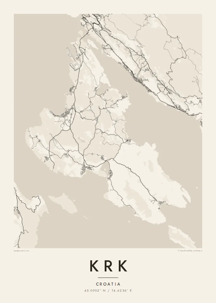
Krk sits in the Kvarner Gulf close to Rijeka, and it is one of the two largest islands in the Adriatic. Its outline is irregular. The north is wider, low and greener, while the south-east rises into bare limestone ridges above the long valley of Baška. The coast is scalloped by bays, the largest of which reach deep into the island at Punat and Soline.
In the north, the Krk Bridge links the island to the mainland. Opened in 1980, it runs in two concrete arches via a small islet, and Rijeka airport sits on the island near its landing. The towns are strung along the shore: Omišalj on its hill, Malinska and Njivice on the western coast, and the walled town of Krk on the south-west.
A Krk map poster also takes in the enclosed bay of Punat with the small islet of Košljun and its Franciscan monastery. In the south, Baška is where the Baška tablet was found. This stone slab carries one of the earliest inscriptions in Croatian, in the Glagolitic script, and is often cited as a founding text of the language.
Two concrete arches leap from the mainland to the island via a rocky islet. They form the single fixed link at the northern tip.
An almost enclosed bay south-east of Krk town, with the small islet of Košljun in the middle. On the map it looks like an inland lake.
A compact walled town on the south-west coast, with narrow streets inside the old defences and a small harbour on the waterfront.
Özüňiziňki ediň
Sene, at ýa-da öz setiriňizi goşuň, stili, ölçegi ýa-da ugry üýtgediň.
Mugt deslapky görnüş pes durulykda we suw belgili. Çaplar we HD faýllar suw belgisiz, 300 DPI, 7,200 × 10,800 px çenli işlenip taýýarlanýar.
Näme üçin Krk
Krk is where many families have spent summers for generations, arriving over the bridge from Rijeka. The island's bays and ridges give a poster plenty of detail without crowding, and it looks right in both large and small frames.
Add your own title, subtitle and coordinates line, such as a village name or a year. Choose Classic black & white, Noir, Paper, Blueprint or Sand, then get HD files for $9 or a printed poster with an optional wooden frame.
Krk posterini sargyt ediň| Çap ölçegi | Çözgüt | Faýllar |
|---|---|---|
| 30 × 40 cm (11.8 × 15.7″) | 3,543 × 4,724 px | PNG · PDF |
| 29.7 × 42 cm (A3, 11.7 × 16.5″) | 3,508 × 4,961 px | PNG · PDF |
| 42 × 59.4 cm (A2, 16.5 × 23.4″) | 4,961 × 7,016 px | PNG · PDF |
| 45.7 × 61 cm (18 × 24″) | 5,400 × 7,200 px | PNG · PDF |
| 50 × 70 cm (19.7 × 27.6″) | 5,906 × 8,268 px | PNG · PDF |
| 61 × 91.4 cm (24 × 36″) | 7,200 × 10,800 px | PNG · PDF |
Deňeşdirmek üçin: mugt nusga 900 px giňlikde, suw belgili we ekranlar üçin niýetlenen. HD faýllaryň çözgüdi her tarapa 8 esse çenli ýokary we doly plakat ölçeginde arassa çap edilýär.
Sahypanyň ýokarsyndan stili saýlaň, soňra Çap edilen Poster — ölçegini we isleseňiz çarçuwasyny — ýa-da Sanly HD Faýllary saýlaň. Töleg bir ädimde amala aşyrylýar, tölegiňiz geçen dessine sargyt sahypaňyz täzelenýär.
Ol ýokary hilli 200 gsm mat kagyza, alty ölçegiň birinde, 30 × 40 sm-den 24 × 36″-a çenli çap edilýär. Çap edilen posterler {printFrom}-dan başlaýar, eltip bermek bahasy girýär.
Hawa. Gara, ak, tebigy dub ýa-da garaňky agaç reňkinde tutuş agaç çarçuwany saýlaň. Ol döwülmeýän aýna bilen gelýär we asmaga taýýar. Çarçuwaly posterler {framedFrom}-dan başlaýar, eltip bermek bahasy girýär.
Eltip bermek dünýäniň ähli ýerinde mugt. Her poster 30-dan gowrak ýurtdaky çap hyzmatdaşlarymyzyň iň ýakynynda çap edilýär we adatça 3–7 iş gününde gelýär. Ýagdaýyny we yzarlamany Sargytlarym bölüminde görüp bilersiňiz.
Eltilenden soň 14 günüň dowamynda bize surat iberiň, biz ony mugt gaýtadan çap ederis ýa-da puluňyzy yzyna gaýtararys.
Hawa. Bu sahypadaky redaktorda ady, kiçi ady we koordinatlar setirini islän zadyňyza üýtgediň, soňra stil we ölçeg saýlaň. Çap edilen, çarçuwaly we sanly sargytlaryň ählisi siziň dizaýnyňyzy takyk ulanýar.
$9 üçin ähli alty ölçegde, suw belgisiz, islendik ýerde çap edip bolýan 300 DPI PNG we çap etmäge taýyn PDF faýllaryny alýarsyňyz. Entek gutarnykly karara gelmediňizmi? Ilki mugt, suw belgili deslapky görnüşi göçürip alyň.
Golaýda
