Bay and shoreline
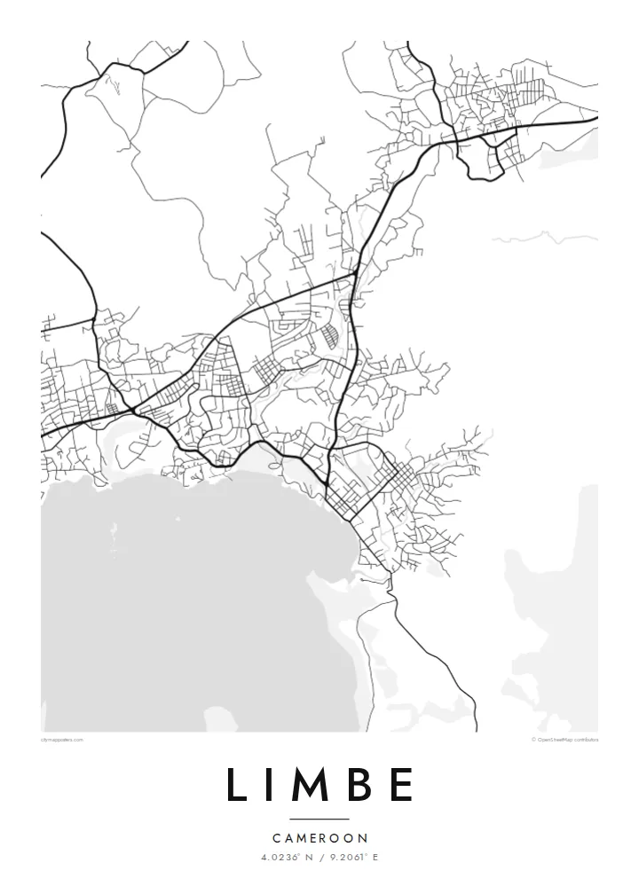
The town curves around a small Atlantic bay. The coastline, with its points and coves, gives the poster its most defining line.
Minimalistik karta plakaty · Kamerun
4.0236° N / 9.2061° E
A coastal town beneath Mount Cameroon, with dark volcanic beaches, a botanic garden and streets that climb from the bay.


Bir şäher, bäş keýp
Diwarda nähili görünjegini görmek üçin stile basyň. Ähli stiller bir bahadan — çap edilen, çarçuwaly ýa-da HD faýl görnüşinde.
 Hakyky pikseller · 24 × 36″ çap faýly
Çapda aýdyň
Bu hakyky çap faýlynyň 100% kesigi. Her poster — çap edilen, çarçuwaly ýa-da ýüklenen — serwerlerimizde 300 DPI, 7,200 × 10,800 piksele çenli işlenip taýýarlanýar, şonuň üçin iň kiçi köçeler hem 24 × 36″ çapda arassa görünýär.
Diwarda


Karta
Limbe lies on the Atlantic coast of Cameroon, at the foot of Mount Cameroon, the highest peak in West and Central Africa. The town wraps around a small bay, and behind it the ground begins its long climb toward the volcano. On a map the coastline and the slope set the shape of the town: a curve of streets along the shore that reaches inland wherever the land allows.
The English Baptist missionary Alfred Saker founded the town in 1858, and it was called Victoria until 1982. The Limbe Botanic Garden, established in 1892 during the German colonial period, is still one of its best-known sites. It is a large green space close to the centre and shows as open ground on the map.
Past lava flows from Mount Cameroon have left the nearby beaches dark with volcanic sand, and the coast mixes rocky points with small coves. A Limbe map poster keeps the essential lines of this landscape: shore, slope and streets. It shows a town held between the ocean and one of Africa's active volcanoes.
The town curves around a small Atlantic bay. The coastline, with its points and coves, gives the poster its most defining line.
The historic botanic garden near the centre forms a broad open area among the streets and a calm space in the composition.
Roads lead inland and upward toward the mountain. They thin out as the terrain rises and leave the upper edge of the map open.
Özüňiziňki ediň
Sene, at ýa-da öz setiriňizi goşuň, stili, ölçegi ýa-da ugry üýtgediň.
Mugt deslapky görnüş pes durulykda we suw belgili. Çaplar we HD faýllar suw belgisiz, 300 DPI, 7,200 × 10,800 px çenli işlenip taýýarlanýar.
Näme üçin Limbe
Limbe is a place of beaches, fishing boats and family weekends by the sea, and for many Cameroonians it is closely tied to home. A map of the town keeps the bay, the mountain and the familiar streets together in one clear image.
Personalise the title, subtitle and coordinates line, for example with Victoria as a subtitle or a meaningful date, and choose from five styles: Classic black & white, Noir, Paper, Blueprint or Sand. Noir suits a town known for its dark volcanic shore.
Limbe posterini sargyt ediň| Çap ölçegi | Çözgüt | Faýllar |
|---|---|---|
| 30 × 40 cm (11.8 × 15.7″) | 3,543 × 4,724 px | PNG · PDF |
| 29.7 × 42 cm (A3, 11.7 × 16.5″) | 3,508 × 4,961 px | PNG · PDF |
| 42 × 59.4 cm (A2, 16.5 × 23.4″) | 4,961 × 7,016 px | PNG · PDF |
| 45.7 × 61 cm (18 × 24″) | 5,400 × 7,200 px | PNG · PDF |
| 50 × 70 cm (19.7 × 27.6″) | 5,906 × 8,268 px | PNG · PDF |
| 61 × 91.4 cm (24 × 36″) | 7,200 × 10,800 px | PNG · PDF |
Deňeşdirmek üçin: mugt nusga 900 px giňlikde, suw belgili we ekranlar üçin niýetlenen. HD faýllaryň çözgüdi her tarapa 8 esse çenli ýokary we doly plakat ölçeginde arassa çap edilýär.
Sahypanyň ýokarsyndan stili saýlaň, soňra Çap edilen Poster — ölçegini we isleseňiz çarçuwasyny — ýa-da Sanly HD Faýllary saýlaň. Töleg bir ädimde amala aşyrylýar, tölegiňiz geçen dessine sargyt sahypaňyz täzelenýär.
Ol ýokary hilli 200 gsm mat kagyza, alty ölçegiň birinde, 30 × 40 sm-den 24 × 36″-a çenli çap edilýär. Çap edilen posterler {printFrom}-dan başlaýar, eltip bermek bahasy girýär.
Hawa. Gara, ak, tebigy dub ýa-da garaňky agaç reňkinde tutuş agaç çarçuwany saýlaň. Ol döwülmeýän aýna bilen gelýär we asmaga taýýar. Çarçuwaly posterler {framedFrom}-dan başlaýar, eltip bermek bahasy girýär.
Eltip bermek dünýäniň ähli ýerinde mugt. Her poster 30-dan gowrak ýurtdaky çap hyzmatdaşlarymyzyň iň ýakynynda çap edilýär we adatça 3–7 iş gününde gelýär. Ýagdaýyny we yzarlamany Sargytlarym bölüminde görüp bilersiňiz.
Eltilenden soň 14 günüň dowamynda bize surat iberiň, biz ony mugt gaýtadan çap ederis ýa-da puluňyzy yzyna gaýtararys.
Hawa. Bu sahypadaky redaktorda ady, kiçi ady we koordinatlar setirini islän zadyňyza üýtgediň, soňra stil we ölçeg saýlaň. Çap edilen, çarçuwaly we sanly sargytlaryň ählisi siziň dizaýnyňyzy takyk ulanýar.
$9 üçin ähli alty ölçegde, suw belgisiz, islendik ýerde çap edip bolýan 300 DPI PNG we çap etmäge taýyn PDF faýllaryny alýarsyňyz. Entek gutarnykly karara gelmediňizmi? Ilki mugt, suw belgili deslapky görnüşi göçürip alyň.
Golaýda
