Atlantic port
Breakwaters and quays extend into the sea beside the city centre, forming the sharpest geometric shapes on the map and marking the country's main gateway for shipping.
Pōhita mape faigofie · Congo - Brazzaville
4.7761° S / 11.8635° E
An Atlantic port city on a flat coastal plain, where Congo's railway from the interior meets the sea.



Taone e tahi, lagona e lima
Pa'i se ata ke va'ai ai i luga o te pā. E tutusa te tau o ata uma — i lomiga, fakapipi'i i faleata, pe ko faila HD.
 Pixels mo'i · Faila lomiga 24 × 36″
Manino mo te lomiga
Ko se kupega 100% mai te faila lomiga mo'i. Poster uma — pe lomiina, fakapipi'i i faleata, pe download-ina — e fakaatagia i luga o a matou setula i te 300 DPI, e oo atu ki te 7,200 × 10,800 pixels, ina ia mautinoa e ma'ai pea auala tuai foki i luga o se lomiga 24 × 36″.
I luga o te pa


Te mape
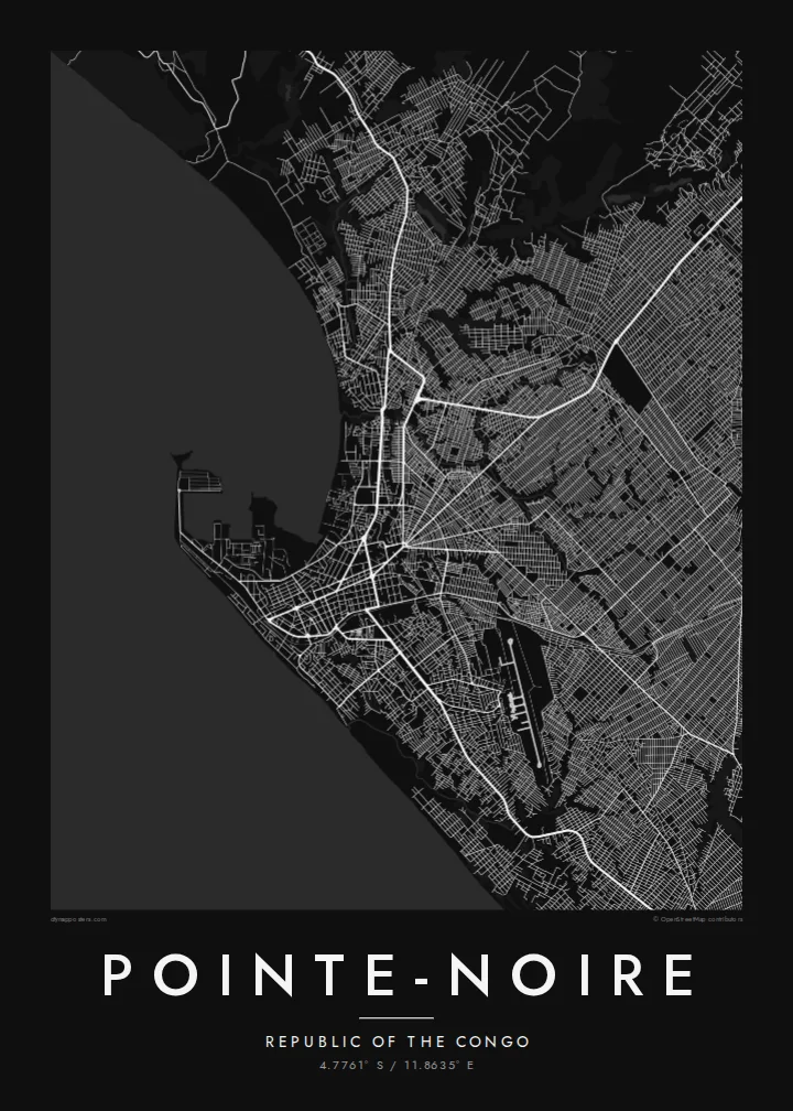
Pointe-Noire is the main seaport of the Republic of the Congo and the country's economic centre, built on a flat coastal plain beside the Atlantic. Its name comes from a dark rocky point that Portuguese sailors noted along the shore. On a map the coastline gives a strong western edge, with the port's breakwaters and quays reaching into the sea near the centre.
The city is the terminus of the Congo-Ocean Railway, built in the 1920s and 1930s to link the coast with Brazzaville, and its railway station remains a well-known landmark. Offshore oil made Pointe-Noire the base of the country's energy industry, and the port handles much of the national trade. Residential districts spread inland in a wide, fairly regular pattern.
A Pointe-Noire map poster frames the city between ocean and plain: the port and beaches along the shore, the straight roads of the older centre and the broad neighbourhoods behind them. It is a clear, legible plan, and the Atlantic coastline stretching away in both directions gives the composition a calm, steady balance.
Breakwaters and quays extend into the sea beside the city centre, forming the sharpest geometric shapes on the map and marking the country's main gateway for shipping.
The Congo-Ocean Railway ends in the heart of the city, and its line heading inland provides a strong route across the map toward Brazzaville, far to the east.
Long sandy beaches follow the shore on either side of the port, a soft edge between the city streets and the open ocean that runs the length of the composition.
Fai mo koe
Fakaopoopo he aho, he igoa pe he upu a koe, hui te faiga, te lahi pe te tūlaga.
Ko te va'aiga e leai se totogi e maualalo tona resolution ma iai se fakailoga vai. E fakaatagia lomiga ma faila HD i te 300 DPI, e oo atu ki te 7,200 × 10,800 px, e aunoa ma se fakailoga vai.
Aiheā Pointe-Noire
Pointe-Noire is home to many families, to port and oil workers, and to people who spent years in the city before moving on. A map of its coast and streets is a personal reminder of that time and a good fit for an office or a home.
The title, subtitle and coordinates line can be personalised, and you can choose from five styles: Classic black & white, Noir, Paper, Blueprint and Sand. HD files without a watermark are $9, and printed posters ship from partners in more than 30 countries.
Oka te poster Pointe-Noire| Lahi o te lomiga | Manino | Faila |
|---|---|---|
| 30 × 40 cm11.8 × 15.7″ | 3,543 × 4,724 px | PNG · PDF |
| 29.7 × 42 cm (A3)11.7 × 16.5″ | 3,508 × 4,961 px | PNG · PDF |
| 42 × 59.4 cm (A2)16.5 × 23.4″ | 4,961 × 7,016 px | PNG · PDF |
| 45.7 × 61 cm18 × 24″ | 5,400 × 7,200 px | PNG · PDF |
| 50 × 70 cm19.7 × 27.6″ | 5,906 × 8,268 px | PNG · PDF |
| 61 × 91.4 cm24 × 36″ | 7,200 × 10,800 px | PNG · PDF |
Mo te fakatatau, ko te fakaakoakoga e hē totogi e 900 px te lautele, e ihi te fakailoga ma mo te lau komipiuta. Ko nā faila HD e oko ki te 8× te manino i itū taki tahi ma e lomia lelei i te lahi kātoa o te pōhita.
Filifili se ata i te pito i luga o te itulau, ona filifili lea o te Poster Lomiina — se lapoa ma, ka manako ai koe, se faleata — pe ko Faila HD Fakaonaonaina. E tasi te laasaga o te ōkaina, ma ka fakafou loa lau itulau ōkaina pe a mae'a te totogi.
E lomiina i luga o se pepa matte kaliki maualuga e 200 gsm, i se tasi o ni lapoa e ono, mai le 30 × 40 cm ki te 24 × 36″. E kamata te tau o poster lomiina mai le $39, aofia ai te uta.
Ioe. Filifili se faleata lakau malō i te lanu uli, tea, oki masani pe lakau pouli. E aumai fakatasi mo se tioata e le gagamu ma ua sauni ke tautau. E kamata te tau o poster fakapipi'i i se faleata mai le $99, aofia ai te uta.
E tuku uma te uta ki fenua e 60+. Ko te pepa takitasi e lomi e te tasi o a matou paaga lomi i fenua e 30+, ka tae mai i aso galue e 3–7. E mafai ke e maimoa ki te tulaga mo te tulitaki i lalo o Taku Fakatonuga. E lauiti nei fenua e 2–5 wiki, ka ko nei fenua e le o tuku atu ai, e fakamatala atu e te weepisi i mua o te totogi.
Auina mai se ata pikitia i loto o te 14 aso mai te taimi na oo mai ai, ka toe lomiina e matou e leai se totogi pe toe totogi atu lau tupe.
Ioe. I te mea fakasa'o i luga o lenei itulau, sui te ulutala, te ulutala lalo ma te laina fakamaoniga tulaga ki so se mea e manako ai koe, ona filifili lea o se ata ma se lapoa. Okaina lomiina, fakapipi'i i faleata, ma fakaonaonaina e fakaaogā uma i tau ata tonu.
Mo le $9 e maua e koe ni faila PNG 300 DPI ma PDF sauni-mo-lomiga i lapoa e ono uma, e aunoa ma se fakailoga vai, ke lomiina i so se mea. E le'i mautinoa? Download muamua se va'aiga fakailoga vai e leai se totogi.
