Lakes and tanks
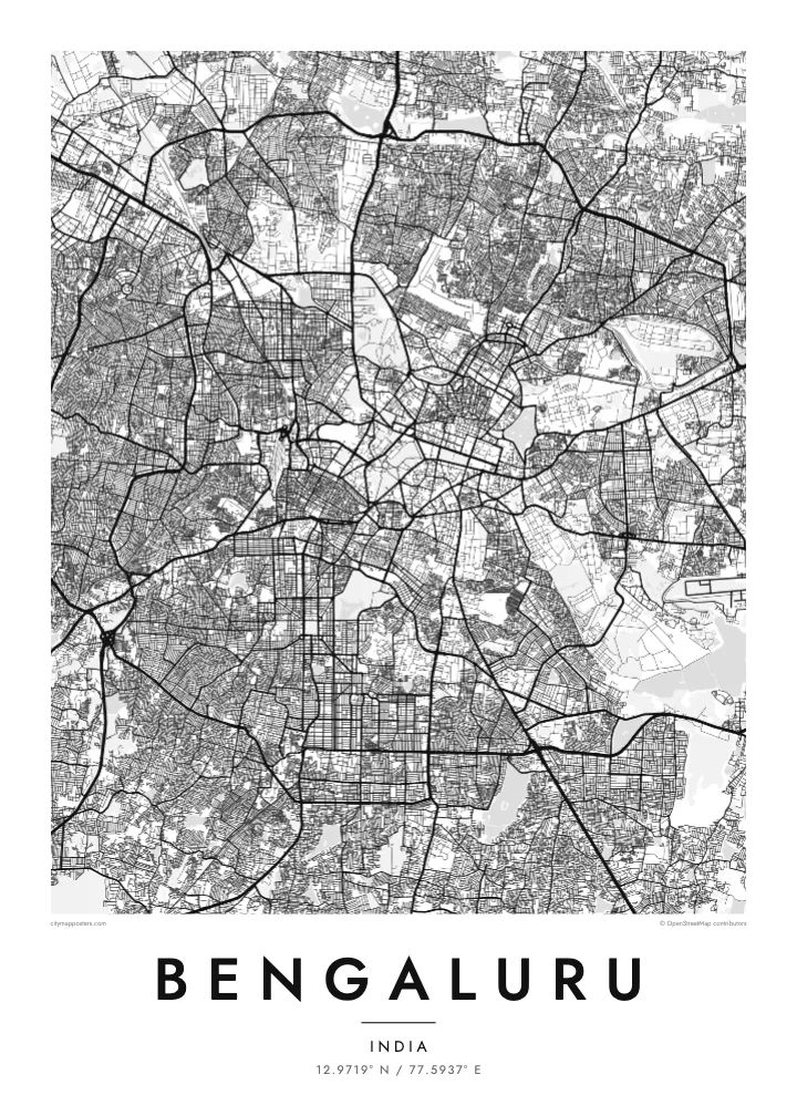
Hundreds of man-made lakes once spread across the plateau, and many survive. On the poster they appear as scattered, irregular forms, giving the city a watery texture without any river.
Pōsitā mape sitaila faingofua · ʻInitia
12.9719° N / 77.5937° E
A plateau city of lakes and ring roads, with two large parks at its centre and tree-lined avenues spreading outward.


Kolo ʻe taha, ongoʻi ʻe nima
Tuki ha sitaile ke sio ai 'i ho holisi. 'Oku tatau pē 'a e totongi 'o e sitaile kotoa pē — tā pepa, fa'o, pe ko e fa'ile HD.
 Pika mo'oni · fa'ile tā 24 × 36″
Mahino ke paaki
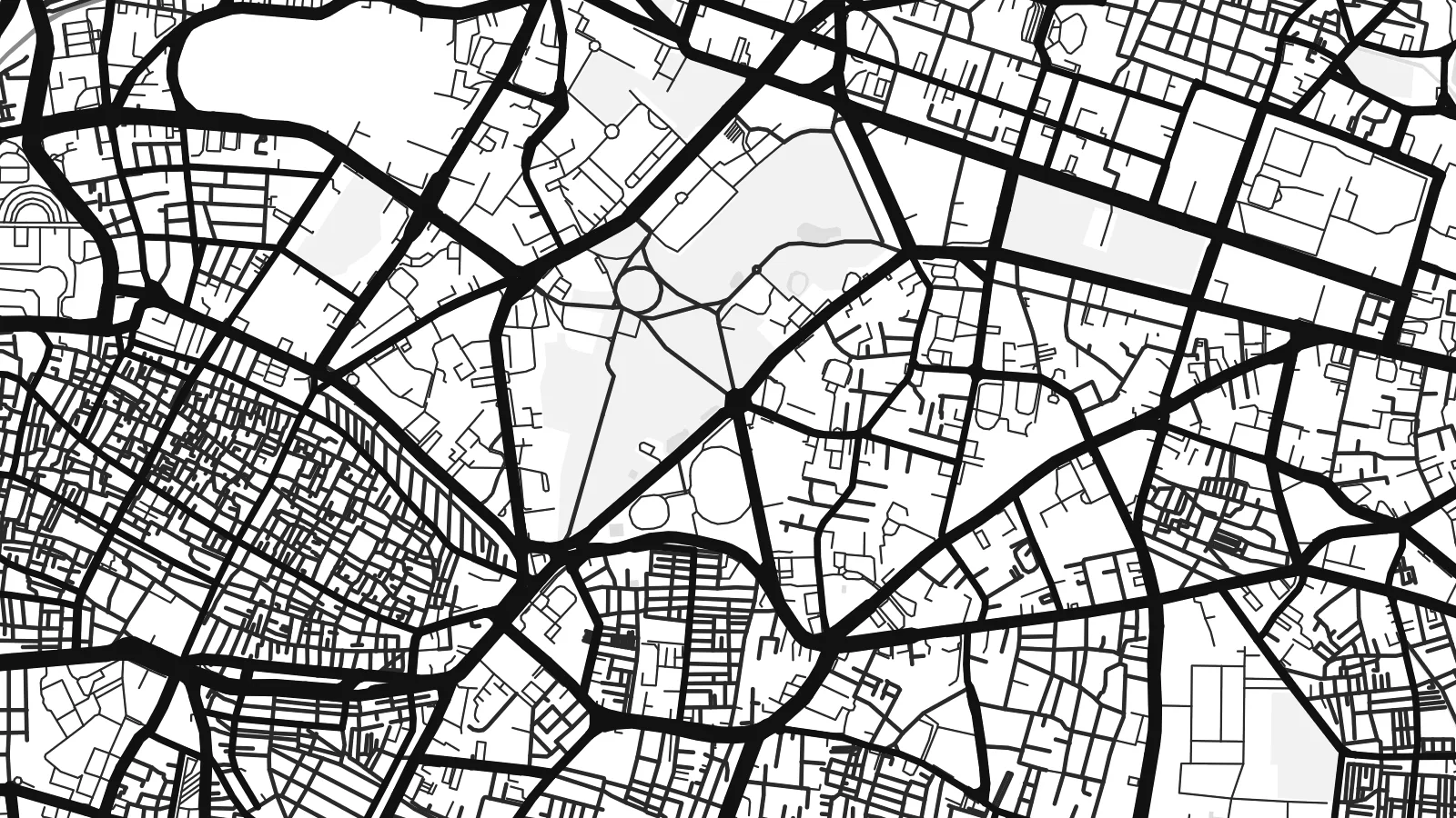
Ko ha konga 100% eni mei he fa'ile tā mo'oni. Ko e posita kotoa pē — tā pepa, fa'o, pe download — 'oku ngaohi 'i he'emau sāvā 'i he 300 DPI, 'o a'u ki he 7,200 × 10,800 pika, koe'uhi ke mahino lelei 'a e ngaahi hala si'isi'i taha 'i ha tā 24 × 36″.
'I he pā


Ko e mape
Bengaluru sits on the Deccan Plateau at roughly 900 metres, with no major river running through it. Instead, the map is dotted with lakes, most of them historic tanks built to store rainwater and once linked by channels that follow the gentle slope of the land. Ulsoor, Hebbal, Bellandur and many smaller lakes appear as irregular shapes between the streets.
The city traces its founding to 1537, when the chieftain Kempe Gowda built a mud fort here, and the old market area around the Pete still has narrow, crowded lanes. The centre is marked by two large green spaces: Cubbon Park, beside the Vidhana Soudha, and Lalbagh Botanical Garden to the south, both reasons the city was long called the Garden City of India.
Much of modern Bengaluru grew along its ring roads, especially the Outer Ring Road, where many of the technology parks behind its reputation as India's software capital are concentrated. A Bengaluru map poster places those newer districts in relation to the older centre, the lakes and the cantonment streets east of Cubbon Park, which were laid out under British rule.
Hundreds of man-made lakes once spread across the plateau, and many survive. On the poster they appear as scattered, irregular forms, giving the city a watery texture without any river.
A large park in the administrative centre, crossed by curving drives and paths and bordered by the Vidhana Soudha and the High Court. It is the clearest open space on the central map.
A long orbital road looping through the eastern and southern suburbs, lined with office campuses. Its broad arc roughly marks where the older, denser city gives way to newer growth.
Ke ʻaʻau pē
Tānaki ha ʻaho, ha hingoa pe ha laine ʻaʻau, pea liliu ʻa e sitaila, saisi pe tuʻunga.
Ko e sio muʻa ta'etotongi 'oku ma'ulalo hono lelei pea 'oku ai hano fakaʻilonga vai. Ko e ngaahi tā mo e fa'ile HD 'oku ngaohi 'i he 300 DPI, 'o a'u ki he 7,200 × 10,800 px, ta'e ha fakaʻilonga vai.
Ko e hā ʻa Bengaluru
Bengaluru draws people from across India and abroad, and many spend important years there, in a first job, a first apartment, a favourite café in Indiranagar or Jayanagar. A map of the city keeps that chapter recognisable long after moving on.
Choose a title, add a subtitle with a date or neighbourhood, and decide whether to keep the coordinates line. Five styles are available, from Paper and Sand to Noir. Printed posters come on matte paper, with an optional wooden frame, from partners in 30+ countries.
'Oda 'a e posita Bengaluru| Saisi paaki | Tuʻunga mahino | Ngaahi faile |
|---|---|---|
| 30 × 40 cm11.8 × 15.7″ | 3,543 × 4,724 px | PNG · PDF |
| 29.7 × 42 cm (A3)11.7 × 16.5″ | 3,508 × 4,961 px | PNG · PDF |
| 42 × 59.4 cm (A2)16.5 × 23.4″ | 4,961 × 7,016 px | PNG · PDF |
| 45.7 × 61 cm18 × 24″ | 5,400 × 7,200 px | PNG · PDF |
| 50 × 70 cm19.7 × 27.6″ | 5,906 × 8,268 px | PNG · PDF |
| 61 × 91.4 cm24 × 36″ | 7,200 × 10,800 px | PNG · PDF |
Ke fakafehoanaki, ko e sio fakamuʻa taʻetotongi ʻoku fālahi ʻaki ʻa e 900 px, ʻi ai hono fakaʻilonga-vai pea ki he ngaahi screen pē. ʻOku liunga 8 hono mahino ʻo e ngaahi faile HD ʻi he tafaʻaki kotoa pea ʻoku paaki lelei ʻi he saisi kakato ʻo e pōsitā.
Fili ha sitaile 'i he tumu'aki 'o e peesi, pea fili leva ha Posita Tā — ha lahi pea, kapau 'oku ke sai'ia, ha fa'o — pe ko e ngaahi Fa'ile Digital HD. Ko e Checkout ko e sitepu pē 'e taha, pea 'e fakafo'ou leva ho'o peesi 'oda 'i he taimi 'e a'u ai 'a e totongi.
'Oku tā ia 'i ha pepa matte 200 gsm mo'oni lelei taha, 'i ha taha 'o e ngaahi lahi 'e ono, mei he 30 × 40 cm ki he 24 × 36″. 'Oku kamata 'a e ngaahi posita kuo tā 'i he $39, kuo kau ai 'a e 'ave.
'Io. Fili ha fa'o 'akau mo'oni 'i he 'uli'uli, hina, oki fakanatula pe 'akau fu'u 'uli'uli. 'Oku fakataha mai mo ha sio'ata ta'emafesi pea kuo mateuteu ke tautau. 'Oku kamata 'a e ngaahi posita kuo fa'o 'i he $99, kuo kau ai 'a e 'ave.
ʻOku ʻataʻatā ʻa e fakaheka ki he ngaahi fonua ʻe 60+. ʻOku paaki ʻa e tuʻunga taki taha ʻe he tokotaha paaki ofi taha ʻo kitautolu ʻi he ngaahi fonua ʻe 30+, pea ʻoku maʻu angamaheni ia ʻi he ʻaho ngāue ʻe 3–7. ʻE lava ke ke muimui ki he tuʻunga mo e fakaʻilo ʻi he ʻOku ou Fakamaʻu. ʻOku toki ʻaho ʻe 2–5 uike ʻa e ngaahi fonua si'i, pea ʻi he ngaahi fonua ʻoku te teʻeki ke fakaheka ki ai, ʻoku fakahā atu ʻe he uepisaiti ʻi he ʻuluaki ʻo e totongi.
'Ave mai ha foto kiate kimautolu 'i he lolotonga 'o e 'aho 'e 14 mei he taimi na'e a'u mai ai, pea te mau toe tā ia ta'etotongi pe toe totongi atu 'a ho'o pa'anga.
'Io. 'I he editor 'i he peesi ni, liliu 'a e kaveinga, 'a e kaveinga si'i mo e laine fakafuofua ki ha me'a pē 'oku ke sai'ia ai, pea fili ha sitaile mo ha lahi. Ko e ngaahi 'oda tā, fa'o mo digital kotoa 'oku ngāue'aki ai pē ho'o fakatātā tofu pē.
'I he totongi 'e $9 'oku ke ma'u ai 'a e ngaahi fa'ile PNG 300 DPI mo e PDF kuo mateuteu ki he tā 'i he lahi 'e ono kotoa, 'ikai ha fakaʻilonga vai, ke tā ai 'i ha feitu'u pē. Te ke kei ta'epau? Download muʻa ha sio muʻa ta'etotongi 'oku ai hano fakaʻilonga vai.
Ofi mai
