Museum Island
The northern end of the Spree island holds five major museums between two arms of the river. It is a compact shape, recognizable on any map of Berlin.
Pōsitā mape sitaila faingofua · Siamane
52.5222° N / 13.3977° E
The Spree splits around Museum Island while Unter den Linden draws a straight line west to the Brandenburg Gate.


Kolo ʻe taha, ongoʻi ʻe nima
Tuki ha sitaile ke sio ai 'i ho holisi. 'Oku tatau pē 'a e totongi 'o e sitaile kotoa pē — tā pepa, fa'o, pe ko e fa'ile HD.
 Pika mo'oni · fa'ile tā 24 × 36″
Mahino ke paaki
Ko ha konga 100% eni mei he fa'ile tā mo'oni. Ko e posita kotoa pē — tā pepa, fa'o, pe download — 'oku ngaohi 'i he'emau sāvā 'i he 300 DPI, 'o a'u ki he 7,200 × 10,800 pika, koe'uhi ke mahino lelei 'a e ngaahi hala si'isi'i taha 'i ha tā 24 × 36″.
'I he pā


Ko e mape
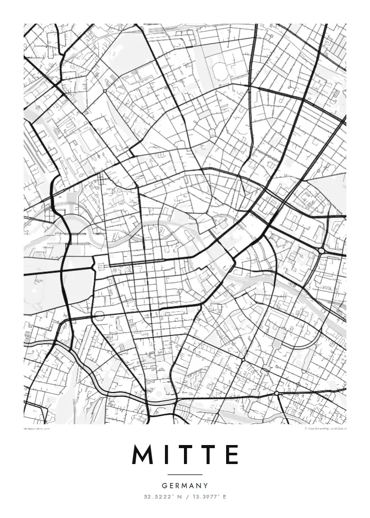
Mitte is Berlin's historic core, and its map is organized around the Spree. The river divides into two arms here, enclosing an island whose northern tip holds Museum Island, a UNESCO World Heritage ensemble of five museums. West of the water, Unter den Linden runs in a broad straight line to the Brandenburg Gate and the Tiergarten. Friedrichstraße crosses it on a long north–south axis.
East of the river, the plan changes. Alexanderplatz opens as a large irregular space beneath the television tower, completed in 1969, and wide postwar boulevards replace the older baroque grid. The Berlin Wall ran along much of Mitte's western and southern edges. You can still trace its former line where newer buildings fill strips that once stood empty.
A Mitte map poster brings these layers together on one sheet: the curving river, the ordered blocks of Friedrichstadt south of Unter den Linden, squares such as Gendarmenmarkt, and the looser plan around Alexanderplatz. The center of the image is dense and opens toward the park on one side, which gives the composition a natural sense of weight.
The northern end of the Spree island holds five major museums between two arms of the river. It is a compact shape, recognizable on any map of Berlin.
A wide tree-lined boulevard runs from the island west to the Brandenburg Gate. It is one of the clearest straight lines in the city.
Within the Friedrichstadt grid, this square framed by two domed churches and a concert hall stands out as a precise open rectangle among regular blocks.
Ke ʻaʻau pē
Tānaki ha ʻaho, ha hingoa pe ha laine ʻaʻau, pea liliu ʻa e sitaila, saisi pe tuʻunga.
Ko e sio muʻa ta'etotongi 'oku ma'ulalo hono lelei pea 'oku ai hano fakaʻilonga vai. Ko e ngaahi tā mo e fa'ile HD 'oku ngaohi 'i he 300 DPI, 'o a'u ki he 7,200 × 10,800 px, ta'e ha fakaʻilonga vai.
Ko e hā ʻa Mitte
Mitte is where many visitors first meet Berlin, and where many residents work, study or first settle. Its map carries the city's divided past without spelling it out, which makes it a thoughtful piece for a wall.
You can personalize the title and subtitle with a year or an address, and keep or edit the coordinates. Choose one of five styles. Blueprint suits the river and the grid especially well. Download the files for $9 or order a printed poster.
'Oda 'a e posita Mitte| Saisi paaki | Tuʻunga mahino | Ngaahi faile |
|---|---|---|
| 30 × 40 cm (11.8 × 15.7″) | 3,543 × 4,724 px | PNG · PDF |
| 29.7 × 42 cm (A3, 11.7 × 16.5″) | 3,508 × 4,961 px | PNG · PDF |
| 42 × 59.4 cm (A2, 16.5 × 23.4″) | 4,961 × 7,016 px | PNG · PDF |
| 45.7 × 61 cm (18 × 24″) | 5,400 × 7,200 px | PNG · PDF |
| 50 × 70 cm (19.7 × 27.6″) | 5,906 × 8,268 px | PNG · PDF |
| 61 × 91.4 cm (24 × 36″) | 7,200 × 10,800 px | PNG · PDF |
Ke fakafehoanaki, ko e sio fakamuʻa taʻetotongi ʻoku fālahi ʻaki ʻa e 900 px, ʻi ai hono fakaʻilonga-vai pea ki he ngaahi screen pē. ʻOku liunga 8 hono mahino ʻo e ngaahi faile HD ʻi he tafaʻaki kotoa pea ʻoku paaki lelei ʻi he saisi kakato ʻo e pōsitā.
Fili ha sitaile 'i he tumu'aki 'o e peesi, pea fili leva ha Posita Tā — ha lahi pea, kapau 'oku ke sai'ia, ha fa'o — pe ko e ngaahi Fa'ile Digital HD. Ko e Checkout ko e sitepu pē 'e taha, pea 'e fakafo'ou leva ho'o peesi 'oda 'i he taimi 'e a'u ai 'a e totongi.
'Oku tā ia 'i ha pepa matte 200 gsm mo'oni lelei taha, 'i ha taha 'o e ngaahi lahi 'e ono, mei he 30 × 40 cm ki he 24 × 36″. 'Oku kamata 'a e ngaahi posita kuo tā 'i he {printFrom}, kuo kau ai 'a e 'ave.
'Io. Fili ha fa'o 'akau mo'oni 'i he 'uli'uli, hina, oki fakanatula pe 'akau fu'u 'uli'uli. 'Oku fakataha mai mo ha sio'ata ta'emafesi pea kuo mateuteu ke tautau. 'Oku kamata 'a e ngaahi posita kuo fa'o 'i he {framedFrom}, kuo kau ai 'a e 'ave.
'Oku ta'etotongi 'a e 'ave 'i māmani kotoa. 'Oku tā 'a e posita taki taha 'e homau kaungāfakatau tā ofi taha 'i he ngaahi fonua 'e laka hake he 30, pea 'oku a'u lelei ia 'i he 'aho ngāue 'e 3–7. 'E lava ke ke sio ki hono tu'unga mo hono 'ave 'i lalo 'i he'eku Ngaahi 'Oda.
'Ave mai ha foto kiate kimautolu 'i he lolotonga 'o e 'aho 'e 14 mei he taimi na'e a'u mai ai, pea te mau toe tā ia ta'etotongi pe toe totongi atu 'a ho'o pa'anga.
'Io. 'I he editor 'i he peesi ni, liliu 'a e kaveinga, 'a e kaveinga si'i mo e laine fakafuofua ki ha me'a pē 'oku ke sai'ia ai, pea fili ha sitaile mo ha lahi. Ko e ngaahi 'oda tā, fa'o mo digital kotoa 'oku ngāue'aki ai pē ho'o fakatātā tofu pē.
'I he totongi 'e $9 'oku ke ma'u ai 'a e ngaahi fa'ile PNG 300 DPI mo e PDF kuo mateuteu ki he tā 'i he lahi 'e ono kotoa, 'ikai ha fakaʻilonga vai, ke tā ai 'i ha feitu'u pē. Te ke kei ta'epau? Download muʻa ha sio muʻa ta'etotongi 'oku ai hano fakaʻilonga vai.
