Panel housing estate
Long prefabricated blocks are arranged in angled rows and courtyards. On the map they form one of the most geometric areas on Prague's edge.
Minimalist harita posteri · Çekya
50.0706° N / 14.3005° E
A western Prague district where a large panel housing estate meets an old village core near Bílá Hora


Tek şehir, beş farklı hava
Bir stili duvarda görmek için dokun. Tüm stiller aynı fiyat — baskı, çerçeveli veya HD dosya olarak.
 Gerçek piksel boyutu · 24 × 36″ baskı dosyası
Baskıda keskin
Bu, gerçek baskı dosyasından %100 oranında bir kırpma. Her poster — baskı, çerçeveli veya indirilen — sunucularımızda 300 DPI'de, 7,200 × 10,800 piksele kadar oluşturulur; böylece en ince sokaklar bile 24 × 36″ baskıda keskin kalır.
Duvarda


Harita
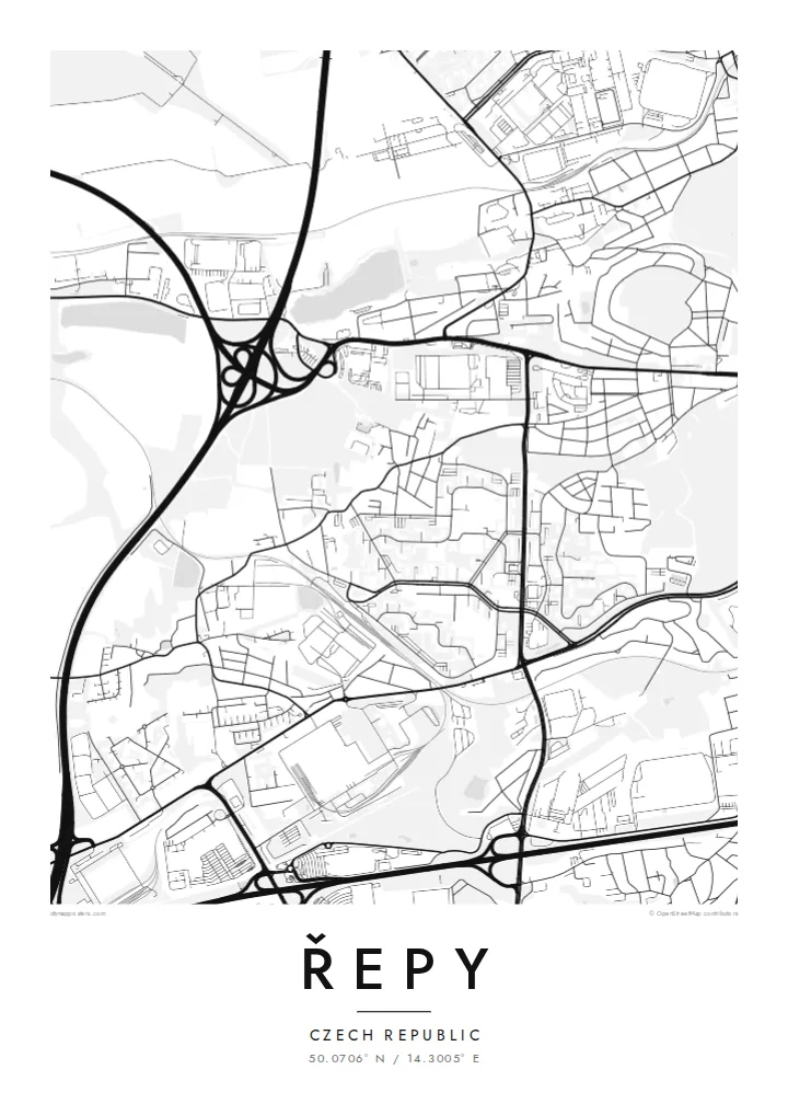
Řepy is on the western edge of Prague, in the Prague 17 district. On a map two very different patterns sit side by side. The old village of Řepy has a small, irregular core of lanes and farmsteads. Next to it is a large housing estate of prefabricated panel blocks from the late communist period, laid out as long slabs around open courtyards.
Just east of Řepy lies Bílá Hora, the White Mountain plateau, where the battle of 1620 was fought. That battle shaped Bohemian history for centuries. Tram lines from central Prague end at the Sídliště Řepy terminus, which ties the estate to the city. Open fields and green areas are still visible at the western and southern edges.
A Řepy map poster is interesting because of its contrast. The geometric blocks of the housing estate, drawn as bold rectangles, sit next to the soft, older shape of the village and the green space around them. In black and white it looks almost like an architectural plan, and it is a good example of how post-war Prague grew.
Long prefabricated blocks are arranged in angled rows and courtyards. On the map they form one of the most geometric areas on Prague's edge.
The historic centre of Řepy survives as a small cluster of irregular lanes and older buildings, a clear contrast to the estate beside it.
Tram lines from the city end at Sídliště Řepy. Their loop and route toward the centre give the map a clear link to the rest of Prague.
Size özel yapın
Bir tarih, bir isim ya da kendi cümlenizi ekleyin; stili, boyutu veya yönü değiştirin.
Ücretsiz önizleme düşük çözünürlüklü ve filigranlıdır. Baskılar ve HD dosyalar filigransız olarak 300 DPI'de, 7,200 × 10,800 px'e kadar oluşturulur.
Neden Řepy
Many Prague families have lived in the Řepy estate for a generation or more. A map poster of its blocks, lanes and green edges makes a personal gift, and the strong shapes of panel architecture look good on a modern wall.
You can personalise the title, subtitle and coordinates line, for example with a street name or the year you moved in. Choose Classic black & white, Noir, Paper, Blueprint or Sand. Digital files cost $9, and printed posters with optional frames are also available.
Řepy posterini sipariş et| Baskı boyutu | Çözünürlük | Dosyalar |
|---|---|---|
| 30 × 40 cm11.8 × 15.7″ | 3,543 × 4,724 px | PNG · PDF |
| 29.7 × 42 cm (A3)11.7 × 16.5″ | 3,508 × 4,961 px | PNG · PDF |
| 42 × 59.4 cm (A2)16.5 × 23.4″ | 4,961 × 7,016 px | PNG · PDF |
| 45.7 × 61 cm18 × 24″ | 5,400 × 7,200 px | PNG · PDF |
| 50 × 70 cm19.7 × 27.6″ | 5,906 × 8,268 px | PNG · PDF |
| 61 × 91.4 cm24 × 36″ | 7,200 × 10,800 px | PNG · PDF |
Karşılaştırma için: ücretsiz önizleme 900 piksel genişliğinde, filigranlı ve ekranlar için tasarlanmıştır. HD dosyalar her yönde 8 kata kadar daha yüksek çözünürlüğe sahiptir ve tam poster boyutunda temiz basılır.
Sayfanın üst kısmından bir stil seç, ardından Baskılı Poster — bir boyut ve istersen bir çerçeve — ya da Dijital HD Dosyalar seçeneğini işaretle. Ödeme tek adımda tamamlanır ve ödeme onaylanır onaylanmaz sipariş sayfan güncellenir.
Premium 200 gsm mat kağıda, 30 × 40 cm'den 24 × 36″'a kadar altı boyuttan birinde basılır. Baskılı posterler $39 fiyatından başlar, kargo dahil.
Evet. Siyah, beyaz, doğal meşe veya koyu ahşap renginde masif ahşap bir çerçeve seçebilirsin. Kırılmaz cam ile gelir ve asmaya hazırdır. Çerçeveli posterler $99 fiyatından başlar, kargo dahil.
60+ ülkeye kargo ücretsizdir. Her poster, 30+ ülkedeki baskı ortaklarımızdan size en yakın olanda basılır ve genellikle 3–7 iş gününde elinize ulaşır. Durumu ve kargo takibini Siparişlerim bölümünden izleyebilirsiniz. Bazı ülkelere teslimat 2–5 hafta sürer; henüz kargo yapmadığımız yerlerde site, ödeme yapmadan önce sizi bilgilendirir.
Teslimattan itibaren 14 gün içinde bize bir fotoğraf gönder, posterini ücretsiz olarak yeniden basalım ya da ücretini iade edelim.
Evet. Bu sayfadaki düzenleyicide başlığı, alt başlığı ve koordinat satırını istediğin gibi değiştirebilir, bir stil ve boyut seçebilirsin. Baskılı, çerçeveli ve dijital siparişlerin hepsi tam olarak senin tasarımını kullanır.
$9 karşılığında, filigransız, istediğin yerde bastırabileceğin, altı boyutun tamamında 300 DPI PNG ve baskıya hazır PDF dosyaları alırsın. Henüz emin değil misin? Önce ücretsiz, filigranlı bir önizleme indir.
Yakındakiler
