White Nile channel
The wide river with its islands and marshy banks runs along the city's eastern side, forming the most striking shape on the map.
Pousita mape faigofie · South Sudan
4.8517° N / 31.5825° E
South Sudan's capital on the west bank of the White Nile, with river islands, a single bridge and hills beyond


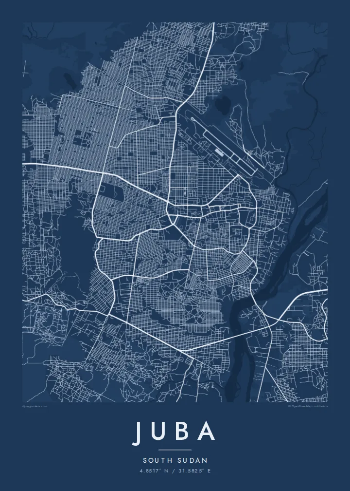
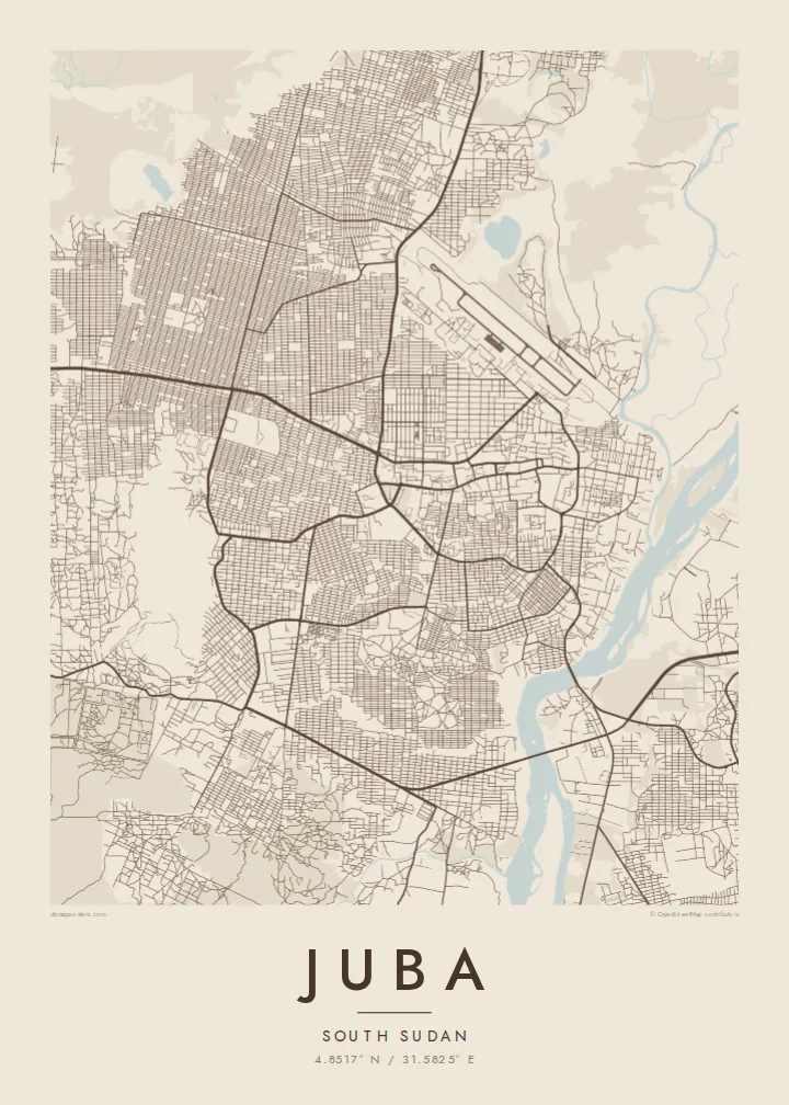
Taone e tasi, lagona e lima
Pau te tapaki o se style ke lavea i luga i te puipui. E tutasi te tau o style takitasi — telotele mo faaki, e aunoa io me fai ki faila HD.
 Pixel tonu · faila lolomi 24 × 36″
Manino ki te lomiga
Tenei se 100% mai te faila lolomi tonu. Poster takitasi — telotele, faaki io me download — e faite i luga i a matou server i te 300 DPI, e oko atu ki 7,200 × 10,800 pixel, ko ala e maofio ei mo maiga vaega foliki i luga i te lolomi 24 × 36″.
I te pakitala


Te mape
Juba sits on the west bank of the White Nile in the south of South Sudan. On a map the river is the dominant feature, a wide channel with islands and wetlands running along the eastern side of the city. Roads spread west from the waterfront across flat ground, and Jebel Kujur, a rocky hill, rises on the western outskirts.
Juba became the capital of South Sudan when the country gained independence in 2011, making it the capital of the world's youngest nation at the time. The city has grown quickly since then, and new bridges over the Nile have been added to link it with the eastern bank.
A Juba map poster shows a young capital shaped by a great river. The Nile's broad, braided course provides a strong natural edge, the older central streets cluster near the waterfront, and newer neighbourhoods fan outward in looser patterns. It is a spare, memorable composition with the river as its central character.
The wide river with its islands and marshy banks runs along the city's eastern side, forming the most striking shape on the map.
Bridges span the river to the eastern bank, drawing clear lines across the water and linking Juba to the wider region.
To the west, this rocky hill interrupts the spread of streets, leaving an open space at the edge of the growing city.
Fai ke fakatau ki a koe
Fakaopoopo se aso, se igoa io me se fuaiupu o koe, sui te sitaila, te lasi io me te tuuga.
Te preview fua e maulalo te malamalama kae iai se watermark. Poster telotele mo faila HD e faite i te 300 DPI, e oko atu ki 7,200 × 10,800 px, aunoa mo se watermark.
Kaia a Juba
Juba holds deep meaning for South Sudanese at home and across the diaspora, as well as for people who have worked there. A map of the capital and its river is a quiet, lasting way to remember it.
Add your own title, subtitle and coordinates, perhaps a family name or the year you arrived. Choose Classic black & white, Noir, Paper, Blueprint or Sand, then download HD files for $9 or order a printed poster from a partner near you.
Otaina te poster Juba| Lasi o te lomiga | Manino | Faila |
|---|---|---|
| 30 × 40 cm11.8 × 15.7″ | 3,543 × 4,724 px | PNG · PDF |
| 29.7 × 42 cm (A3)11.7 × 16.5″ | 3,508 × 4,961 px | PNG · PDF |
| 42 × 59.4 cm (A2)16.5 × 23.4″ | 4,961 × 7,016 px | PNG · PDF |
| 45.7 × 61 cm18 × 24″ | 5,400 × 7,200 px | PNG · PDF |
| 50 × 70 cm19.7 × 27.6″ | 5,906 × 8,268 px | PNG · PDF |
| 61 × 91.4 cm24 × 36″ | 7,200 × 10,800 px | PNG · PDF |
Ke fakatusa, a te ata fakataitai fua e 900 px te lautele, mo te fakailoga kae mo lau lavea i luga i te komipiuta. A faila HD e oko ki te 8× te manino i itu katoa kae lomi faka‵lei i te lasi katoa o te pousita.
Filifili se style i te pito i luga o te itulau, kae filifili Poster Telotele — se lasi mo se faaki manafai e manako koe — io me Faila Digital HD. E tasi te sitepu mo te checkout, kae ka fakafou te itulau o tau ota i te taimi e mafai ei te totogi.
E telotele i luga o te pepa vali gali 200 gsm i se tasi mai lasi e ono, mai te 30 × 40 cm ki te 24 × 36″. E kamata te poster telotele mai i te $39, kae aofia ei te uta.
Ioe. Filifili se faaki lakau maoli i te kulokula, tea, oak maoli io me lakau pogisa. E oo mai ki tioata e se malepe kae toka ke tautau. E kamata te poster faaki mai i te $99, kae aofia ei te uta.
E tuku fua ki fenua e 60+. A poloaiga taki tasi e ta ne te tauhaga e latalata mai i a matou tauhaga ta i fenua e 30+, kae e masani o aunoa i aso galue e 3–7. E mafai o salasala te tulaga mo te sukesuke i lalo o Aku poloaiga. I nisi fenua e 2–5 vaiaso, kae i mea e seki tuku atu ei matou, e fakailoa atu e te mea tafaoga i mua o te totogi.
Auina mai se ata i loto i te 14 aso mai te taimi e oko ei kae ka toe telotele fua ne matou io me toe totogi atu tau tupe.
Ioe. I te editor i te itulau tenei, sui te ulutala, te ulutala lalo mo te laina o coordinate ki so se mea e manako koe, kae filifili se style mo se lasi. Oga telotele, faaki mo digital e faigana katoa i tau tusiga tonu.
Mo te $9 ka maua ne koe faila PNG 300 DPI mo PDF fakatoka lolomi i lasi e ono katoa, aunoa mo se watermark, ke lolomi i so se koga. E se mautinoa koe? Download muamua se preview fua e iai te watermark.
