Hwangjiji pond
A small pond in the city centre is known as the source of the Nakdong River. It is a modest spot on the map with a surprising significance.
Pousita mape faigofie · South Korea
37.1759° N / 128.9889° E
A mountain city in narrow valleys of the Taebaek range, its streets threading between steep slopes and old mining districts.

Taone e tasi, lagona e lima
Pau te tapaki o se style ke lavea i luga i te puipui. E tutasi te tau o style takitasi — telotele mo faaki, e aunoa io me fai ki faila HD.
 Pixel tonu · faila lolomi 24 × 36″
Manino ki te lomiga
Tenei se 100% mai te faila lolomi tonu. Poster takitasi — telotele, faaki io me download — e faite i luga i a matou server i te 300 DPI, e oko atu ki 7,200 × 10,800 pixel, ko ala e maofio ei mo maiga vaega foliki i luga i te lolomi 24 × 36″.
I te pakitala
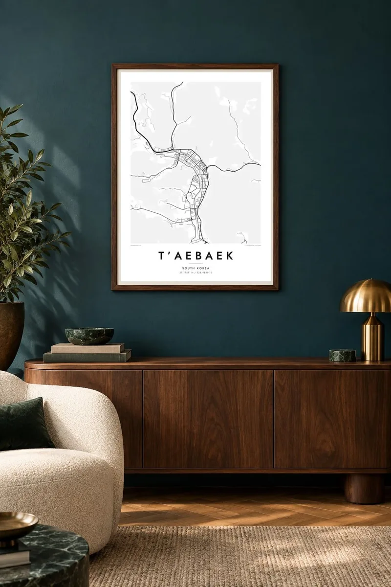


Te mape
T'aebaek lies high in the Taebaek Mountains of Gangwon Province, and it is often described as the highest city in South Korea. From above, it is not one compact mass. The city stretches along narrow valleys where roads, a railway and a stream share the limited flat ground, and wooded slopes rise sharply on each side.
For much of the twentieth century, it was a coal-mining city, and former mining areas still shape its districts. Two of Korea's great rivers are said to begin here. The Hwangjiji pond in the city centre is considered the source of the Nakdong, and Geomnyongso, outside town, is a source of the Han. Every winter, a snow festival is held on Taebaeksan.
A T'aebaek map poster shows a city fitted into its mountains, with long, branching valley streets and wide empty areas of forest. It is a striking image for hikers, winter travellers and families with roots in mining communities.
A small pond in the city centre is known as the source of the Nakdong River. It is a modest spot on the map with a surprising significance.
Roads and rail follow the valley floors between steep slopes. This gives the city a branching, elongated shape instead of a compact centre.
Forested ridges surround every part of the city. On the map, they appear as broad empty areas that make the valley streets stand out.
Fai ke fakatau ki a koe
Fakaopoopo se aso, se igoa io me se fuaiupu o koe, sui te sitaila, te lasi io me te tuuga.
Te preview fua e maulalo te malamalama kae iai se watermark. Poster telotele mo faila HD e faite i te 300 DPI, e oko atu ki 7,200 × 10,800 px, aunoa mo se watermark.
Kaia a T’aebaek
T'aebaek means something particular: mining family histories, snow in winter, and the climb up Taebaeksan at dawn. A map of its valleys is a quiet way to remember any of those.
The title, subtitle and coordinates can be set as you like, including Korean text in the title. Choose Classic black & white, Noir, Paper, Blueprint or Sand. Files come as 300 DPI PNGs and print-ready PDFs.
Otaina te poster T’aebaek| Lasi o te lomiga | Manino | Faila |
|---|---|---|
| 30 × 40 cm11.8 × 15.7″ | 3,543 × 4,724 px | PNG · PDF |
| 29.7 × 42 cm (A3)11.7 × 16.5″ | 3,508 × 4,961 px | PNG · PDF |
| 42 × 59.4 cm (A2)16.5 × 23.4″ | 4,961 × 7,016 px | PNG · PDF |
| 45.7 × 61 cm18 × 24″ | 5,400 × 7,200 px | PNG · PDF |
| 50 × 70 cm19.7 × 27.6″ | 5,906 × 8,268 px | PNG · PDF |
| 61 × 91.4 cm24 × 36″ | 7,200 × 10,800 px | PNG · PDF |
Ke fakatusa, a te ata fakataitai fua e 900 px te lautele, mo te fakailoga kae mo lau lavea i luga i te komipiuta. A faila HD e oko ki te 8× te manino i itu katoa kae lomi faka‵lei i te lasi katoa o te pousita.
Filifili se style i te pito i luga o te itulau, kae filifili Poster Telotele — se lasi mo se faaki manafai e manako koe — io me Faila Digital HD. E tasi te sitepu mo te checkout, kae ka fakafou te itulau o tau ota i te taimi e mafai ei te totogi.
E telotele i luga o te pepa vali gali 200 gsm i se tasi mai lasi e ono, mai te 30 × 40 cm ki te 24 × 36″. E kamata te poster telotele mai i te $39, kae aofia ei te uta.
Ioe. Filifili se faaki lakau maoli i te kulokula, tea, oak maoli io me lakau pogisa. E oo mai ki tioata e se malepe kae toka ke tautau. E kamata te poster faaki mai i te $99, kae aofia ei te uta.
E tuku fua ki fenua e 60+. A poloaiga taki tasi e ta ne te tauhaga e latalata mai i a matou tauhaga ta i fenua e 30+, kae e masani o aunoa i aso galue e 3–7. E mafai o salasala te tulaga mo te sukesuke i lalo o Aku poloaiga. I nisi fenua e 2–5 vaiaso, kae i mea e seki tuku atu ei matou, e fakailoa atu e te mea tafaoga i mua o te totogi.
Auina mai se ata i loto i te 14 aso mai te taimi e oko ei kae ka toe telotele fua ne matou io me toe totogi atu tau tupe.
Ioe. I te editor i te itulau tenei, sui te ulutala, te ulutala lalo mo te laina o coordinate ki so se mea e manako koe, kae filifili se style mo se lasi. Oga telotele, faaki mo digital e faigana katoa i tau tusiga tonu.
Mo te $9 ka maua ne koe faila PNG 300 DPI mo PDF fakatoka lolomi i lasi e ono katoa, aunoa mo se watermark, ke lolomi i so se koga. E se mautinoa koe? Download muamua se preview fua e iai te watermark.
