Mays Island
A narrow island in the Cedar River holding civic buildings, linked to both banks by bridges. On the poster it appears as a small block of streets floating in the middle of the water.
Мінімалістичний постер-карта · Сполучені Штати
42.0083° N / 91.6441° W
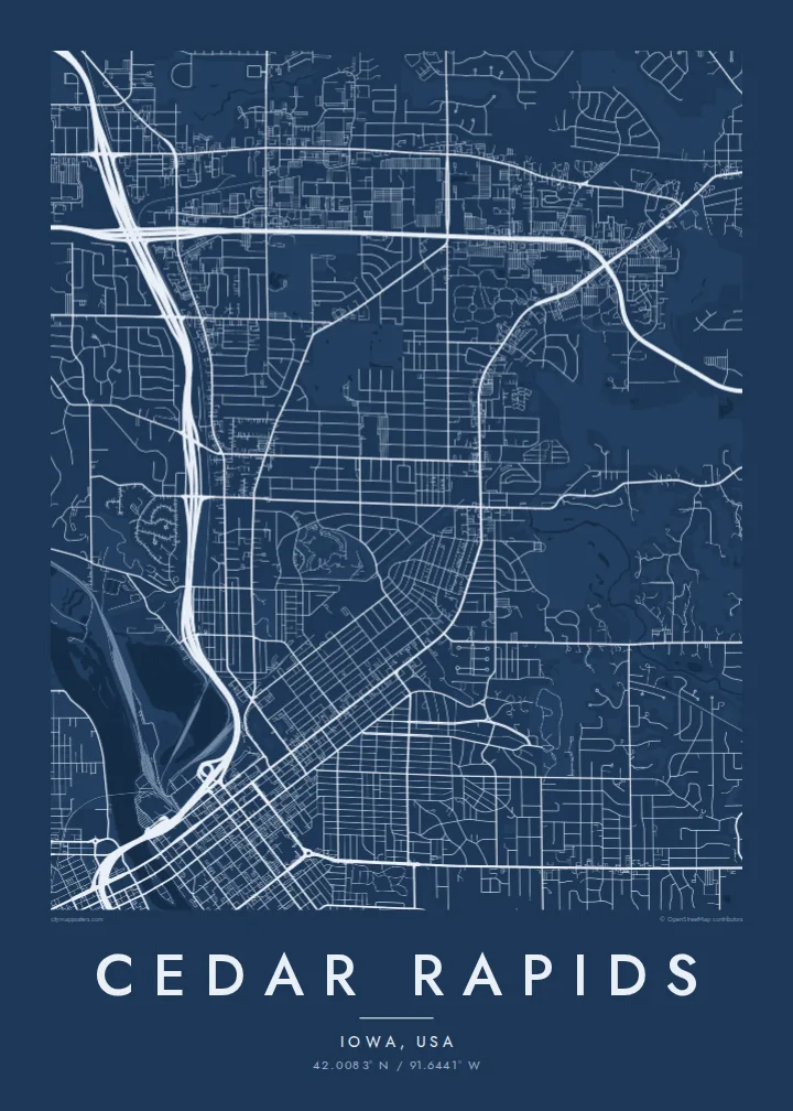
A river city split diagonally by the Cedar, with an island at its centre and four quadrants of numbered streets.



Одне місто, пʼять настроїв
Торкніться стилю, щоб побачити його на стіні. Усі стилі коштують однаково — у друку, в рамці чи як HD-файли.
 Реальні пікселі · файл друку 24 × 36″
Чіткість для друку
Це стовідсотковий фрагмент справжнього файлу для друку. Кожен постер — друкований, у рамці чи завантажений — рендериться на наших серверах із роздільністю 300 DPI, до 7,200 × 10,800 пікселів, тож навіть найдрібніші вулиці залишаються чіткими на друку 24 × 36″.
На стіні


Карта
From above, Cedar Rapids is organised around the Cedar River, which cuts through the city from northwest to southeast. Streets and avenues are numbered and labelled by quadrant (NE, NW, SE and SW), so the map reads as four grids meeting at the water. Downtown sits on the east bank, and a series of bridges connects it to the west side and to Mays Island in the middle of the channel.
Mays Island is the detail most people remember. Civic buildings stand on it, which makes Cedar Rapids one of very few American cities with its seat of government on a river island. A short walk upstream, the large Quaker Oats plant reflects the city's long connection to grain processing, and on some days the smell of toasted oats drifts across downtown.
A Cedar Rapids map poster shows the whole arrangement at once: the river, the island, Interstate 380 curving through the centre and residential blocks spreading toward the farmland of eastern Iowa. The painter Grant Wood lived and worked here, and his ordered, clean-lined view of the Midwest suits the calm geometry of a black-and-white street map.
A narrow island in the Cedar River holding civic buildings, linked to both banks by bridges. On the poster it appears as a small block of streets floating in the middle of the water.
Numbered streets and avenues divide into NE, NW, SE and SW sections. The result is four slightly offset grids that meet along the river and give the map its structure.
The interstate runs north to south through the city and crosses the river close to downtown. Its long, smooth curves stand out against the square blocks on either side.
Зробіть його своїм
Додайте дату, імʼя чи власний підпис, змініть стиль, розмір або орієнтацію.
Безкоштовний перегляд — низької роздільності та з водяним знаком. Друк і HD-файли рендеряться з роздільністю 300 DPI, до 7,200 × 10,800 px, без водяного знака.
Чому Cedar Rapids
Cedar Rapids maps tend to go to people with a long attachment to the city: those who grew up in its quadrants, worked in its plants and offices, or helped rebuild after the 2008 flood. The river and the island make the layout recognisable even without labels.
The title, subtitle and coordinates line can all be personalised, for example with a family name or a date that matters, and the map comes in five styles: Classic black & white, Noir, Paper, Blueprint and Sand. Choose the $9 digital HD files or a printed poster with an optional wooden frame.
Замовити постер «Cedar Rapids»| Розмір друку | Роздільність | Файли |
|---|---|---|
| 30 × 40 cm (11.8 × 15.7″) | 3,543 × 4,724 px | PNG · PDF |
| 29.7 × 42 cm (A3, 11.7 × 16.5″) | 3,508 × 4,961 px | PNG · PDF |
| 42 × 59.4 cm (A2, 16.5 × 23.4″) | 4,961 × 7,016 px | PNG · PDF |
| 45.7 × 61 cm (18 × 24″) | 5,400 × 7,200 px | PNG · PDF |
| 50 × 70 cm (19.7 × 27.6″) | 5,906 × 8,268 px | PNG · PDF |
| 61 × 91.4 cm (24 × 36″) | 7,200 × 10,800 px | PNG · PDF |
Для порівняння: безкоштовне превʼю має ширину 900 px, водяний знак і призначене для екранів. HD-файли мають до 8× більшу роздільність у кожному вимірі й чисто друкуються в повному розмірі постера.
Оберіть стиль угорі сторінки, потім виберіть Друкований постер — розмір і, за бажанням, рамку — або Цифрові HD-файли. Оформлення замовлення займає один крок, і сторінка замовлення оновиться, щойно пройде оплата.
Його друкують на щільному матовому папері 200 г/м² в одному з шести розмірів — від 30 × 40 см до 24 × 36″. Друковані постери коштують від $39, доставка включена.
Так. Оберіть рамку з масиву дерева — чорну, білу, натуральний дуб або темне дерево. Вона йде з ударостійким склом і готова до розміщення на стіні. Постери в рамці коштують від $99, доставка включена.
Доставка безкоштовна по всьому світу. Кожен постер друкує найближчий із наших друкарських партнерів у понад 30 країнах, і зазвичай він доходить за 3–7 робочих днів. Статус і трекінг можна відстежувати в розділі «Мої замовлення». До деяких країн доставка займає 2–5 тижнів, а якщо ми ще не доставляємо у ваш регіон, сайт повідомить про це до оплати.
Надішліть нам фото протягом 14 днів після доставки, і ми безкоштовно надрукуємо новий постер або повернемо кошти.
Так. У редакторі на цій сторінці змініть заголовок, підзаголовок і рядок з координатами на будь-які, а також оберіть стиль і розмір. Друковані, оформлені в рамку та цифрові замовлення повністю відповідають вашому дизайну.
За $9 ви отримаєте PNG і готові до друку PDF-файли з роздільністю 300 DPI у всіх шести розмірах, без водяного знака, для друку будь-де. Ще не впевнені? Спершу завантажте безкоштовний попередній перегляд із водяним знаком.
