Cité Plantagenêt
The old walled quarter forms a compact, irregular cluster of lanes on the high ground above the Sarthe, clearly different from the wider boulevards of the later city around it.
Мінімалістичний постер-карта · Франція
48.0021° N / 0.2025° E
A walled old town above the Sarthe, streets radiating outwards, and a racing circuit curving through the countryside to the south
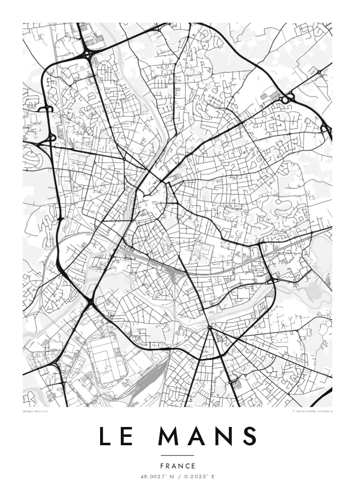

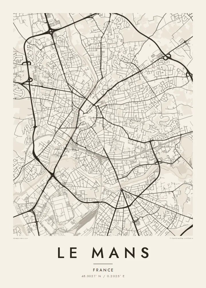

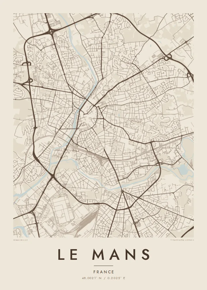
Одне місто, пʼять настроїв
Торкніться стилю, щоб побачити його на стіні. Усі стилі коштують однаково — у друку, в рамці чи як HD-файли.
 Реальні пікселі · файл друку 24 × 36″
Чіткість для друку
Це стовідсотковий фрагмент справжнього файлу для друку. Кожен постер — друкований, у рамці чи завантажений — рендериться на наших серверах із роздільністю 300 DPI, до 7,200 × 10,800 пікселів, тож навіть найдрібніші вулиці залишаються чіткими на друку 24 × 36″.
На стіні


Карта
Le Mans grew on a ridge above the east bank of the Sarthe, close to where the Huisne flows in from the east. Seen from above, the old core is a tight, irregular knot of lanes on the high ground by the river. From there, boulevards and later districts spread out in rough rings, and a tram line traces a long arc through the modern city.
The Cité Plantagenêt, the medieval quarter, sits inside one of the best-preserved Gallo-Roman city walls in Europe, and the Cathédrale Saint-Julien rises at its northern end. South of the city, public roads and a permanent track together form the Circuit de la Sarthe, where the 24 Hours of Le Mans endurance race has been held since 1923.
A Le Mans map poster keeps both identities in view. The dense medieval centre and the curve of the Sarthe hold the middle of the frame, while wider views bring in the long straights and sweeping bends of the circuit at the southern edge. Bridges tie the two banks together, and the meeting of the two rivers gives the lower part of the city its shape.
The old walled quarter forms a compact, irregular cluster of lanes on the high ground above the Sarthe, clearly different from the wider boulevards of the later city around it.
The Sarthe runs north to south through the city, and the Huisne joins it from the east. Together the two rivers give Le Mans a clear watery framework.
To the south, the race circuit’s long straight and wide curves can be traced along ordinary roads. It is a well-known line for anyone who follows motorsport.
Зробіть його своїм
Додайте дату, імʼя чи власний підпис, змініть стиль, розмір або орієнтацію.
Безкоштовний перегляд — низької роздільності та з водяним знаком. Друк і HD-файли рендеряться з роздільністю 300 DPI, до 7,200 × 10,800 px, без водяного знака.
Чому Le Mans
Some people hang Le Mans for the cathedral and the medieval lanes, others for the June race weekend. Plenty want both. The map puts the two side by side without favouring either, which suits a hallway, a study or a garage wall.
Put a race year, a family name or the coordinates of a favourite spot in the title, subtitle and coordinates line. Then choose from five styles: Classic black & white, Noir, Paper, Blueprint or Sand.
Замовити постер «Le Mans»| Розмір друку | Роздільність | Файли |
|---|---|---|
| 30 × 40 cm (11.8 × 15.7″) | 3,543 × 4,724 px | PNG · PDF |
| 29.7 × 42 cm (A3, 11.7 × 16.5″) | 3,508 × 4,961 px | PNG · PDF |
| 42 × 59.4 cm (A2, 16.5 × 23.4″) | 4,961 × 7,016 px | PNG · PDF |
| 45.7 × 61 cm (18 × 24″) | 5,400 × 7,200 px | PNG · PDF |
| 50 × 70 cm (19.7 × 27.6″) | 5,906 × 8,268 px | PNG · PDF |
| 61 × 91.4 cm (24 × 36″) | 7,200 × 10,800 px | PNG · PDF |
Для порівняння: безкоштовне превʼю має ширину 900 px, водяний знак і призначене для екранів. HD-файли мають до 8× більшу роздільність у кожному вимірі й чисто друкуються в повному розмірі постера.
Оберіть стиль угорі сторінки, потім виберіть Друкований постер — розмір і, за бажанням, рамку — або Цифрові HD-файли. Оформлення замовлення займає один крок, і сторінка замовлення оновиться, щойно пройде оплата.
Його друкують на щільному матовому папері 200 г/м² в одному з шести розмірів — від 30 × 40 см до 24 × 36″. Друковані постери коштують від {printFrom}, доставка включена.
Так. Оберіть рамку з масиву дерева — чорну, білу, натуральний дуб або темне дерево. Вона йде з ударостійким склом і готова до розміщення на стіні. Постери в рамці коштують від {framedFrom}, доставка включена.
Доставка безкоштовна по всьому світу. Кожен постер друкує найближчий з наших партнерів у понад 30 країнах, зазвичай доставка займає 3–7 робочих днів. Статус і трек-номер можна відстежити в розділі «Мої замовлення».
Надішліть нам фото протягом 14 днів після доставки, і ми безкоштовно надрукуємо новий постер або повернемо кошти.
Так. У редакторі на цій сторінці змініть заголовок, підзаголовок і рядок з координатами на будь-які, а також оберіть стиль і розмір. Друковані, оформлені в рамку та цифрові замовлення повністю відповідають вашому дизайну.
За $9 ви отримаєте PNG і готові до друку PDF-файли з роздільністю 300 DPI у всіх шести розмірах, без водяного знака, для друку будь-де. Ще не впевнені? Спершу завантажте безкоштовний попередній перегляд із водяним знаком.
Поруч
