Lincoln Highway
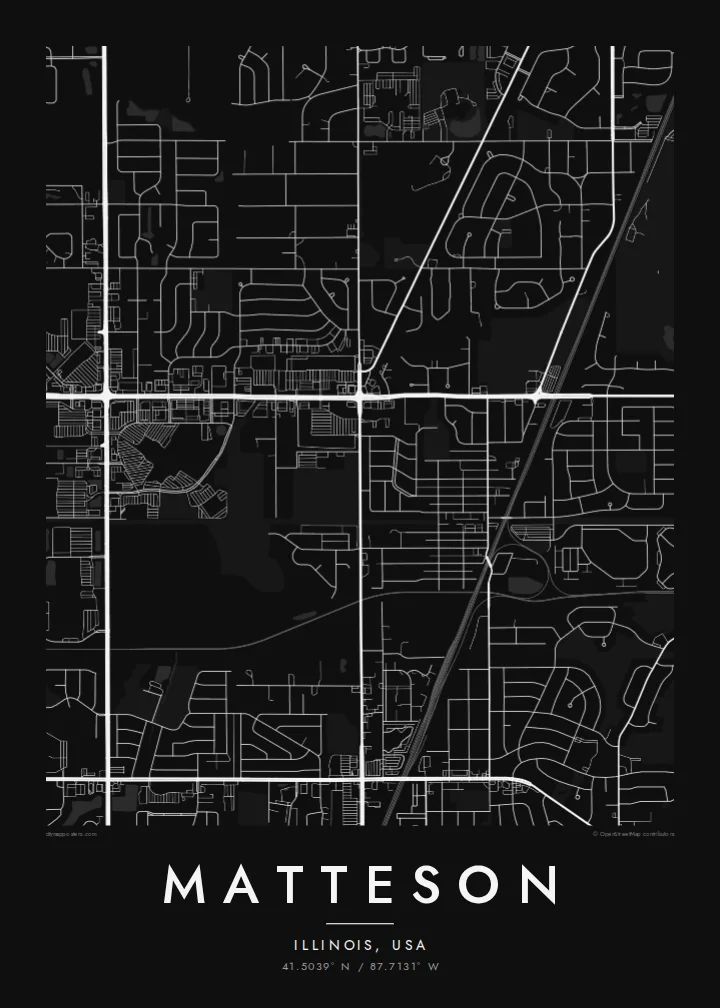
US 30 crosses the village east to west along the route of the Lincoln Highway, the early twentieth-century road linking New York and San Francisco. On the poster it is one of the longest straight lines.
Мінімалістичний постер-карта · Сполучені Штати
41.5039° N / 87.7131° W
A south-suburban Chicago grid where Interstate 57, the Lincoln Highway and the Metra Electric line cut clean lines across former prairie.



Одне місто, пʼять настроїв
Торкніться стилю, щоб побачити його на стіні. Усі стилі коштують однаково — у друку, в рамці чи як HD-файли.
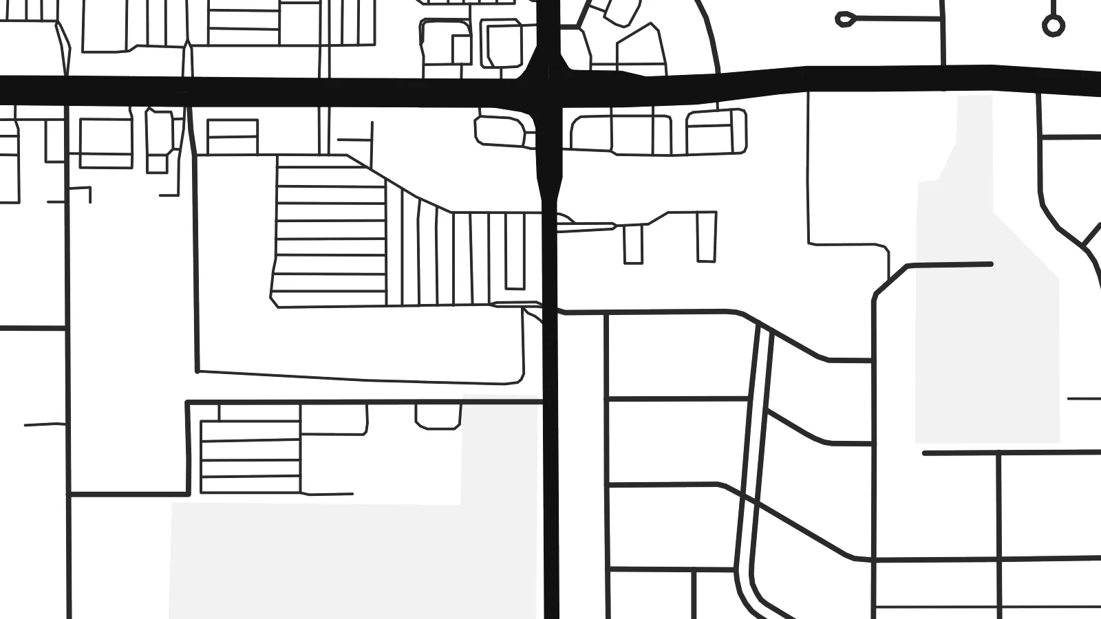 Реальні пікселі · файл друку 24 × 36″
Чіткість для друку
Це стовідсотковий фрагмент справжнього файлу для друку. Кожен постер — друкований, у рамці чи завантажений — рендериться на наших серверах із роздільністю 300 DPI, до 7,200 × 10,800 пікселів, тож навіть найдрібніші вулиці залишаються чіткими на друку 24 × 36″.
На стіні


Карта
Matteson sits on the flat land south of Chicago, where the old prairie was divided into survey-mile squares long before the houses arrived. From above, that pattern is still easy to read. Section-line roads run straight north–south and east–west, and the residential streets inside each square form the loops, cul-de-sacs and short crescents typical of postwar Illinois suburbs.
The village began as a railroad settlement and is named after Joel Matteson, a governor of Illinois in the 1850s. The rail corridor still runs through town and now carries Metra Electric commuter trains toward downtown Chicago. On the map it reads as a long, unbroken line, and most streets meet it at right angles instead of crossing it at random.
Two major roads frame the picture. Interstate 57 runs north–south through the village with its interchange ramps, and US 30, the historic Lincoln Highway, runs east–west along one of the country's earliest coast-to-coast routes. A Matteson map poster shows where a transcontinental road, a commuter railway and quiet residential blocks meet, all in one orderly composition.
US 30 crosses the village east to west along the route of the Lincoln Highway, the early twentieth-century road linking New York and San Francisco. On the poster it is one of the longest straight lines.
The interstate runs north–south through the village. Its interchange ramps are the most curved, sculptural shapes on an otherwise rectilinear map.
Between the section-line roads, subdivisions use curving drives and cul-de-sacs. Each square mile gets its own pattern of rounded lines inside a rigid outer frame.
Зробіть його своїм
Додайте дату, імʼя чи власний підпис, змініть стиль, розмір або орієнтацію.
Безкоштовний перегляд — низької роздільності та з водяним знаком. Друк і HD-файли рендеряться з роздільністю 300 DPI, до 7,200 × 10,800 px, без водяного знака.
Чому Matteson
For people who grew up in the south suburbs or rode the Metra from here, the map is a quiet record of daily routes: the station, the highway ramps, the street where the family house stood. It suits a hallway, a home office or a first apartment in the city.
You can set your own title, subtitle and coordinates line, for example a family name or a move-in date, and choose Classic black & white, Noir, Paper, Blueprint or Sand. The $9 digital download includes six print sizes as 300 DPI PNG and PDF files. Printed and framed versions ship from partners in 30+ countries.
Замовити постер «Matteson»| Розмір друку | Роздільність | Файли |
|---|---|---|
| 30 × 40 cm11.8 × 15.7″ | 3,543 × 4,724 px | PNG · PDF |
| 29.7 × 42 cm (A3)11.7 × 16.5″ | 3,508 × 4,961 px | PNG · PDF |
| 42 × 59.4 cm (A2)16.5 × 23.4″ | 4,961 × 7,016 px | PNG · PDF |
| 45.7 × 61 cm18 × 24″ | 5,400 × 7,200 px | PNG · PDF |
| 50 × 70 cm19.7 × 27.6″ | 5,906 × 8,268 px | PNG · PDF |
| 61 × 91.4 cm24 × 36″ | 7,200 × 10,800 px | PNG · PDF |
Для порівняння: безкоштовне превʼю має ширину 900 px, водяний знак і призначене для екранів. HD-файли мають до 8× більшу роздільність у кожному вимірі й чисто друкуються в повному розмірі постера.
Оберіть стиль угорі сторінки, потім виберіть Друкований постер — розмір і, за бажанням, рамку — або Цифрові HD-файли. Оформлення замовлення займає один крок, і сторінка замовлення оновиться, щойно пройде оплата.
Його друкують на щільному матовому папері 200 г/м² в одному з шести розмірів — від 30 × 40 см до 24 × 36″. Друковані постери коштують від $39, доставка включена.
Так. Оберіть рамку з масиву дерева — чорну, білу, натуральний дуб або темне дерево. Вона йде з ударостійким склом і готова до розміщення на стіні. Постери в рамці коштують від $99, доставка включена.
Доставка безкоштовна до 60+ країн. Кожен постер друкує найближчий із наших друкарських партнерів у 30+ країнах, і зазвичай він надходить за 3–7 робочих днів. Статус і трекінг можна відстежувати в розділі «Мої замовлення». До кількох країн доставка триває 2–5 тижнів, а якщо ми ще не доставляємо у вашу країну, сайт повідомить про це до оплати.
Надішліть нам фото протягом 14 днів після доставки, і ми безкоштовно надрукуємо новий постер або повернемо кошти.
Так. У редакторі на цій сторінці змініть заголовок, підзаголовок і рядок з координатами на будь-які, а також оберіть стиль і розмір. Друковані, оформлені в рамку та цифрові замовлення повністю відповідають вашому дизайну.
За $9 ви отримаєте PNG і готові до друку PDF-файли з роздільністю 300 DPI у всіх шести розмірах, без водяного знака, для друку будь-де. Ще не впевнені? Спершу завантажте безкоштовний попередній перегляд із водяним знаком.
