River Lagan bridges
The Lagan winds through the city before widening into the lough. A row of bridges stitches its east and west banks together across the poster.
سادہ نقشہ پوسٹر · سلطنت متحدہ
54.5968° N / 5.9254° W
A city spread around the head of Belfast Lough, split by the River Lagan and framed by dark hills


ایک شہر، پانچ انداز
کوئی بھی اسٹائل منتخب کریں اور دیکھیں دیوار پر کیسا لگتا ہے۔ ہر اسٹائل کی قیمت ایک جیسی ہے — پرنٹ، فریم یا HD فائلز کے طور پر۔
 اصل پکسلز · 24 × 36″ پرنٹ فائل
پرنٹ جیسی واضح
یہ اصل پرنٹ فائل کا 100% کراپ ہے۔ ہر پوسٹر — چاہے پرنٹ ہو، فریم شدہ ہو یا ڈاؤن لوڈ کیا گیا ہو — ہمارے سرورز پر 300 DPI اور 7,200 × 10,800 پکسلز تک رینڈر کیا جاتا ہے، تاکہ 24 × 36″ پرنٹ پر بھی سب سے باریک گلیاں تک صاف نظر آئیں۔
دیوار پر


نقشہ
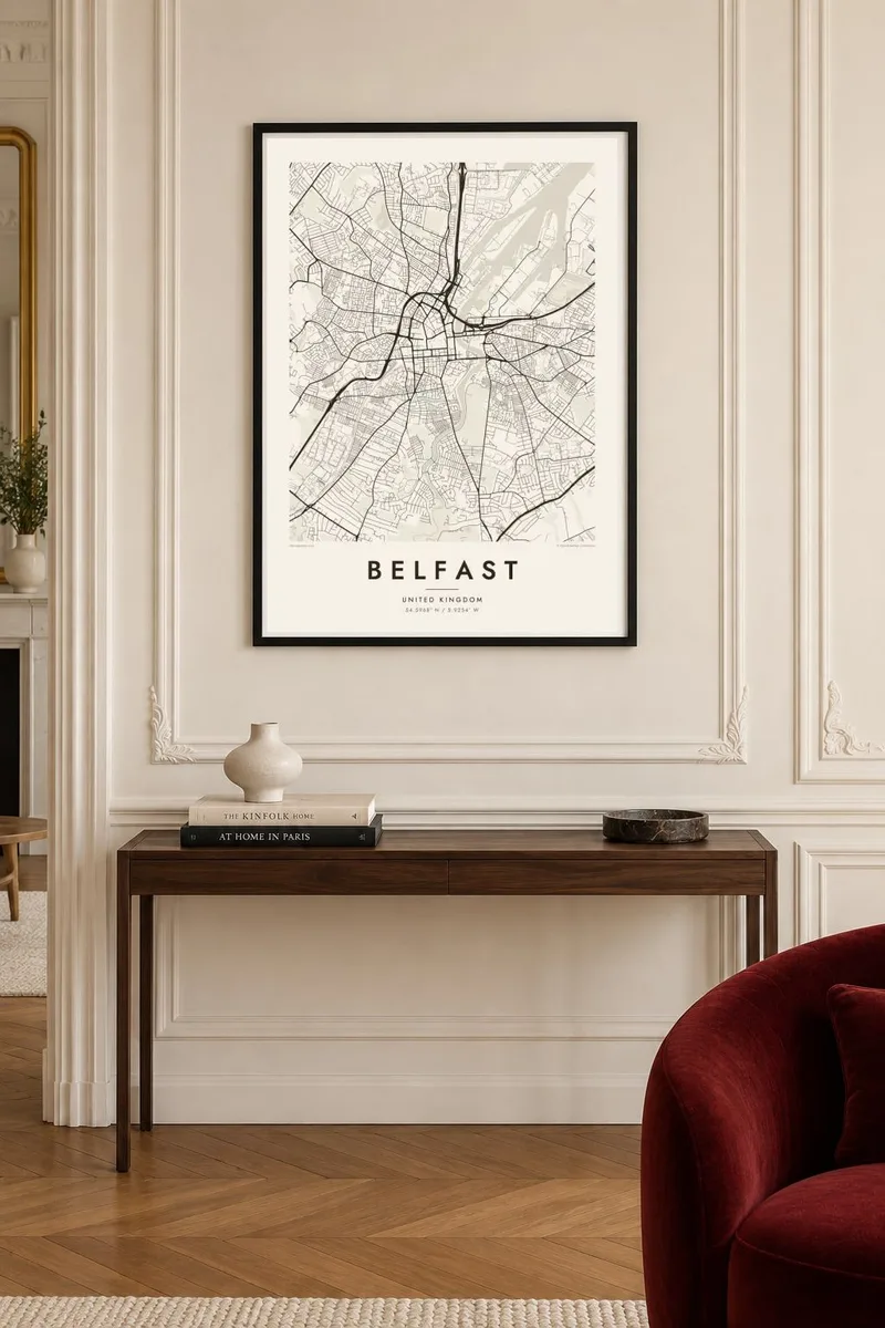
Belfast sits where the River Lagan flows into Belfast Lough. On the map, the lough opens out to the northeast, docks and shipyards fill the land beside it, and the city centre gathers around City Hall and Donegall Square. To the north and west the streets climb toward a line of hills, with the distinctive outline of Cave Hill looking down over everything.
The city's industrial history is written into its shape. Harland & Wolff's shipyard built the Titanic, and the reclaimed land where the ship was launched is now the Titanic Quarter, home to a large museum. South of the centre, Queen's University and the Botanic Gardens anchor a quieter district of terraces.
A Belfast map poster carries all of these layers: the curving Lagan with its bridges, the long straight quays, the tight terraced streets of the inner neighbourhoods and the broad docklands opening onto the lough. It is a city whose water and industry still determine how it looks from above.
The Lagan winds through the city before widening into the lough. A row of bridges stitches its east and west banks together across the poster.
The former shipyard land on Queen's Island, where the Titanic was built, makes a large open area. The shapes of old slipways and docks stand out against the lough.
To the north the streets stop at the slopes of Cave Hill. The built area gives way to parkland and steep ground at the top of the composition.
اسے اپنا بنائیں
کوئی تاریخ، نام یا اپنی کوئی سطر شامل کریں، انداز، سائز یا رخ بدلیں۔
مفت پیش منظر کم ریزولیوشن اور واٹر مارک کے ساتھ ہوتا ہے۔ پرنٹس اور HD فائلز 300 DPI اور 7,200 × 10,800 px تک بغیر واٹر مارک کے رینڈر کی جاتی ہیں۔
Belfast ہی کیوں
Belfast has a large diaspora, and a map of the city makes a fitting gift for anyone who grew up there, studied at Queen's or still keeps family ties. It also appeals to anyone interested in the city's maritime and industrial past.
Personalise the title, subtitle and coordinates line to mark an address, a graduation or a wedding. Then choose from five styles: Classic black & white, Noir, Paper, Blueprint or Sand. Blueprint suits the shipbuilding heritage particularly well.
Belfast پوسٹر آرڈر کریں| پرنٹ سائز | ریزولوشن | فائلیں |
|---|---|---|
| 30 × 40 cm (11.8 × 15.7″) | 3,543 × 4,724 px | PNG · PDF |
| 29.7 × 42 cm (A3, 11.7 × 16.5″) | 3,508 × 4,961 px | PNG · PDF |
| 42 × 59.4 cm (A2, 16.5 × 23.4″) | 4,961 × 7,016 px | PNG · PDF |
| 45.7 × 61 cm (18 × 24″) | 5,400 × 7,200 px | PNG · PDF |
| 50 × 70 cm (19.7 × 27.6″) | 5,906 × 8,268 px | PNG · PDF |
| 61 × 91.4 cm (24 × 36″) | 7,200 × 10,800 px | PNG · PDF |
موازنے کے لیے، مفت پیش نظارہ 900 px چوڑا ہے، واٹر مارک کے ساتھ اور اسکرین کے لیے ہے۔ HD فائلوں کی ریزولوشن ہر سمت میں 8 گنا تک زیادہ ہے اور پورے پوسٹر سائز پر صاف پرنٹ ہوتی ہیں۔
صفحے کے اوپر ایک اسٹائل منتخب کریں، پھر پرنٹڈ پوسٹر چنیں — سائز اور چاہیں تو فریم بھی — یا ڈیجیٹل HD فائلز۔ چیک آؤٹ صرف ایک مرحلے میں مکمل ہوتا ہے، اور ادائیگی مکمل ہوتے ہی آپ کا آرڈر پیج اپڈیٹ ہو جاتا ہے۔
یہ پریمیم 200 gsm میٹ پیپر پر چھ سائزز میں سے کسی ایک میں پرنٹ ہوتا ہے، 30 × 40 cm سے لے کر 24 × 36″ تک۔ پرنٹڈ پوسٹرز کی قیمت $39 سے شروع ہوتی ہے، شپنگ شامل ہے۔
جی ہاں۔ سیاہ، سفید، قدرتی اوک یا گہری لکڑی میں سولڈ ووڈ فریم منتخب کریں۔ اس کے ساتھ ٹوٹ پھوٹ سے محفوظ شیشہ لگا ہوتا ہے اور یہ لٹکانے کے لیے تیار ہوتا ہے۔ فریم شدہ پوسٹرز کی قیمت $99 سے شروع ہوتی ہے، شپنگ شامل ہے۔
دنیا بھر میں شپنگ مفت ہے۔ ہر پوسٹر 30 سے زائد ممالک میں ہمارے قریب ترین پرنٹ پارٹنر کے ہاں چھپتا ہے اور عموماً 3–7 کاروباری دنوں میں پہنچ جاتا ہے۔ آرڈر کی صورتحال اور ٹریکنگ آپ میرے آرڈرز میں دیکھ سکتے ہیں۔ چند ممالک میں 2–5 ہفتے لگتے ہیں، اور جہاں ہم ابھی شپنگ نہیں کرتے وہاں ادائیگی سے پہلے سائٹ خود آپ کو بتا دیتی ہے۔
ڈیلیوری کے 14 دنوں کے اندر ہمیں تصویر بھیجیں اور ہم اسے مفت دوبارہ پرنٹ کر دیں گے یا آپ کی رقم واپس کر دیں گے۔
جی ہاں۔ اس صفحے کے ایڈیٹر میں عنوان، ذیلی عنوان اور کوآرڈینیٹس کی لائن کو اپنی مرضی کے مطابق تبدیل کریں، اور اسٹائل و سائز منتخب کریں۔ پرنٹڈ، فریم شدہ اور ڈیجیٹل — سب آرڈرز میں عین آپ کا ڈیزائن استعمال ہوتا ہے۔
$9 میں آپ کو 300 DPI PNG اور پرنٹ کے لیے تیار PDF فائلز چھ سائزز میں ملتی ہیں، بغیر واٹر مارک کے، جنہیں کہیں بھی پرنٹ کیا جا سکتا ہے۔ ابھی یقین نہیں؟ پہلے مفت واٹر مارک والا پیش منظر ڈاؤن لوڈ کریں۔
