Discovery Passage
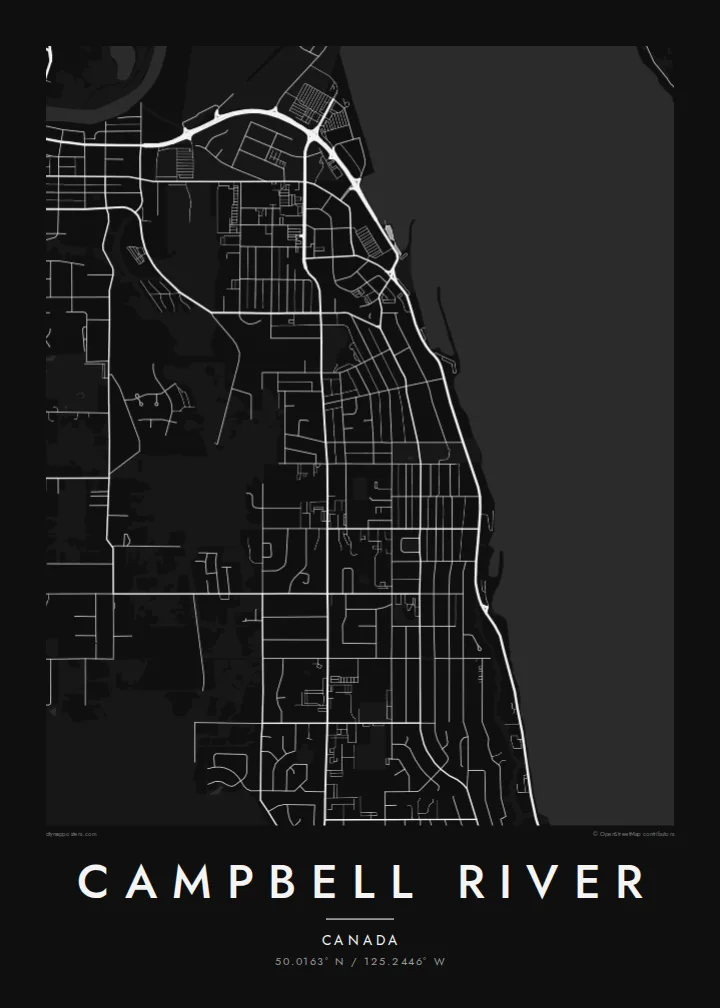
The narrow channel between Vancouver Island and Quadra Island runs along the whole town. Its fast tides and the facing shores create a strong coastal composition.
سادہ نقشہ پوسٹر · کینیڈا
50.0163° N / 125.2446° W
A Vancouver Island town stretched along Discovery Passage, with forests behind it and islands across the water



ایک شہر، پانچ انداز
کوئی بھی اسٹائل منتخب کریں اور دیکھیں دیوار پر کیسا لگتا ہے۔ ہر اسٹائل کی قیمت ایک جیسی ہے — پرنٹ، فریم یا HD فائلز کے طور پر۔
 اصل پکسلز · 24 × 36″ پرنٹ فائل
پرنٹ جیسی واضح
یہ اصل پرنٹ فائل کا 100% کراپ ہے۔ ہر پوسٹر — چاہے پرنٹ ہو، فریم شدہ ہو یا ڈاؤن لوڈ کیا گیا ہو — ہمارے سرورز پر 300 DPI اور 7,200 × 10,800 پکسلز تک رینڈر کیا جاتا ہے، تاکہ 24 × 36″ پرنٹ پر بھی سب سے باریک گلیاں تک صاف نظر آئیں۔
دیوار پر


نقشہ
Campbell River lies on the east coast of Vancouver Island, where the Strait of Georgia narrows into Discovery Passage. The town runs in a long ribbon along the shoreline, with Quadra Island just across the channel. Behind it, streets give way to forest and to the river that gives the city its name.
The city calls itself the Salmon Capital of the World. The strong tidal currents in the passage and the salmon runs in the river have drawn anglers here for well over a century. Upstream, Elk Falls drops into a rocky canyon, and a suspension bridge hangs over the gorge.
A Campbell River map poster captures the meeting of forest, river and sea. The long waterfront, the ferry link to Quadra and the river mouth give the drawing definition, while the wooded interior thins to a few roads and trails. It is a map with room to breathe.
The narrow channel between Vancouver Island and Quadra Island runs along the whole town. Its fast tides and the facing shores create a strong coastal composition.
The Campbell River reaches the sea at the south end of town. Its winding course inland adds a natural line through the streets and forest.
The town follows the shore in a long, narrow strip. The main roads parallel the water, and residential streets climb gently inland.
اسے اپنا بنائیں
کوئی تاریخ، نام یا اپنی کوئی سطر شامل کریں، انداز، سائز یا رخ بدلیں۔
مفت پیش منظر کم ریزولیوشن اور واٹر مارک کے ساتھ ہوتا ہے۔ پرنٹس اور HD فائلز 300 DPI اور 7,200 × 10,800 px تک بغیر واٹر مارک کے رینڈر کی جاتی ہیں۔
Campbell River ہی کیوں
For anglers, island families and anyone who has watched the tide race through Discovery Passage, the map captures the island's edge in clean lines. It suits a cabin as well as a city apartment.
Personalise the title, a subtitle such as a fishing trip or a wedding date, and the coordinates line. Then choose Classic black & white, Noir, Paper, Blueprint or Sand. The Blueprint style works especially well with the coastline.
Campbell River پوسٹر آرڈر کریں| پرنٹ سائز | ریزولوشن | فائلیں |
|---|---|---|
| 30 × 40 cm11.8 × 15.7″ | 3,543 × 4,724 px | PNG · PDF |
| 29.7 × 42 cm (A3)11.7 × 16.5″ | 3,508 × 4,961 px | PNG · PDF |
| 42 × 59.4 cm (A2)16.5 × 23.4″ | 4,961 × 7,016 px | PNG · PDF |
| 45.7 × 61 cm18 × 24″ | 5,400 × 7,200 px | PNG · PDF |
| 50 × 70 cm19.7 × 27.6″ | 5,906 × 8,268 px | PNG · PDF |
| 61 × 91.4 cm24 × 36″ | 7,200 × 10,800 px | PNG · PDF |
موازنے کے لیے، مفت پیش نظارہ 900 px چوڑا ہے، واٹر مارک کے ساتھ اور اسکرین کے لیے ہے۔ HD فائلوں کی ریزولوشن ہر سمت میں 8 گنا تک زیادہ ہے اور پورے پوسٹر سائز پر صاف پرنٹ ہوتی ہیں۔
صفحے کے اوپر ایک اسٹائل منتخب کریں، پھر پرنٹڈ پوسٹر چنیں — سائز اور چاہیں تو فریم بھی — یا ڈیجیٹل HD فائلز۔ چیک آؤٹ صرف ایک مرحلے میں مکمل ہوتا ہے، اور ادائیگی مکمل ہوتے ہی آپ کا آرڈر پیج اپڈیٹ ہو جاتا ہے۔
یہ پریمیم 200 gsm میٹ پیپر پر چھ سائزز میں سے کسی ایک میں پرنٹ ہوتا ہے، 30 × 40 cm سے لے کر 24 × 36″ تک۔ پرنٹڈ پوسٹرز کی قیمت $39 سے شروع ہوتی ہے، شپنگ شامل ہے۔
جی ہاں۔ سیاہ، سفید، قدرتی اوک یا گہری لکڑی میں سولڈ ووڈ فریم منتخب کریں۔ اس کے ساتھ ٹوٹ پھوٹ سے محفوظ شیشہ لگا ہوتا ہے اور یہ لٹکانے کے لیے تیار ہوتا ہے۔ فریم شدہ پوسٹرز کی قیمت $99 سے شروع ہوتی ہے، شپنگ شامل ہے۔
60 سے زائد ممالک میں شپنگ مفت ہے۔ ہر پوسٹر 30 سے زائد ممالک میں موجود ہمارے پرنٹ پارٹنرز میں سے قریب ترین پارٹنر پرنٹ کرتا ہے اور عموماً 3–7 کاروباری دنوں میں پہنچ جاتا ہے۔ آپ اپنے آرڈر کی حالت اور ٹریکنگ "میرے آرڈرز" میں دیکھ سکتے ہیں۔ چند ممالک میں 2–5 ہفتے لگتے ہیں، اور جہاں ہم ابھی شپنگ نہیں کرتے، وہاں ادائیگی سے پہلے ہی سائٹ آپ کو بتا دیتی ہے۔
ڈیلیوری کے 14 دنوں کے اندر ہمیں تصویر بھیجیں اور ہم اسے مفت دوبارہ پرنٹ کر دیں گے یا آپ کی رقم واپس کر دیں گے۔
جی ہاں۔ اس صفحے کے ایڈیٹر میں عنوان، ذیلی عنوان اور کوآرڈینیٹس کی لائن کو اپنی مرضی کے مطابق تبدیل کریں، اور اسٹائل و سائز منتخب کریں۔ پرنٹڈ، فریم شدہ اور ڈیجیٹل — سب آرڈرز میں عین آپ کا ڈیزائن استعمال ہوتا ہے۔
$9 میں آپ کو 300 DPI PNG اور پرنٹ کے لیے تیار PDF فائلز چھ سائزز میں ملتی ہیں، بغیر واٹر مارک کے، جنہیں کہیں بھی پرنٹ کیا جا سکتا ہے۔ ابھی یقین نہیں؟ پہلے مفت واٹر مارک والا پیش منظر ڈاؤن لوڈ کریں۔
