Chain of beaches
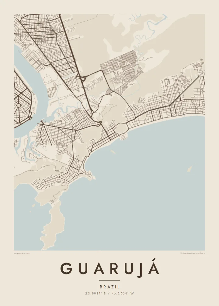
A sequence of wide sandy bays runs along the ocean shore, each separated by a rocky headland, giving the coastline a scalloped outline.
سادہ نقشہ پوسٹر · برازیل
23.9931° S / 46.2564° W
An island city of curving Atlantic beaches and rocky headlands, separated from the port of Santos by a narrow channel


ایک شہر، پانچ انداز
کوئی بھی اسٹائل منتخب کریں اور دیکھیں دیوار پر کیسا لگتا ہے۔ ہر اسٹائل کی قیمت ایک جیسی ہے — پرنٹ، فریم یا HD فائلز کے طور پر۔
 اصل پکسلز · 24 × 36″ پرنٹ فائل
پرنٹ جیسی واضح
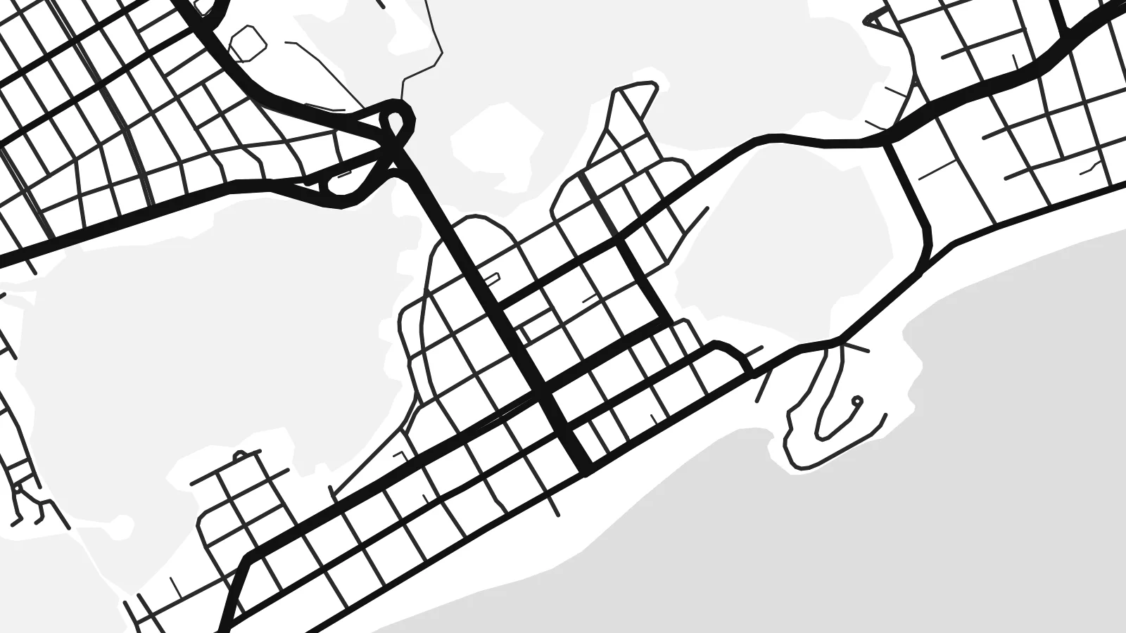
یہ اصل پرنٹ فائل کا 100% کراپ ہے۔ ہر پوسٹر — چاہے پرنٹ ہو، فریم شدہ ہو یا ڈاؤن لوڈ کیا گیا ہو — ہمارے سرورز پر 300 DPI اور 7,200 × 10,800 پکسلز تک رینڈر کیا جاتا ہے، تاکہ 24 × 36″ پرنٹ پر بھی سب سے باریک گلیاں تک صاف نظر آئیں۔
دیوار پر


نقشہ
Guarujá occupies Santo Amaro island on the coast of São Paulo state, across a narrow channel from the port city of Santos. From above the island is a mosaic of forested hills, rocky points and sandy bays, with the town concentrated on the flatter ground behind the beaches and along the channel side facing Santos.
The coastline is what defines the map. Beaches such as Pitangueiras, Enseada and Pernambuco curve between headlands, each forming a clean arc against the Atlantic, and apartment blocks line the seafront in dense strips. The nickname Pearl of the Atlantic reflects the town's long history as a weekend and summer retreat for people from São Paulo.
On the western side of the island, a ferry crossing links Guarujá with Santos, while mangroves and quiet channels mark the northern shore. A Guarujá map poster brings together those contrasting edges: the harbour channel, the wetlands and the chain of ocean beaches, all wrapped around the steep, forested hills at the island's centre.
A sequence of wide sandy bays runs along the ocean shore, each separated by a rocky headland, giving the coastline a scalloped outline.
The narrow waterway on the western side separates Guarujá from Santos, lined with port terminals and crossed by ferries rather than bridges.
Forested high ground rises between the beaches and the channel, leaving much of the island's interior free of streets and framing the town around it.
اسے اپنا بنائیں
کوئی تاریخ، نام یا اپنی کوئی سطر شامل کریں، انداز، سائز یا رخ بدلیں۔
مفت پیش منظر کم ریزولیوشن اور واٹر مارک کے ساتھ ہوتا ہے۔ پرنٹس اور HD فائلز 300 DPI اور 7,200 × 10,800 px تک بغیر واٹر مارک کے رینڈر کی جاتی ہیں۔
Guarujá ہی کیوں
For many families in São Paulo, Guarujá is the beach of childhood holidays and long weekends. A map of the island captures that coastline in a way a photograph cannot, with every bay and headland visible at once.
Personalise the title with a beach name or a family surname, add a subtitle and a date, and adjust the coordinates line. Choose Sand or Paper for a coastal feel, and download the $9 HD files or order a printed matte poster.
Guarujá پوسٹر آرڈر کریں| پرنٹ سائز | ریزولوشن | فائلیں |
|---|---|---|
| 30 × 40 cm11.8 × 15.7″ | 3,543 × 4,724 px | PNG · PDF |
| 29.7 × 42 cm (A3)11.7 × 16.5″ | 3,508 × 4,961 px | PNG · PDF |
| 42 × 59.4 cm (A2)16.5 × 23.4″ | 4,961 × 7,016 px | PNG · PDF |
| 45.7 × 61 cm18 × 24″ | 5,400 × 7,200 px | PNG · PDF |
| 50 × 70 cm19.7 × 27.6″ | 5,906 × 8,268 px | PNG · PDF |
| 61 × 91.4 cm24 × 36″ | 7,200 × 10,800 px | PNG · PDF |
موازنے کے لیے، مفت پیش نظارہ 900 px چوڑا ہے، واٹر مارک کے ساتھ اور اسکرین کے لیے ہے۔ HD فائلوں کی ریزولوشن ہر سمت میں 8 گنا تک زیادہ ہے اور پورے پوسٹر سائز پر صاف پرنٹ ہوتی ہیں۔
صفحے کے اوپر ایک اسٹائل منتخب کریں، پھر پرنٹڈ پوسٹر چنیں — سائز اور چاہیں تو فریم بھی — یا ڈیجیٹل HD فائلز۔ چیک آؤٹ صرف ایک مرحلے میں مکمل ہوتا ہے، اور ادائیگی مکمل ہوتے ہی آپ کا آرڈر پیج اپڈیٹ ہو جاتا ہے۔
یہ پریمیم 200 gsm میٹ پیپر پر چھ سائزز میں سے کسی ایک میں پرنٹ ہوتا ہے، 30 × 40 cm سے لے کر 24 × 36″ تک۔ پرنٹڈ پوسٹرز کی قیمت $39 سے شروع ہوتی ہے، شپنگ شامل ہے۔
جی ہاں۔ سیاہ، سفید، قدرتی اوک یا گہری لکڑی میں سولڈ ووڈ فریم منتخب کریں۔ اس کے ساتھ ٹوٹ پھوٹ سے محفوظ شیشہ لگا ہوتا ہے اور یہ لٹکانے کے لیے تیار ہوتا ہے۔ فریم شدہ پوسٹرز کی قیمت $99 سے شروع ہوتی ہے، شپنگ شامل ہے۔
60 سے زائد ممالک میں شپنگ مفت ہے۔ ہر پوسٹر 30 سے زائد ممالک میں موجود ہمارے پرنٹ پارٹنرز میں سے قریب ترین پارٹنر پرنٹ کرتا ہے اور عموماً 3–7 کاروباری دنوں میں پہنچ جاتا ہے۔ آپ اپنے آرڈر کی حالت اور ٹریکنگ "میرے آرڈرز" میں دیکھ سکتے ہیں۔ چند ممالک میں 2–5 ہفتے لگتے ہیں، اور جہاں ہم ابھی شپنگ نہیں کرتے، وہاں ادائیگی سے پہلے ہی سائٹ آپ کو بتا دیتی ہے۔
ڈیلیوری کے 14 دنوں کے اندر ہمیں تصویر بھیجیں اور ہم اسے مفت دوبارہ پرنٹ کر دیں گے یا آپ کی رقم واپس کر دیں گے۔
جی ہاں۔ اس صفحے کے ایڈیٹر میں عنوان، ذیلی عنوان اور کوآرڈینیٹس کی لائن کو اپنی مرضی کے مطابق تبدیل کریں، اور اسٹائل و سائز منتخب کریں۔ پرنٹڈ، فریم شدہ اور ڈیجیٹل — سب آرڈرز میں عین آپ کا ڈیزائن استعمال ہوتا ہے۔
$9 میں آپ کو 300 DPI PNG اور پرنٹ کے لیے تیار PDF فائلز چھ سائزز میں ملتی ہیں، بغیر واٹر مارک کے، جنہیں کہیں بھی پرنٹ کیا جا سکتا ہے۔ ابھی یقین نہیں؟ پہلے مفت واٹر مارک والا پیش منظر ڈاؤن لوڈ کریں۔
