Airport runways
Helsinki Airport's crossing runways are the strongest geometric element in Vantaa, long clean strokes that anchor the centre of the map and contrast with the organic forms of the forests around them.
سادہ نقشہ پوسٹر · فن لینڈ
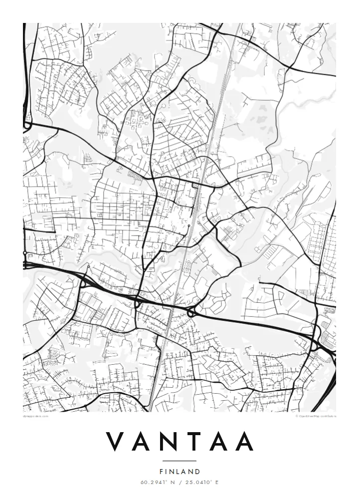
60.2941° N / 25.0410° E
Suburban centres, forests and a major airport spread across the river valley just north of Helsinki


ایک شہر، پانچ انداز
کوئی بھی اسٹائل منتخب کریں اور دیکھیں دیوار پر کیسا لگتا ہے۔ ہر اسٹائل کی قیمت ایک جیسی ہے — پرنٹ، فریم یا HD فائلز کے طور پر۔
 اصل پکسلز · 24 × 36″ پرنٹ فائل
پرنٹ جیسی واضح
یہ اصل پرنٹ فائل کا 100% کراپ ہے۔ ہر پوسٹر — چاہے پرنٹ ہو، فریم شدہ ہو یا ڈاؤن لوڈ کیا گیا ہو — ہمارے سرورز پر 300 DPI اور 7,200 × 10,800 پکسلز تک رینڈر کیا جاتا ہے، تاکہ 24 × 36″ پرنٹ پر بھی سب سے باریک گلیاں تک صاف نظر آئیں۔
دیوار پر


نقشہ
Vantaa has no single historic core. Instead the map shows several distinct centres, such as Tikkurila, Myyrmäki and Korso, each a cluster of apartment blocks, rail stations and shopping streets, separated by forests, fields and river valleys. It became a town in the early 1970s, formed from a rural municipality that had grown quickly as Helsinki expanded northward.
The largest single shape on the map is Helsinki Airport, whose runways cut long straight lines through the middle of the city and around which the Aviapolis business district has grown. Ring III, the outer ring road of the capital region, crosses Vantaa from west to east, while the Vantaa River winds south toward Helsinki through a green valley.
Vantaa is also home to Heureka, the Finnish Science Centre in Tikkurila. A Vantaa map poster suits the city's layered pattern: rail lines radiating out of Helsinki and the Ring Rail loop that dips beneath the airport, curving suburban streets, and large patches of forest that keep the neighbourhoods apart and give the composition room to breathe.
Helsinki Airport's crossing runways are the strongest geometric element in Vantaa, long clean strokes that anchor the centre of the map and contrast with the organic forms of the forests around them.
The river that gives the city its name meanders through farmland and parkland toward Helsinki, drawing a soft, looping line through the south and west of the city.
The outer ring road sweeps across Vantaa with large interchanges, a strong line that ties together the city's scattered centres, business parks and industrial areas.
اسے اپنا بنائیں
کوئی تاریخ، نام یا اپنی کوئی سطر شامل کریں، انداز، سائز یا رخ بدلیں۔
مفت پیش منظر کم ریزولیوشن اور واٹر مارک کے ساتھ ہوتا ہے۔ پرنٹس اور HD فائلز 300 DPI اور 7,200 × 10,800 px تک بغیر واٹر مارک کے رینڈر کی جاتی ہیں۔
Vantaa ہی کیوں
Vantaa is where many people in the capital region actually live, commute and first arrive in Finland. A map of it recalls a first home, a neighbourhood near the rail line, or the airport where a new chapter began.
Add your own title, subtitle and coordinates, for example the name of a district and the year you moved in. Choose among five styles: Classic black and white keeps the forests crisp, while Blueprint suits the runway geometry.
Vantaa پوسٹر آرڈر کریں| پرنٹ سائز | ریزولوشن | فائلیں |
|---|---|---|
| 30 × 40 cm (11.8 × 15.7″) | 3,543 × 4,724 px | PNG · PDF |
| 29.7 × 42 cm (A3, 11.7 × 16.5″) | 3,508 × 4,961 px | PNG · PDF |
| 42 × 59.4 cm (A2, 16.5 × 23.4″) | 4,961 × 7,016 px | PNG · PDF |
| 45.7 × 61 cm (18 × 24″) | 5,400 × 7,200 px | PNG · PDF |
| 50 × 70 cm (19.7 × 27.6″) | 5,906 × 8,268 px | PNG · PDF |
| 61 × 91.4 cm (24 × 36″) | 7,200 × 10,800 px | PNG · PDF |
موازنے کے لیے، مفت پیش نظارہ 900 px چوڑا ہے، واٹر مارک کے ساتھ اور اسکرین کے لیے ہے۔ HD فائلوں کی ریزولوشن ہر سمت میں 8 گنا تک زیادہ ہے اور پورے پوسٹر سائز پر صاف پرنٹ ہوتی ہیں۔
صفحے کے اوپر ایک اسٹائل منتخب کریں، پھر پرنٹڈ پوسٹر چنیں — سائز اور چاہیں تو فریم بھی — یا ڈیجیٹل HD فائلز۔ چیک آؤٹ صرف ایک مرحلے میں مکمل ہوتا ہے، اور ادائیگی مکمل ہوتے ہی آپ کا آرڈر پیج اپڈیٹ ہو جاتا ہے۔
یہ پریمیم 200 gsm میٹ پیپر پر چھ سائزز میں سے کسی ایک میں پرنٹ ہوتا ہے، 30 × 40 cm سے لے کر 24 × 36″ تک۔ پرنٹڈ پوسٹرز کی قیمت {printFrom} سے شروع ہوتی ہے، شپنگ شامل ہے۔
جی ہاں۔ سیاہ، سفید، قدرتی اوک یا گہری لکڑی میں سولڈ ووڈ فریم منتخب کریں۔ اس کے ساتھ ٹوٹ پھوٹ سے محفوظ شیشہ لگا ہوتا ہے اور یہ لٹکانے کے لیے تیار ہوتا ہے۔ فریم شدہ پوسٹرز کی قیمت {framedFrom} سے شروع ہوتی ہے، شپنگ شامل ہے۔
شپنگ پوری دنیا میں مفت ہے۔ ہر پوسٹر 30 سے زائد ممالک میں موجود ہمارے قریب ترین پرنٹ پارٹنر کے ذریعے پرنٹ ہوتا ہے اور عام طور پر 3 سے 7 کاروباری دنوں میں پہنچ جاتا ہے۔ آپ اسٹیٹس اور ٹریکنگ My Orders کے تحت دیکھ سکتے ہیں۔
ڈیلیوری کے 14 دنوں کے اندر ہمیں تصویر بھیجیں اور ہم اسے مفت دوبارہ پرنٹ کر دیں گے یا آپ کی رقم واپس کر دیں گے۔
جی ہاں۔ اس صفحے کے ایڈیٹر میں عنوان، ذیلی عنوان اور کوآرڈینیٹس کی لائن کو اپنی مرضی کے مطابق تبدیل کریں، اور اسٹائل و سائز منتخب کریں۔ پرنٹڈ، فریم شدہ اور ڈیجیٹل — سب آرڈرز میں عین آپ کا ڈیزائن استعمال ہوتا ہے۔
$9 میں آپ کو 300 DPI PNG اور پرنٹ کے لیے تیار PDF فائلز چھ سائزز میں ملتی ہیں، بغیر واٹر مارک کے، جنہیں کہیں بھی پرنٹ کیا جا سکتا ہے۔ ابھی یقین نہیں؟ پہلے مفت واٹر مارک والا پیش منظر ڈاؤن لوڈ کریں۔
