Citadel hill
The walled citadel rises above Ulus, north-east of the centre. Its irregular ring of fortifications and tight inner lanes form the densest and oldest street pattern in the city.
Minimalistik xarita posteri · Turkiya
39.9199° N / 32.8543° E
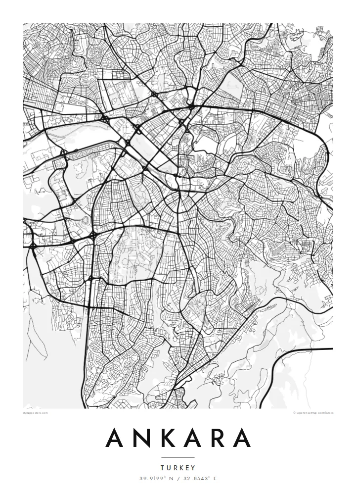
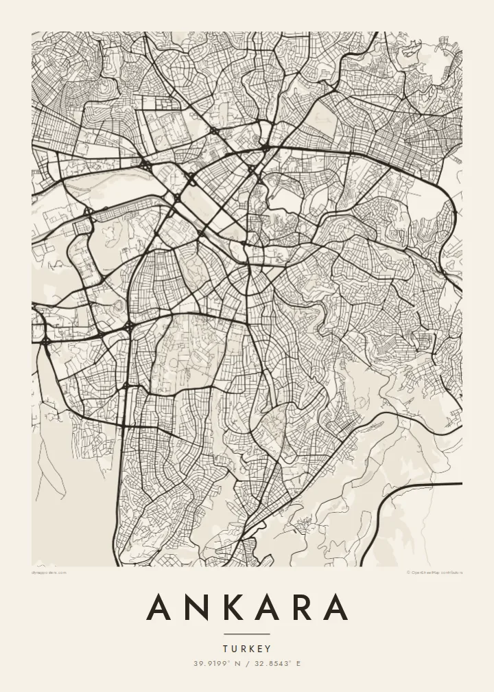
A plateau capital spreading from a citadel hill, cut through by a long boulevard running south toward the ministries and Çankaya.



Bitta shahar, besh kayfiyat
Devorda qanday ko'rinishini bilish uchun uslubni tanlang. Har bir uslub bir xil narxda — bosma, ramkali yoki HD fayl sifatida.
 Haqiqiy piksellar · 24 × 36″ bosma fayl
Bosmada tiniq
Bu haqiqiy bosma faylning 100% o'lchamdagi qismi. Har bir poster — bosma, ramkali yoki yuklab olinadigan — serverlarimizda 300 DPI sifatida, 7,200 × 10,800 pikselgacha render qilinadi, shuning uchun 24 × 36″ bosmada eng ingichka ko'chalar ham aniq ko'rinadi.
Devorda


Xarita
Ankara sits on the Anatolian plateau at more than 900 metres, and from above its oldest layer is easy to find: the citadel on its rocky hill north-east of the centre, wrapped in a tight knot of lanes that ignore any grid. Everything newer radiates away from that point. Over the twentieth century the city was pushed outward as a small provincial town became the seat of a republic.
Ankara became the capital in 1923, and the plan drawn up for it in the late 1920s by the German planner Hermann Jansen still shows in the map. Atatürk Boulevard runs as a long spine from Ulus through Kızılay to the government quarter. Gençlik Park is pressed against the old centre, and Anıtkabir, Atatürk's mausoleum, occupies its own hill to the west within a broad ceremonial park.
Further out, the city loses its early order and breaks into large residential districts, ring roads and campuses. The wooded grounds of the Middle East Technical University form one of the largest green shapes on the south-western edge, with the lakes of Eymir and Mogan beyond them. An Ankara map poster captures both the deliberately planned capital and the much larger city that grew around it.
The walled citadel rises above Ulus, north-east of the centre. Its irregular ring of fortifications and tight inner lanes form the densest and oldest street pattern in the city.
A straight north–south axis linking Ulus, Kızılay and Çankaya. On the map it reads as the city's backbone, with ministries, parks and embassies lined up along it.
Atatürk's mausoleum stands on a hilltop west of Kızılay, surrounded by a broad area of green and ceremonial ground that stands out clearly against the housing blocks around it.
Oʻzingizga moslang
Sana, ism yoki oʻz soʻzlaringizni qoʻshing, uslub, oʻlcham yoki yoʻnalishni oʻzgartiring.
Bepul ko'rinish past sifatli va suv belgili bo'ladi. Bosma va HD fayllar 300 DPI da, 7,200 × 10,800 px gacha, suv belgisisiz render qilinadi.
Nega aynan Ankara
Ankara tends to be personal for the people who hang it: students who spent years at one of its universities, diplomats posted to Çankaya, families who moved to the capital for work. The map holds the route from the citadel down the boulevard, a walk most of them made many times.
You can change the title and subtitle, add a date that matters and adjust the coordinates line. Choose Classic black & white, Noir, Paper, Blueprint or Sand, then download the $9 HD files to print at home, or order a matte print.
Ankara posterini buyurtma qiling| Bosma oʻlchami | Ruxsat | Fayllar |
|---|---|---|
| 30 × 40 cm (11.8 × 15.7″) | 3,543 × 4,724 px | PNG · PDF |
| 29.7 × 42 cm (A3, 11.7 × 16.5″) | 3,508 × 4,961 px | PNG · PDF |
| 42 × 59.4 cm (A2, 16.5 × 23.4″) | 4,961 × 7,016 px | PNG · PDF |
| 45.7 × 61 cm (18 × 24″) | 5,400 × 7,200 px | PNG · PDF |
| 50 × 70 cm (19.7 × 27.6″) | 5,906 × 8,268 px | PNG · PDF |
| 61 × 91.4 cm (24 × 36″) | 7,200 × 10,800 px | PNG · PDF |
Taqqoslash uchun: bepul namuna 900 px kenglikda, suv belgisi bilan va ekranlar uchun moʻljallangan. HD fayllarning aniqligi har bir yoʻnalishda 8 baravargacha yuqori va toʻliq poster oʻlchamida toza bosiladi.
Sahifa tepasida uslubni tanlang, so'ng Bosma Poster — o'lcham va xohlasangiz ramka — yoki Raqamli HD Fayllarni tanlang. To'lov bir bosqichda amalga oshadi, to'lov o'tishi bilan buyurtma sahifangiz yangilanadi.
U premium 200 gsm mat qog'ozda, oltita o'lchamdan birida — 30 × 40 sm dan 24 × 36″ gacha — chop etiladi. Bosma posterlar narxi $39 dan boshlanadi, yetkazib berish narxga kiritilgan.
Ha. Qora, oq, tabiiy eman yoki to'q rangdagi yog'ochdan yasalgan ramkani tanlang. U sinmaydigan shisha bilan birga keladi va osishga tayyor. Ramkali posterlar narxi $99 dan boshlanadi, yetkazib berish narxga kiritilgan.
Yetkazib berish butun dunyo bo'ylab bepul. Har bir poster 30 dan ortiq davlatdagi hamkor bosmaxonalarning sizga eng yaqinida chop etiladi va odatda 3–7 ish kunida yetib boradi. Buyurtma holati va kuzatuv raqamini «Buyurtmalarim» bo'limida ko'rishingiz mumkin. Ba'zi davlatlarga yetkazish 2–5 hafta oladi, hozircha yetkazib bera olmaydigan joylar haqida esa sayt to'lovdan oldin ogohlantiradi.
Yetkazib berilgandan keyin 14 kun ichida bizga rasmini yuboring — uni bepul qayta chop etamiz yoki pulingizni qaytaramiz.
Ha. Shu sahifadagi muharrirda sarlavha, kichik sarlavha va koordinatalar qatorini xohlagancha o'zgartiring hamda uslub va o'lchamni tanlang. Bosma, ramkali va raqamli buyurtmalarning barchasi aynan sizning dizayningizdan foydalanadi.
$9 evaziga siz suv belgisisiz, 300 DPI PNG va bosishga tayyor PDF fayllarni barcha oltita o'lchamda olasiz — istalgan joyda chop etishingiz mumkin. Hali ishonchingiz komil emasmi? Avval bepul, suv belgili ko'rinishni yuklab ko'ring.
Yaqin atrofda
