The Mahakali River
The broad braided river along the western edge forms the international border. Its channels and sandbars give the map a loose, shifting edge instead of a hard line.
Minimalistik xarita posteri · Nepal
28.9640° N / 80.1771° E
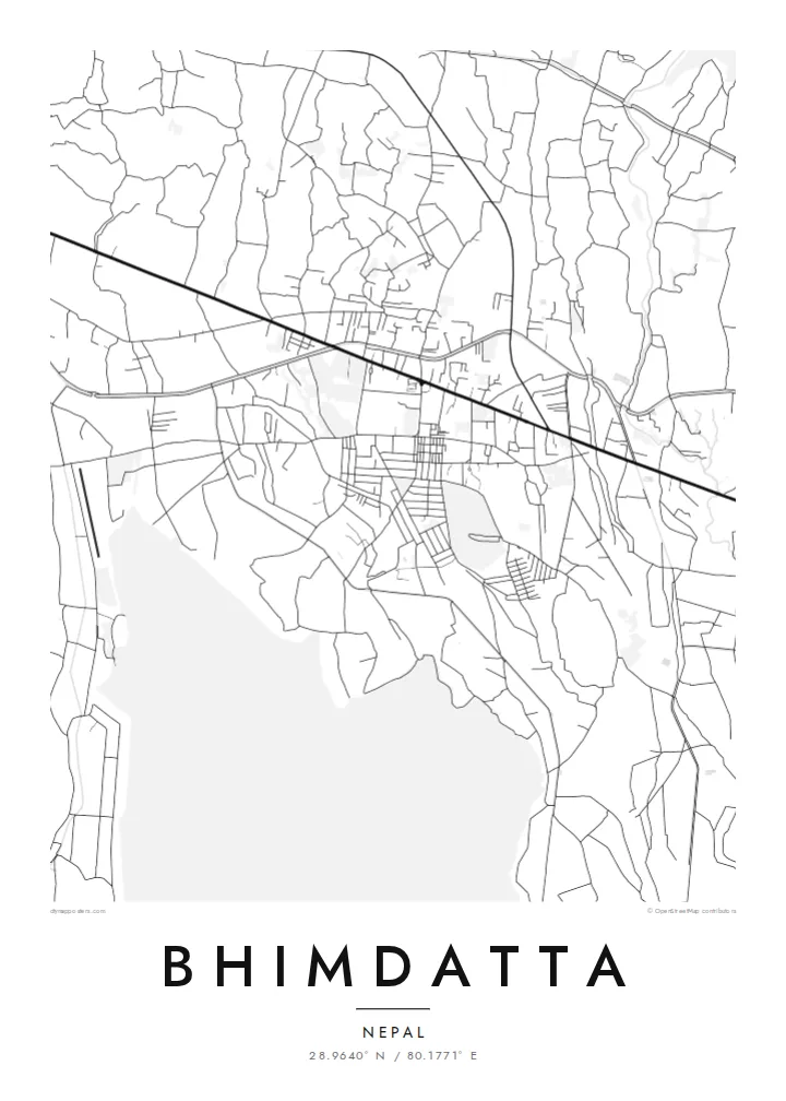
A flat Terai town at Nepal's far-western edge, set between the Mahakali River, forest reserves and the first ridges of hills.


Bitta shahar, besh kayfiyat
Devorda qanday ko'rinishini bilish uchun uslubni tanlang. Har bir uslub bir xil narxda — bosma, ramkali yoki HD fayl sifatida.
 Haqiqiy piksellar · 24 × 36″ bosma fayl
Bosmada tiniq
Bu haqiqiy bosma faylning 100% o'lchamdagi qismi. Har bir poster — bosma, ramkali yoki yuklab olinadigan — serverlarimizda 300 DPI sifatida, 7,200 × 10,800 pikselgacha render qilinadi, shuning uchun 24 × 36″ bosmada eng ingichka ko'chalar ham aniq ko'rinadi.
Devorda


Xarita
Bhimdatta, long known as Mahendranagar, is the main town of Kanchanpur District in Sudurpashchim Pradesh, in the far west of Nepal. It sits on the level plain of the Terai, close to the border with India. The flat ground shows on a map. Streets spread across open land without the switchbacks of hill towns, and the edges run out into fields, irrigation channels and patches of forest.
The Mahakali River, which marks this stretch of the border between Nepal and India, runs just west of the town. It sets the western limit of the map. Across it is the Indian town of Banbasa, and the crossing between them is one of the busiest in western Nepal. To the south lies Shuklaphanta National Park, a wide area of grassland and forest that appears on a Bhimdatta map poster as a large, quiet space.
The town was renamed in honour of Bhimdatta Panta, a twentieth-century activist remembered for his campaigns for farmers' rights in the far west. It is also near the western end of the Mahendra Highway, the east–west route that crosses the country's lowland belt. That road ties Bhimdatta to the rest of Nepal, so the town reads as a western terminus as well as a border town.
The broad braided river along the western edge forms the international border. Its channels and sandbars give the map a loose, shifting edge instead of a hard line.
The national park south of town is a large expanse of grassland and forest with almost no streets. On the poster it becomes a calm open area next to the urban blocks.
The Mahendra Highway reaches this corner of the country after crossing the lowlands from the east. On the map it is the long straight line that anchors the town.
Oʻzingizga moslang
Sana, ism yoki oʻz soʻzlaringizni qoʻshing, uslub, oʻlcham yoki yoʻnalishni oʻzgartiring.
Bepul ko'rinish past sifatli va suv belgili bo'ladi. Bosma va HD fayllar 300 DPI da, 7,200 × 10,800 px gacha, suv belgisisiz render qilinadi.
Nega aynan Bhimdatta
For people from Kanchanpur, or those who have crossed the border here or travelled Nepal's lowland highway to its western end, this map marks a real point of arrival. The flat plain, the river and the reserve make a clear, balanced composition on a wall.
You can edit the title, subtitle and coordinates, for example to use Mahendranagar, the older name, or a date that matters to you. Then pick one of five styles: Classic black and white, Noir, Paper, Blueprint or Sand.
Bhimdatta posterini buyurtma qiling| Bosma oʻlchami | Ruxsat | Fayllar |
|---|---|---|
| 30 × 40 cm11.8 × 15.7″ | 3,543 × 4,724 px | PNG · PDF |
| 29.7 × 42 cm (A3)11.7 × 16.5″ | 3,508 × 4,961 px | PNG · PDF |
| 42 × 59.4 cm (A2)16.5 × 23.4″ | 4,961 × 7,016 px | PNG · PDF |
| 45.7 × 61 cm18 × 24″ | 5,400 × 7,200 px | PNG · PDF |
| 50 × 70 cm19.7 × 27.6″ | 5,906 × 8,268 px | PNG · PDF |
| 61 × 91.4 cm24 × 36″ | 7,200 × 10,800 px | PNG · PDF |
Taqqoslash uchun: bepul namuna 900 px kenglikda, suv belgisi bilan va ekranlar uchun moʻljallangan. HD fayllarning aniqligi har bir yoʻnalishda 8 baravargacha yuqori va toʻliq poster oʻlchamida toza bosiladi.
Sahifa tepasida uslubni tanlang, so'ng Bosma Poster — o'lcham va xohlasangiz ramka — yoki Raqamli HD Fayllarni tanlang. To'lov bir bosqichda amalga oshadi, to'lov o'tishi bilan buyurtma sahifangiz yangilanadi.
U premium 200 gsm mat qog'ozda, oltita o'lchamdan birida — 30 × 40 sm dan 24 × 36″ gacha — chop etiladi. Bosma posterlar narxi $39 dan boshlanadi, yetkazib berish narxga kiritilgan.
Ha. Qora, oq, tabiiy eman yoki to'q rangdagi yog'ochdan yasalgan ramkani tanlang. U sinmaydigan shisha bilan birga keladi va osishga tayyor. Ramkali posterlar narxi $99 dan boshlanadi, yetkazib berish narxga kiritilgan.
60+ davlatga yetkazib berish bepul. Har bir poster 30+ davlatdagi chop etish hamkorlarimizdan eng yaqinida chop etiladi va odatda 3–7 ish kunida yetib boradi. Holat va kuzatuvni «Buyurtmalarim» bo‘limida kuzatishingiz mumkin. Ayrim davlatlarga 2–5 hafta ketadi, hali yetkazib bermaydigan joylar haqida esa sayt to‘lovdan oldin xabar beradi.
Yetkazib berilgandan keyin 14 kun ichida bizga rasmini yuboring — uni bepul qayta chop etamiz yoki pulingizni qaytaramiz.
Ha. Shu sahifadagi muharrirda sarlavha, kichik sarlavha va koordinatalar qatorini xohlagancha o'zgartiring hamda uslub va o'lchamni tanlang. Bosma, ramkali va raqamli buyurtmalarning barchasi aynan sizning dizayningizdan foydalanadi.
$9 evaziga siz suv belgisisiz, 300 DPI PNG va bosishga tayyor PDF fayllarni barcha oltita o'lchamda olasiz — istalgan joyda chop etishingiz mumkin. Hali ishonchingiz komil emasmi? Avval bepul, suv belgili ko'rinishni yuklab ko'ring.
Yaqin atrofda
