Misumi West Port
A carefully engineered Meiji-era harbour of cut stone, with canals and quays, lies near the tip of the peninsula. It is one of the few ports of its era to survive largely intact.
Minimalistik xarita posteri · Yaponiya
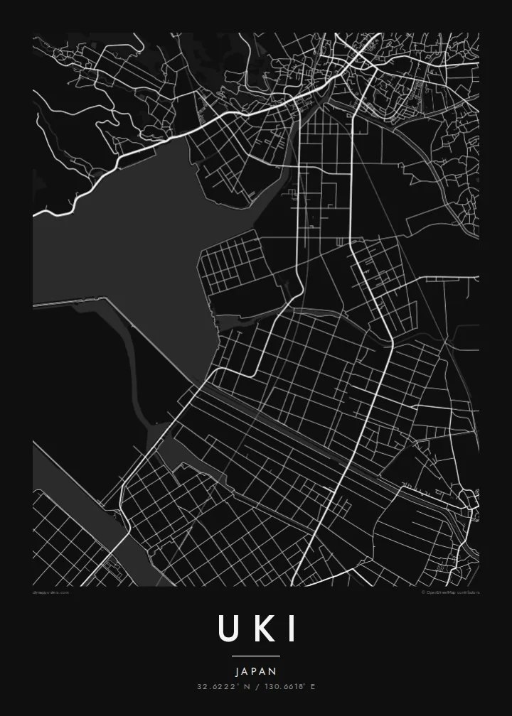
32.6222° N / 130.6618° E
A coastal city at the root of the Uto Peninsula, facing two inland seas with a Meiji-era stone port at its western tip.



Bitta shahar, besh kayfiyat
Devorda qanday ko'rinishini bilish uchun uslubni tanlang. Har bir uslub bir xil narxda — bosma, ramkali yoki HD fayl sifatida.
 Haqiqiy piksellar · 24 × 36″ bosma fayl
Bosmada tiniq
Bu haqiqiy bosma faylning 100% o'lchamdagi qismi. Har bir poster — bosma, ramkali yoki yuklab olinadigan — serverlarimizda 300 DPI sifatida, 7,200 × 10,800 pikselgacha render qilinadi, shuning uchun 24 × 36″ bosmada eng ingichka ko'chalar ham aniq ko'rinadi.
Devorda


Xarita
Uki sits in Kumamoto Prefecture at the base of the Uto Peninsula, which reaches west toward the Amakusa islands. On a map the city stretches along the peninsula. The Ariake Sea lies to the north and the Yatsushiro Sea to the south, and small towns and fishing harbours are strung along both shores. Hills run down the centre of the peninsula, with farmland and orchards on their lower slopes.
At the western end lies Misumi West Port, a stone harbour built in the late nineteenth century to Dutch designs. It is now a UNESCO World Heritage site as part of the Sites of Japan's Meiji Industrial Revolution. The Yatsushiro Sea off Uki's coast is also associated with the shiranui, a rare optical phenomenon of flickering lights on the water described in local tradition.
A Uki map poster traces a long, narrow city defined by its shorelines. Coastal roads follow the edge of the land, while a railway runs out along the peninsula toward the port. Smaller settlements appear as clusters where valleys meet the sea. The water surrounding almost every side gives the map a strong, clean silhouette.
A carefully engineered Meiji-era harbour of cut stone, with canals and quays, lies near the tip of the peninsula. It is one of the few ports of its era to survive largely intact.
The Ariake Sea and the Yatsushiro Sea border the city on opposite sides. On the map the peninsula becomes a long strip of land between two open bodies of water.
Hills run along the centre of the peninsula, with roads and small valleys branching toward the coasts. This inland ridge divides the city's northern and southern shores.
Oʻzingizga moslang
Sana, ism yoki oʻz soʻzlaringizni qoʻshing, uslub, oʻlcham yoki yoʻnalishni oʻzgartiring.
Bepul ko'rinish past sifatli va suv belgili bo'ladi. Bosma va HD fayllar 300 DPI da, 7,200 × 10,800 px gacha, suv belgisisiz render qilinadi.
Nega aynan Uki
Uki is a place of coastal drives, fishing harbours and evenings looking across the water toward Amakusa. A map of the peninsula keeps that geography in view for residents, for visitors and for anyone with family roots in Kumamoto.
Choose Classic black & white, Noir, Paper, Blueprint or Sand, and add your own title, subtitle and coordinates. The free preview lets you check the framing first. HD files cost $9, and printed posters can ship from partners in more than 30 countries.
Uki posterini buyurtma qiling| Bosma oʻlchami | Ruxsat | Fayllar |
|---|---|---|
| 30 × 40 cm (11.8 × 15.7″) | 3,543 × 4,724 px | PNG · PDF |
| 29.7 × 42 cm (A3, 11.7 × 16.5″) | 3,508 × 4,961 px | PNG · PDF |
| 42 × 59.4 cm (A2, 16.5 × 23.4″) | 4,961 × 7,016 px | PNG · PDF |
| 45.7 × 61 cm (18 × 24″) | 5,400 × 7,200 px | PNG · PDF |
| 50 × 70 cm (19.7 × 27.6″) | 5,906 × 8,268 px | PNG · PDF |
| 61 × 91.4 cm (24 × 36″) | 7,200 × 10,800 px | PNG · PDF |
Taqqoslash uchun: bepul namuna 900 px kenglikda, suv belgisi bilan va ekranlar uchun moʻljallangan. HD fayllarning aniqligi har bir yoʻnalishda 8 baravargacha yuqori va toʻliq poster oʻlchamida toza bosiladi.
Sahifa tepasida uslubni tanlang, so'ng Bosma Poster — o'lcham va xohlasangiz ramka — yoki Raqamli HD Fayllarni tanlang. To'lov bir bosqichda amalga oshadi, to'lov o'tishi bilan buyurtma sahifangiz yangilanadi.
U premium 200 gsm mat qog'ozda, oltita o'lchamdan birida — 30 × 40 sm dan 24 × 36″ gacha — chop etiladi. Bosma posterlar narxi $39 dan boshlanadi, yetkazib berish narxga kiritilgan.
Ha. Qora, oq, tabiiy eman yoki to'q rangdagi yog'ochdan yasalgan ramkani tanlang. U sinmaydigan shisha bilan birga keladi va osishga tayyor. Ramkali posterlar narxi $99 dan boshlanadi, yetkazib berish narxga kiritilgan.
Yetkazib berish butun dunyo bo'ylab bepul. Har bir poster 30 dan ortiq davlatdagi hamkor bosmaxonalarning sizga eng yaqinida chop etiladi va odatda 3–7 ish kunida yetib boradi. Buyurtma holati va kuzatuv raqamini «Buyurtmalarim» bo'limida ko'rishingiz mumkin. Ba'zi davlatlarga yetkazish 2–5 hafta oladi, hozircha yetkazib bera olmaydigan joylar haqida esa sayt to'lovdan oldin ogohlantiradi.
Yetkazib berilgandan keyin 14 kun ichida bizga rasmini yuboring — uni bepul qayta chop etamiz yoki pulingizni qaytaramiz.
Ha. Shu sahifadagi muharrirda sarlavha, kichik sarlavha va koordinatalar qatorini xohlagancha o'zgartiring hamda uslub va o'lchamni tanlang. Bosma, ramkali va raqamli buyurtmalarning barchasi aynan sizning dizayningizdan foydalanadi.
$9 evaziga siz suv belgisisiz, 300 DPI PNG va bosishga tayyor PDF fayllarni barcha oltita o'lchamda olasiz — istalgan joyda chop etishingiz mumkin. Hali ishonchingiz komil emasmi? Avval bepul, suv belgili ko'rinishni yuklab ko'ring.
Yaqin atrofda
