Connaught Place
A circular commercial centre built as concentric rings of colonnaded buildings, with roads radiating outward. It is one of the most recognisable geometric shapes in the city.
Ata mapa faigafua · India
28.6519° N / 77.2315° E
A river city of layered capitals, from the walled lanes of Shahjahanabad to the radial avenues of New Delhi


Kolo e tahi, lanu e nima
Tuki he sitaili ke sio ai ʻi te holo. ʻE tatau pē te totogi ʻo te sitaili fuli pē — mokā tā, fakakātoa, peʻe ko he ʻu faila HD.
 Ngaahi pikiseli moʻoni · faila tā 24 × 36″
Mahino lelei ki te pulūti
Ko he konga 100% ʻo te faila tā moʻoni ʻaeni. Ko te ʻu posita fuli pē — mokā tā, fakakātoa peʻe download — ʻe fakatupu ʻi ʻomātou seva ʻi te 300 DPI, aʻu ki te 7,200 × 10,800 pikiseli, koia ʻe nofo mahino ai te ʻu ala liliki ʻi he tā 24 × 36″.
ʻI Te Puipui


Te mapa
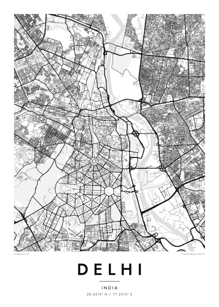
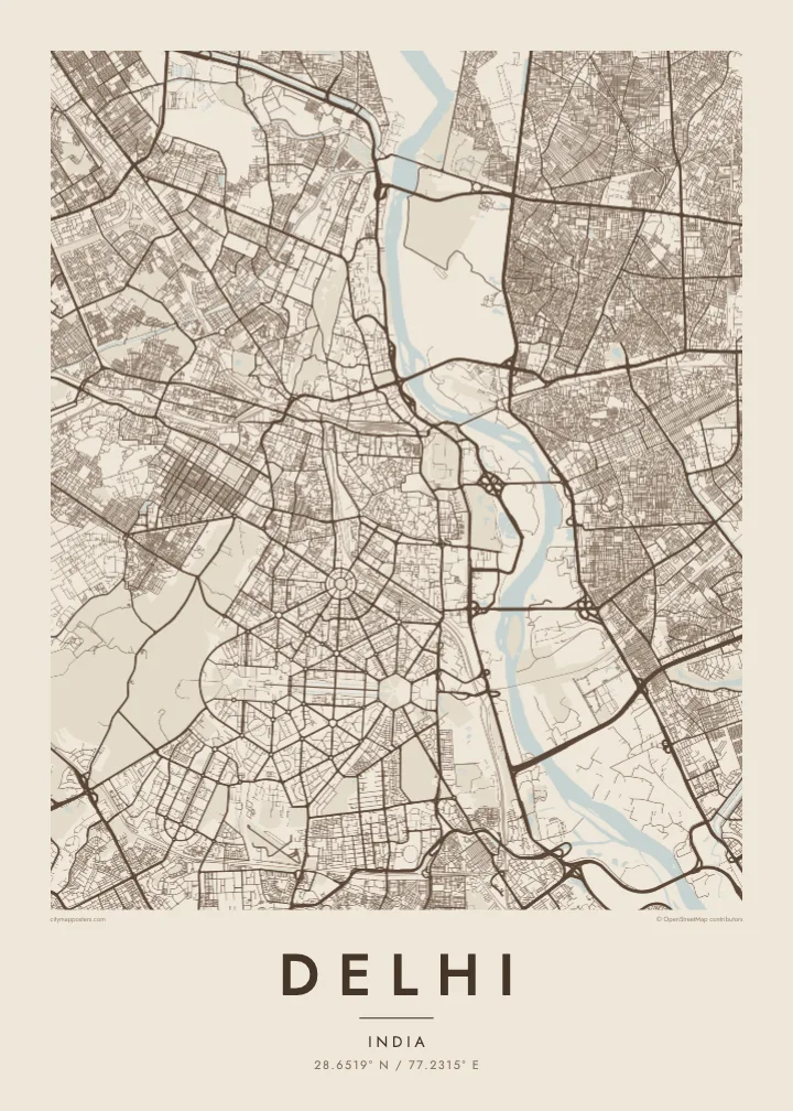
Delhi spreads mainly along the western bank of the Yamuna River, with the forested Ridge, an old extension of the Aravalli hills, running through it from north to south. The city is built in layers, each capital placed beside the last, so the map shows distinct patterns side by side: medieval ruins to the south, the Mughal walled city to the north, and the ordered avenues of New Delhi in between.
Shahjahanabad, now Old Delhi, is a dense web of lanes around the Red Fort and the Jama Masjid, with Chandni Chowk running straight through it. To the south, New Delhi was laid out in the 1910s and 1920s with broad tree-lined avenues, roundabouts and hexagonal blocks. Connaught Place forms a set of concentric circles, and Kartavya Path runs east from Rashtrapati Bhavan to India Gate.
Three UNESCO World Heritage Sites lie within the city: the Red Fort Complex, Humayun’s Tomb and the Qutb Minar with its monuments. A Delhi map poster brings together the contrasts between these eras, the organic lanes of Old Delhi and the formal geometry of the colonial capital, framed by the Ring Road and the Yamuna.
A circular commercial centre built as concentric rings of colonnaded buildings, with roads radiating outward. It is one of the most recognisable geometric shapes in the city.
The ceremonial avenue, formerly Rajpath, runs in a straight line between Rashtrapati Bhavan and India Gate, flanked by lawns and water channels, forming the central axis of New Delhi.
Around the Red Fort and Chandni Chowk, a tight network of lanes and bazaars fills the former walled city, creating the finest, densest texture anywhere on the map.
Faʻu ke ʻau ʻa ʻau
Tuku he ʻaho, he hingoa peʻe he kiʻi palalau ʻa ʻau, fetogi te faʻahiga, te lahi peʻe te hake.
Ko te faʻata fua noa ʻe māʻulalo hono lelei pea ʻe ʻi ai he fakaʻilonga. Ko te ʻu tā mo te ʻu faila HD ʻe fakatupu ʻi te 300 DPI, aʻu ki te 7,200 × 10,800 px, ʻe mole ʻi ai he fakaʻilonga.
Koteā ko Delhi
Delhi is a city of neighbourhoods and memories: a family house in Old Delhi, college years on the North Campus, a first flat somewhere in the south. A map poster keeps those places in one frame and shows how they connect.
Title it Delhi, New Delhi or the name of your colony, and add a subtitle with a date or a message. Edit the coordinates line as you like, and choose from Classic black & white, Noir, Paper, Blueprint and Sand in any of six print sizes.
Fakatau te posita Delhi| Lahi ʻo te pulūti | Mahino | Faile |
|---|---|---|
| 30 × 40 cm11.8 × 15.7″ | 3,543 × 4,724 px | PNG · PDF |
| 29.7 × 42 cm (A3)11.7 × 16.5″ | 3,508 × 4,961 px | PNG · PDF |
| 42 × 59.4 cm (A2)16.5 × 23.4″ | 4,961 × 7,016 px | PNG · PDF |
| 45.7 × 61 cm18 × 24″ | 5,400 × 7,200 px | PNG · PDF |
| 50 × 70 cm19.7 × 27.6″ | 5,906 × 8,268 px | PNG · PDF |
| 61 × 91.4 cm24 × 36″ | 7,200 × 10,800 px | PNG · PDF |
Ko te ata ʻe mole totogi ʻe 900 px tona laulahi, mo te fakaʻilonga, ki te sioʻata pē. Ko te ʻu faile HD ʻe aʻu ki te liuga 8 tona mahino, pea ʻe pulūti lelei ʻi te lahi kātoa.
Fili he sitaili ʻi te tuʻa ʻo te pasina, pea fili leva te Posita Tā — he lahi pea, kapau ʻe ke loto ai, he fakakātoa — peʻe ko te ʻu Faila HD Fakakomipiuta. ʻE tahi pē te sitepu ʻo te totogi, pea ʻe fakafou fakavavevave pē tau pasina fakatau mai te taimi ʻe fai ai te totogi.
ʻE tā ʻi he pepa lelei ʻaupito 200 gsm matte, ʻi he tahi ʻo te ono lahi, mai te 30 × 40 cm ki te 24 × 36″. ʻE kamata te ʻu posita tā ʻi te $39, kātoa mo te ʻave.
ʻIo. Fili he fakakātoa ʻakau moʻoni ʻi te kili, hinahina, ʻakau natula peʻe ʻakau ʻuliʻuli. ʻE ʻi ai mo he sioga mālohi ʻe mole mafesi, pea kua teu ke tautau. ʻE kamata te ʻu posita fakakātoa ʻi te $99, kātoa mo te ʻave.
Ko te fakahoko e mole totogi ki te ʼu fenua e 60+. Ko te pōsita taki taha ʼe tā e te tahi ʼo ʼemau ʼu kaufakalogo tā ʼe ofi mai, ʼi te ʼu fenua e 30+, pea ʼe hoko mai ʼi te ʼu ʼaho gaue e 3–7. ʼE feala hau ke ke vakaʼi te tuʼunga mo te tracking ʼi Oku Fakamaʼu. ʼE ʼi ai te ʼu fenua ʼe 2–5 te ʼu vaiaho, pea ʼi te ʼu fenua ʼaē ʼe heʼeki tou fakahoko ki ai, ʼe fakahā e te saite ʼi muʼa ʼo tau totogi.
Fekau mai he ʻata ʻi loto ʻi te ʻaho e 14 talu mai te aʻu mai, pea mātou toe tā noa peʻe toe totogi atu.
ʻIo. ʻI te meʻa fakatonutonu ʻi te pasina ʻaeni, fetogi te kupu tāfito, te kupu lalo pea mo te laina koʻoliteti ki he meʻa fuli pē ʻe ke loto ai, pea fili he sitaili mo he lahi. Ko te ʻu fakatau tā, fakakātoa mo fakakomipiuta ʻe fakaʻaogaʻi katoa pē tou fakatātā.
Mo te $9 ʻe ke maʻu ai te ʻu faila PNG 300 DPI mo PDF kua teu ke tā, ʻi te ono lahi kātoa, ʻe mole ʻi ai he fakaʻilonga, ke ke tā ai ʻi soʻo he potu. Kei tā fakafiafia? Download muʻa he faʻata mokā mo he fakaʻilonga, ʻe fua noa.
