Cerro de las Pavas
The wooded hill beside the town, topped by a Marian shrine, appears as an open patch of green with roads winding up its slopes.
极简地图海报 · 萨尔瓦多
13.7197° N / 88.9331° W
A hill town east of San Salvador, its grid tilting down from Cerro de las Pavas toward the Pan-American Highway


一座城市,五种风格
点击任意风格,即可预览上墙效果。所有风格价格相同——无论是印刷版、装框版还是高清文件。
 实际像素 · 24 × 36″ 印刷文件
印刷级清晰
这是真实印刷文件的 100% 局部放大图。每张海报——无论是印刷、装框还是下载——都在我们的服务器上以 300 DPI、最高 7,200 × 10,800 像素渲染,即使是最细的街道,在 24 × 36″ 的印刷品上依然清晰锐利。
上墙效果

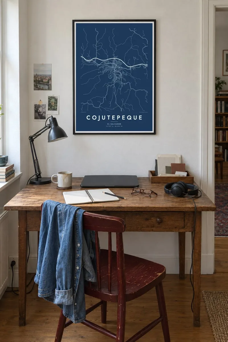

关于地图
Cojutepeque, the capital of Cuscatlán department in El Salvador, is built on uneven ground east of San Salvador. Its central grid, typical of Spanish colonial towns, is laid across slopes, so the blocks bend and shift where the land rises and falls. The Pan-American Highway runs along the town's edge and links it to the capital.
On the edge of town is Cerro de las Pavas, a wooded hill with a shrine dedicated to the Virgin of Fátima that attracts pilgrims. On a map, the hill forms a quiet open space next to the busy streets, and the roads curve around its slopes.
The town is well known across El Salvador for its chorizos, sold in the markets and along the roads. A Cojutepeque map poster shows a place defined by its hills: a grid that adapts to the terrain, a sacred hill beside it and a main road leading west.
The wooded hill beside the town, topped by a Marian shrine, appears as an open patch of green with roads winding up its slopes.
The colonial street grid stretches over uneven ground, so its blocks are slightly irregular, giving the centre a lively, hand-drawn quality.
The highway passes along the edge of town, a clear line connecting Cojutepeque to San Salvador and the east of the country.
专属定制
添加日期、名字或一句自己的话,还可切换风格、尺寸或方向。
免费预览为低分辨率并带水印。印刷品和高清文件均以 300 DPI、最高 7,200 × 10,800 px 渲染,且不带水印。
为什么选Cojutepeque
Cojutepeque means a lot to people who grew up there and to the many Salvadorans who live abroad. A map of its hilly streets is a meaningful gift and a calm, graphic piece for any room.
Personalise the title, add a subtitle with a date or dedication, and set the coordinates. Choose from Classic black & white, Noir, Paper, Blueprint and Sand. Get the $9 HD files in six sizes or a printed poster, framed in wood if you prefer.
订购 Cojutepeque 海报| 印刷尺寸 | 分辨率 | 文件 |
|---|---|---|
| 30 × 40 cm11.8 × 15.7″ | 3,543 × 4,724 px | PNG · PDF |
| 29.7 × 42 cm (A3)11.7 × 16.5″ | 3,508 × 4,961 px | PNG · PDF |
| 42 × 59.4 cm (A2)16.5 × 23.4″ | 4,961 × 7,016 px | PNG · PDF |
| 45.7 × 61 cm18 × 24″ | 5,400 × 7,200 px | PNG · PDF |
| 50 × 70 cm19.7 × 27.6″ | 5,906 × 8,268 px | PNG · PDF |
| 61 × 91.4 cm24 × 36″ | 7,200 × 10,800 px | PNG · PDF |
作为对比,免费预览图宽 900 px,带水印,仅适合屏幕查看。HD 文件在长宽方向上的分辨率最高可达其 8 倍,按完整海报尺寸印刷依然清晰。
在页面顶部选择一种风格,然后选择印刷海报——尺寸,如果需要还可以选装框——或者数字高清文件。结账只需一步,付款完成后订单页面会立即更新。
采用 200 克优质哑光纸印刷,共六种尺寸可选,从 30 × 40 cm 到 24 × 36″。印刷海报起价 $39,包邮。
可以。可选黑色、白色、原木色或深色实木相框,配防碎玻璃,开箱即挂。装框海报起价 $99,包邮。
免运费配送至 60 多个国家。每张海报由我们在 30 多个国家的合作印刷商中距离您最近的一家印制,通常 3–7 个工作日送达。您可以在“我的订单”中查看订单状态和物流跟踪。少数国家需要 2–5 周;如果暂不支持配送到您所在的地区,网站会在付款前告知您。
请在收货后 14 天内发送照片给我们,我们将免费为您重印或退款。
可以。在本页的编辑器中,可随意修改标题、副标题和坐标行,并选择风格和尺寸。印刷、装框和数字版订单都会完全按照您的设计制作。
只需 $9,即可获得全部六种尺寸的 300 DPI PNG 和适合印刷的 PDF 文件,无水印,可随意打印。还不确定?可以先下载带水印的免费预览版。
