Sultanate quarter
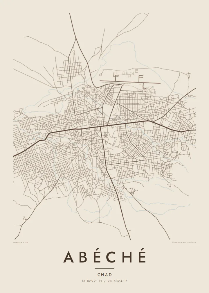
The historic heart of the Ouaddaï capital, with an irregular web of lanes around the old palace and mosque sites. It is the densest, least geometric part of the map.
Qeeqabak kaartah poster · Chad
13.8292° N / 20.8324° E
A low, sprawling Sahelian town of sandy lanes and walled compounds, crossed by seasonal wadis on the eastern Chadian plain


Inki magaala, konoy gaba
Qande inkih tibbixeeh derre baguley table. Kulli qande missoowa caagid—daabbisimta, dirbaabu-le kaadu HD fayla akah.
 Cagalah pixels · 24 × 36″ daabbi fayla
Maxxaacah qeeqa
Tama usuk cagalah daabbi faylak 100% qambaala. Kulli poster — daabbisimta, dirbaabu-le kaadu download geytimta — ni-server-ittal 300 DPI-l ederimta, 7,200 × 10,800 pixels fanah, tokkel iyyi ellee catoy 24 × 36″ daabbi baxsi bahisak raaqu.
Gidarih


Kaarta
Abéché is the main city of eastern Chad and the capital of Ouaddaï province. It stands on a dry plain far from the sea, and on a map it spreads out loosely rather than climbing upward. Lanes run between walled family compounds, and a handful of wider roads head out toward the rest of the region. Sandy wadis flow here only after the rains.
The town has a long political history. In the mid-nineteenth century it became the capital of the Ouaddaï Sultanate, one of the powerful Sahelian states of the region, and remains of the sultans' residence and old mosques still stand in the historic core. More recently Abéché has served as a logistics base for humanitarian operations in eastern Chad.
An Abéché map poster shows a city that does not follow a strict grid. The oldest quarters are made of irregular blocks, while the newer districts sit in looser rectangles farther out. The airport runway forms a clean, straight line on the edge. The result is an honest picture of a desert-edge town whose shape comes from climate, trade routes and centuries of regional power.
The historic heart of the Ouaddaï capital, with an irregular web of lanes around the old palace and mosque sites. It is the densest, least geometric part of the map.
Dry riverbeds wind through and around the town. They are drawn as soft, meandering bands that carry water only briefly during the rainy season.
A long, straight runway sits beside the built-up area. Its hard geometry contrasts with the organic street pattern and acts as a strong graphic anchor.
Kok tanim ab
Ayro, migaq hinnay kok tan xagar osis; gaba, ballaqa hinnay xiqa soorris.
Free preview qansarissi kee watermark-le. Daabbisimtaan kee HD fayla 300 DPI-l, 7,200 × 10,800 px fanah, watermark maleh ederimta.
Macah Abéché
Abéché is a place people carry with them: aid workers, researchers and families from Ouaddaï often have a lasting tie to it. A map poster keeps that connection in a calm, understated form that works in almost any room.
Add a personal title, the years you spent there or the coordinates, and choose from Classic black & white, Noir, Paper, Blueprint or Sand. Sand and Paper suit the dry, earthen character of the city especially well.
Abéché poster orme| Maxxaacah ballaqa | Qeeqa | Faylal |
|---|---|---|
| 30 × 40 cm (11.8 × 15.7″) | 3,543 × 4,724 px | PNG · PDF |
| 29.7 × 42 cm (A3, 11.7 × 16.5″) | 3,508 × 4,961 px | PNG · PDF |
| 42 × 59.4 cm (A2, 16.5 × 23.4″) | 4,961 × 7,016 px | PNG · PDF |
| 45.7 × 61 cm (18 × 24″) | 5,400 × 7,200 px | PNG · PDF |
| 50 × 70 cm (19.7 × 27.6″) | 5,906 × 8,268 px | PNG · PDF |
| 61 × 91.4 cm (24 × 36″) | 7,200 × 10,800 px | PNG · PDF |
Tabbaltah, limo-wayta xaqqa-le ablo 900 px ballaqa le, asta le, iskiriinih keh tan. HD faylal gexsoh inkih addal 8× fanah qeeqa le, poster ballaqa inkih addal meqeh maxxaacimta.
Baxxaqqa qari le qandiy dooriy, tohuk lakal Daabbisimtah Poster — kutuk kee, faxximek, dirbaabu — hinnay HD Digital Fayla dooru. Checkout inki wagitti geytima, kaadu ku-orme page keenih adissa akke waqdi caagoy kummite.
Usuk 200 gsm-le catam kutuk warqatal, lica katiy caagitte {printFrom}-ik hane ayta 30 × 40 cm-ik 24 × 36″ fanah, xaagu keenil warreeh.
Ee. Sarrah-le dirbaabu doori — bad, gudduc, oak-le hinnay bad-madabuy. Usuk finqisiimam ellee sange qarab-le kaadu qari umukku iyya keenih taagu. Dirbaabu-le poster {framedFrom}-ik hane, xaagu keenil warreeh.
Shipping is free worldwide. Each poster is printed by the nearest of our print partners in 30+ countries and usually arrives in 3–7 business days. You can follow the status and tracking under My Orders. A few countries take 2–5 weeks, and where we don't ship yet, the site tells you before you pay.
Geytimeek 14 ayróy addal foto naah rubbaay, cisab-le daabbisiynah hinnay ku-lacay gacisnaah.
Ee. Tama page-l edito addal, migaaq, subtitle kee coordinates sarrah faxxem fanah badal, kaadu qande kee katiy doori. Daabbisimtah, dirbaabu-le kaadu digital orme inkih ku-design cagalah yekkelen.
$9 bacisak 300 DPI PNG kee daabbisimtah adissime PDF fayla lica katiy inkih, watermark maleh, ayyi meki daabbisimtah geeytitta. Cisab makkoysemty ana? Awqak, watermark-le free preview download-eh.
