Abhar River
The river runs through the valley, with gardens and orchards along its banks. It forms the one irregular, natural line through the city.
Qeeqabak kaartah poster · Iran
36.1468° N / 49.2180° E
A city on the high plateau of northwestern Iran, along the Abhar River and the corridor between Qazvin and Zanjan.


Inki magaala, konoy gaba
Qande inkih tibbixeeh derre baguley table. Kulli qande missoowa caagid—daabbisimta, dirbaabu-le kaadu HD fayla akah.
 Cagalah pixels · 24 × 36″ daabbi fayla
Maxxaacah qeeqa
Tama usuk cagalah daabbi faylak 100% qambaala. Kulli poster — daabbisimta, dirbaabu-le kaadu download geytimta — ni-server-ittal 300 DPI-l ederimta, 7,200 × 10,800 pixels fanah, tokkel iyyi ellee catoy 24 × 36″ daabbi baxsi bahisak raaqu.
Gidarih


Kaarta
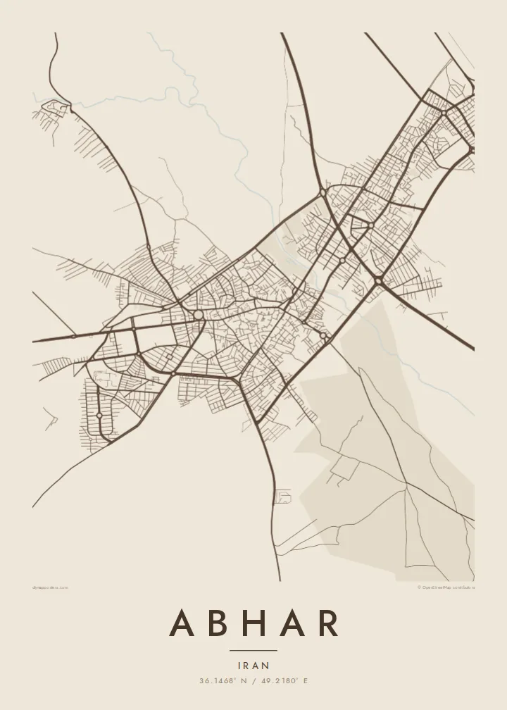
Abhar lies in Zanjan province in northwestern Iran, on a high plateau between mountain ranges. It sits on the long transport corridor that links Tehran and Qazvin with Zanjan and Tabriz, and both the highway and the railway pass nearby. From above, the city is a dense core of streets with newer districts spread out along the main roads.
The Abhar River, the Abharrud, runs through the valley and gives the city its name. Its course and the gardens and orchards along it form a green band that contrasts with the drier land around. The valley is bounded by mountains, which leaves empty terrain at the edges of the map and emphasises the long, linear shape of the settlement.
An Abhar map poster shows a city defined by its route: a river valley that has carried travellers across the plateau for centuries. The domed mausoleum of Soltaniyeh, a UNESCO World Heritage site, stands along the same corridor in Zanjan province. For people from Abhar living in Tehran or abroad, the poster is a quiet, exact picture of home.
The river runs through the valley, with gardens and orchards along its banks. It forms the one irregular, natural line through the city.
The highway and railway between Qazvin and Zanjan pass along the valley, drawing long, parallel lines across the map.
Mountain ranges enclose the valley on both sides. Streets end where the slopes begin, which gives the city a clearly elongated outline.
Kok tanim ab
Ayro, migaq hinnay kok tan xagar osis; gaba, ballaqa hinnay xiqa soorris.
Free preview qansarissi kee watermark-le. Daabbisimtaan kee HD fayla 300 DPI-l, 7,200 × 10,800 px fanah, watermark maleh ederimta.
Macah Abhar
People hang this map to stay close to Abhar, whether they moved to Tehran for work or live far outside Iran. The linear valley shape is distinctive and easy to recognise, even for those who have not been back in years.
Personalise the title, subtitle and coordinates, including the name in Persian script. Choose Classic black & white, Noir, Paper, Blueprint or Sand. The $9 digital files cover six sizes as 300 DPI PNG and PDF, and matte printed posters are also available.
Abhar poster orme| Maxxaacah ballaqa | Qeeqa | Faylal |
|---|---|---|
| 30 × 40 cm (11.8 × 15.7″) | 3,543 × 4,724 px | PNG · PDF |
| 29.7 × 42 cm (A3, 11.7 × 16.5″) | 3,508 × 4,961 px | PNG · PDF |
| 42 × 59.4 cm (A2, 16.5 × 23.4″) | 4,961 × 7,016 px | PNG · PDF |
| 45.7 × 61 cm (18 × 24″) | 5,400 × 7,200 px | PNG · PDF |
| 50 × 70 cm (19.7 × 27.6″) | 5,906 × 8,268 px | PNG · PDF |
| 61 × 91.4 cm (24 × 36″) | 7,200 × 10,800 px | PNG · PDF |
Tabbaltah, limo-wayta xaqqa-le ablo 900 px ballaqa le, asta le, iskiriinih keh tan. HD faylal gexsoh inkih addal 8× fanah qeeqa le, poster ballaqa inkih addal meqeh maxxaacimta.
Baxxaqqa qari le qandiy dooriy, tohuk lakal Daabbisimtah Poster — kutuk kee, faxximek, dirbaabu — hinnay HD Digital Fayla dooru. Checkout inki wagitti geytima, kaadu ku-orme page keenih adissa akke waqdi caagoy kummite.
Usuk 200 gsm-le catam kutuk warqatal, lica katiy caagitte {printFrom}-ik hane ayta 30 × 40 cm-ik 24 × 36″ fanah, xaagu keenil warreeh.
Ee. Sarrah-le dirbaabu doori — bad, gudduc, oak-le hinnay bad-madabuy. Usuk finqisiimam ellee sange qarab-le kaadu qari umukku iyya keenih taagu. Dirbaabu-le poster {framedFrom}-ik hane, xaagu keenil warreeh.
Xaagu addunyal inkih cisab-le. Kulli poster 30+ ummattak ni-daabbi-mara mananih xayyoysa kaadu 3–7 caagu-ayróh fanah geeytima. Ku-orme kee xaagu tarikiy My Orders addal ablitta.
Geytimeek 14 ayróy addal foto naah rubbaay, cisab-le daabbisiynah hinnay ku-lacay gacisnaah.
Ee. Tama page-l edito addal, migaaq, subtitle kee coordinates sarrah faxxem fanah badal, kaadu qande kee katiy doori. Daabbisimtah, dirbaabu-le kaadu digital orme inkih ku-design cagalah yekkelen.
$9 bacisak 300 DPI PNG kee daabbisimtah adissime PDF fayla lica katiy inkih, watermark maleh, ayyi meki daabbisimtah geeytitta. Cisab makkoysemty ana? Awqak, watermark-le free preview download-eh.
