Kiir River
The river, also called Bahr el-Arab, runs across the plain south of the town. It is central to grazing, farming and seasonal movement throughout the region.
Qeeqabak kaartah poster · Sudan
9.5953° N / 28.4349° E
A town on the flat, seasonally flooded plains between Sudan and South Sudan, near the river the region depends on


Inki magaala, konoy gaba
Qande inkih tibbixeeh derre baguley table. Kulli qande missoowa caagid—daabbisimta, dirbaabu-le kaadu HD fayla akah.
 Cagalah pixels · 24 × 36″ daabbi fayla
Maxxaacah qeeqa
Tama usuk cagalah daabbi faylak 100% qambaala. Kulli poster — daabbisimta, dirbaabu-le kaadu download geytimta — ni-server-ittal 300 DPI-l ederimta, 7,200 × 10,800 pixels fanah, tokkel iyyi ellee catoy 24 × 36″ daabbi baxsi bahisak raaqu.
Gidarih


Kaarta
Abyei lies in a flat savannah region on the border between Sudan and South Sudan, and it is known internationally for the unresolved question of which country it belongs to. The area has its own special administrative status, and a United Nations peacekeeping force has been stationed there since 2011. It is home to the Ngok Dinka, and Misseriya herders move through it seasonally with their cattle.
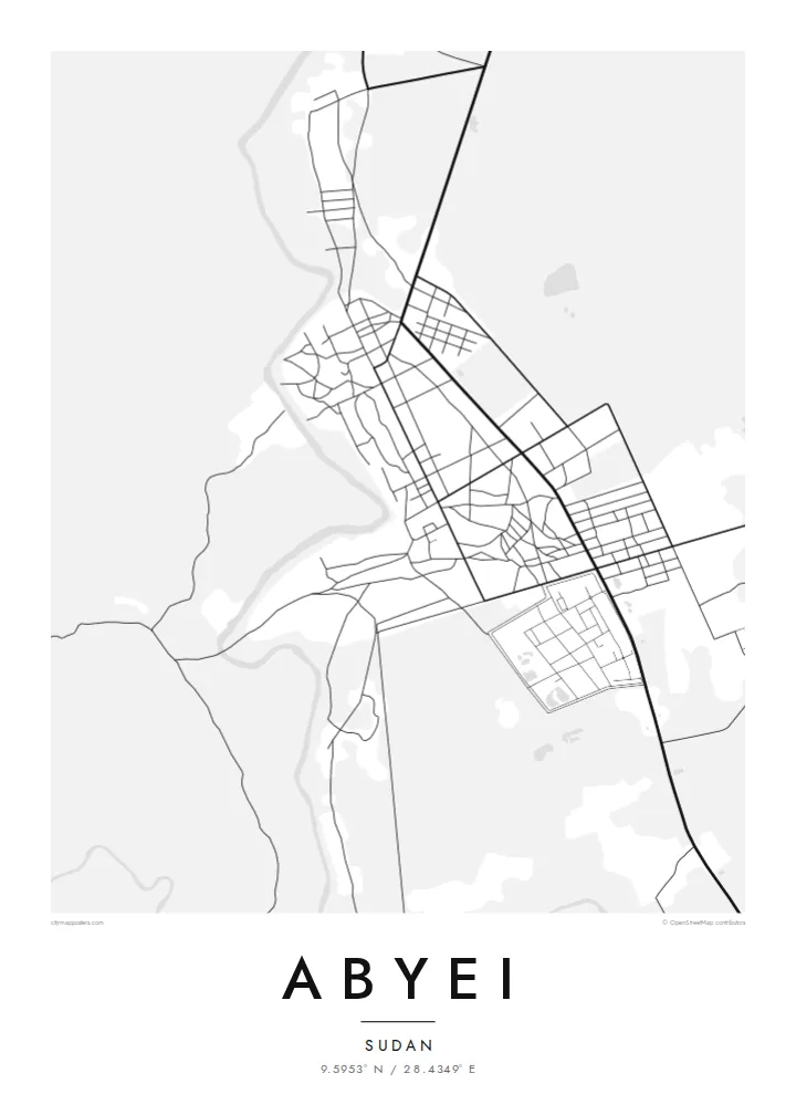
On a map, the landscape is almost entirely level. The Kiir River, also called the Bahr el-Arab, crosses the region to the south of the town, and seasonal watercourses and low-lying wetlands spread across the plain in the rainy months. The town is a compact cluster of streets and compounds, with tracks leading outward across open country.
An Abyei map poster doesn't claim to settle anything. It records a place that many people call home and that others know only from the news: a town, its roads and the waterways that shape life around it. For people from Abyei, for aid workers and for peacekeepers who have served there, the map holds a personal meaning that goes beyond politics.
The river, also called Bahr el-Arab, runs across the plain south of the town. It is central to grazing, farming and seasonal movement throughout the region.
Abyei itself appears as a tight group of streets and compounds. It stands out sharply against the large, open country around it.
Unpaved routes lead away from the town in several directions. They connect it to villages, grazing lands and the wider region.
Kok tanim ab
Ayro, migaq hinnay kok tan xagar osis; gaba, ballaqa hinnay xiqa soorris.
Free preview qansarissi kee watermark-le. Daabbisimtaan kee HD fayla 300 DPI-l, 7,200 × 10,800 px fanah, watermark maleh ederimta.
Macah Abyei
For people from Abyei living elsewhere, and for those who have worked or served there, this map is a way of keeping the place in view on its own terms: as streets, a river and a home, not a headline.
Write the title and subtitle as you see fit, including a name, a date or a dedication, and edit the coordinates line. Choose from Classic black & white, Noir, Paper, Blueprint and Sand. Sand suits the savannah.
Abyei poster orme| Maxxaacah ballaqa | Qeeqa | Faylal |
|---|---|---|
| 30 × 40 cm (11.8 × 15.7″) | 3,543 × 4,724 px | PNG · PDF |
| 29.7 × 42 cm (A3, 11.7 × 16.5″) | 3,508 × 4,961 px | PNG · PDF |
| 42 × 59.4 cm (A2, 16.5 × 23.4″) | 4,961 × 7,016 px | PNG · PDF |
| 45.7 × 61 cm (18 × 24″) | 5,400 × 7,200 px | PNG · PDF |
| 50 × 70 cm (19.7 × 27.6″) | 5,906 × 8,268 px | PNG · PDF |
| 61 × 91.4 cm (24 × 36″) | 7,200 × 10,800 px | PNG · PDF |
Tabbaltah, limo-wayta xaqqa-le ablo 900 px ballaqa le, asta le, iskiriinih keh tan. HD faylal gexsoh inkih addal 8× fanah qeeqa le, poster ballaqa inkih addal meqeh maxxaacimta.
Baxxaqqa qari le qandiy dooriy, tohuk lakal Daabbisimtah Poster — kutuk kee, faxximek, dirbaabu — hinnay HD Digital Fayla dooru. Checkout inki wagitti geytima, kaadu ku-orme page keenih adissa akke waqdi caagoy kummite.
Usuk 200 gsm-le catam kutuk warqatal, lica katiy caagitte {printFrom}-ik hane ayta 30 × 40 cm-ik 24 × 36″ fanah, xaagu keenil warreeh.
Ee. Sarrah-le dirbaabu doori — bad, gudduc, oak-le hinnay bad-madabuy. Usuk finqisiimam ellee sange qarab-le kaadu qari umukku iyya keenih taagu. Dirbaabu-le poster {framedFrom}-ik hane, xaagu keenil warreeh.
Xaagu addunyal inkih cisab-le. Kulli poster 30+ ummattak ni-daabbi-mara mananih xayyoysa kaadu 3–7 caagu-ayróh fanah geeytima. Ku-orme kee xaagu tarikiy My Orders addal ablitta.
Geytimeek 14 ayróy addal foto naah rubbaay, cisab-le daabbisiynah hinnay ku-lacay gacisnaah.
Ee. Tama page-l edito addal, migaaq, subtitle kee coordinates sarrah faxxem fanah badal, kaadu qande kee katiy doori. Daabbisimtah, dirbaabu-le kaadu digital orme inkih ku-design cagalah yekkelen.
$9 bacisak 300 DPI PNG kee daabbisimtah adissime PDF fayla lica katiy inkih, watermark maleh, ayyi meki daabbisimtah geeytitta. Cisab makkoysemty ana? Awqak, watermark-le free preview download-eh.
Xayyo
