Aegina harbour
The main port on the west coast, where ferries from Piraeus arrive. The town's streets fan out behind the waterfront, the most detailed part of a map otherwise made of country roads.
Qeeqabak kaartah poster · Greece
37.7243° N / 23.4914° E
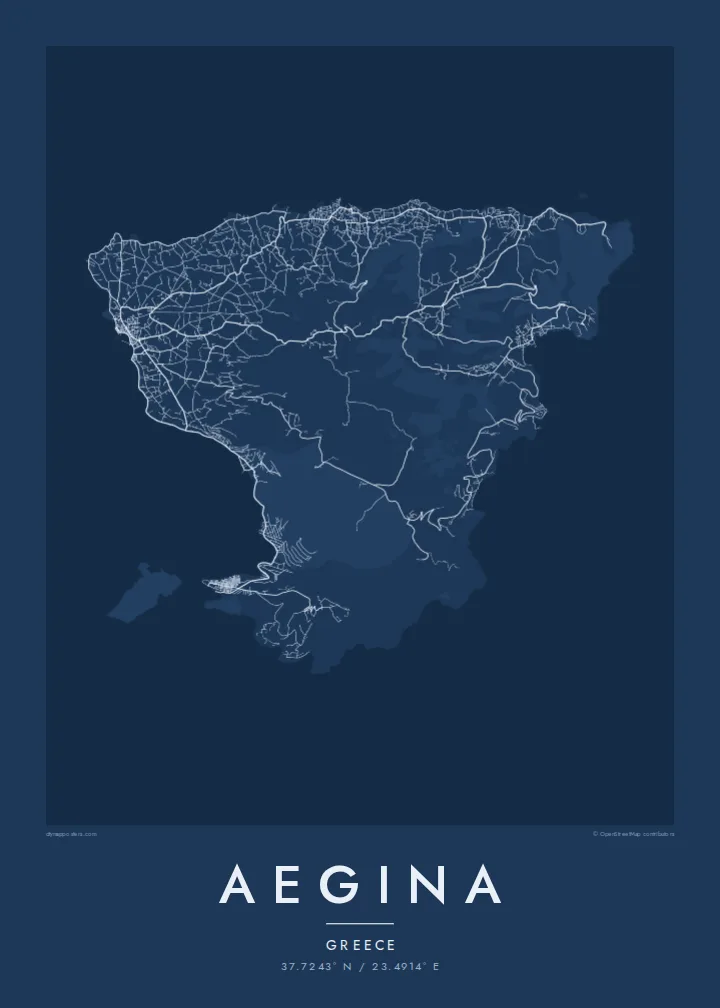
A triangular island in the Saronic Gulf, a harbour town on the west and a volcanic cone rising in the south



Inki magaala, konoy gaba
Qande inkih tibbixeeh derre baguley table. Kulli qande missoowa caagid—daabbisimta, dirbaabu-le kaadu HD fayla akah.
 Cagalah pixels · 24 × 36″ daabbi fayla
Maxxaacah qeeqa
Tama usuk cagalah daabbi faylak 100% qambaala. Kulli poster — daabbisimta, dirbaabu-le kaadu download geytimta — ni-server-ittal 300 DPI-l ederimta, 7,200 × 10,800 pixels fanah, tokkel iyyi ellee catoy 24 × 36″ daabbi baxsi bahisak raaqu.
Gidarih


Kaarta
Aegina lies in the Saronic Gulf, a short ferry ride from Piraeus, and is one of the closest islands to Athens. Its outline is roughly triangular, with a gently curving west coast and a rougher, steeper east. In the south the land rises to the cone of Mount Oros, an extinct volcano and the island's highest point, visible from far across the gulf.
Aegina Town, on the west coast, gathers around a harbour marked by the small white chapel of Agios Nikolaos. After independence the town served briefly as the first capital of modern Greece, and its neoclassical buildings date from that period. Just north of the harbour, the hill of Kolona keeps a single standing column from an ancient temple of Apollo.
Pistachio orchards cover much of the inland countryside, and Aegina's pistachios are among the best known in Greece. The Doric Temple of Aphaia stands on a pine-covered hill in the northeast and is one of the best-preserved temples of its era. An Aegina map poster traces the harbour town, the country roads between the orchards and the long climb toward Oros.
The main port on the west coast, where ferries from Piraeus arrive. The town's streets fan out behind the waterfront, the most detailed part of a map otherwise made of country roads.
An ancient Doric temple on a hilltop in the northeast, above the resort of Agia Marina. It looks out across the gulf toward Athens.
The volcanic cone in the south and the highest ground on the island. Roads stop short of the summit, so on the poster it appears as quiet, open space surrounded by coast.
Kok tanim ab
Ayro, migaq hinnay kok tan xagar osis; gaba, ballaqa hinnay xiqa soorris.
Free preview qansarissi kee watermark-le. Daabbisimtaan kee HD fayla 300 DPI-l, 7,200 × 10,800 px fanah, watermark maleh ederimta.
Macah Aegina
Aegina is close enough to Athens for weekend trips and summer houses, and many families have known it for generations. Its clean triangular outline, the harbour town and the orchard country inland make the map a fond keepsake for anyone who spent summers there.
Personalise the title and subtitle, perhaps with a family name or the year a house was bought, and adjust the coordinates line. Choose from five styles, from Classic black & white to Paper. The $9 download includes six print sizes, each as a 300 DPI PNG and a print-ready PDF.
Aegina poster orme| Maxxaacah ballaqa | Qeeqa | Faylal |
|---|---|---|
| 30 × 40 cm11.8 × 15.7″ | 3,543 × 4,724 px | PNG · PDF |
| 29.7 × 42 cm (A3)11.7 × 16.5″ | 3,508 × 4,961 px | PNG · PDF |
| 42 × 59.4 cm (A2)16.5 × 23.4″ | 4,961 × 7,016 px | PNG · PDF |
| 45.7 × 61 cm18 × 24″ | 5,400 × 7,200 px | PNG · PDF |
| 50 × 70 cm19.7 × 27.6″ | 5,906 × 8,268 px | PNG · PDF |
| 61 × 91.4 cm24 × 36″ | 7,200 × 10,800 px | PNG · PDF |
Tabbaltah, limo-wayta xaqqa-le ablo 900 px ballaqa le, asta le, iskiriinih keh tan. HD faylal gexsoh inkih addal 8× fanah qeeqa le, poster ballaqa inkih addal meqeh maxxaacimta.
Baxxaqqa qari le qandiy dooriy, tohuk lakal Daabbisimtah Poster — kutuk kee, faxximek, dirbaabu — hinnay HD Digital Fayla dooru. Checkout inki wagitti geytima, kaadu ku-orme page keenih adissa akke waqdi caagoy kummite.
Usuk 200 gsm-le catam kutuk warqatal, lica katiy caagitte $39-ik hane ayta 30 × 40 cm-ik 24 × 36″ fanah, xaagu keenil warreeh.
Ee. Sarrah-le dirbaabu doori — bad, gudduc, oak-le hinnay bad-madabuy. Usuk finqisiimam ellee sange qarab-le kaadu qari umukku iyya keenih taagu. Dirbaabu-le poster $99-ik hane, xaagu keenil warreeh.
Dirsa 60+ baaxoh bilsa. Poster kasa 30+ baaxoh nel print kaadu yan kee dirgeh kaxxa kee tanah printa, kee 3–7 xaqu ayyaamah yaaxigeeh. Xaaloo kee tracking "Ac Order" gexsitam. Kaadu baaxo 2–5 isbuuc yaaxigeeh, nanu dirsi yanin baaxoh sajiitah site ku kalah tekkeh.
Geytimeek 14 ayróy addal foto naah rubbaay, cisab-le daabbisiynah hinnay ku-lacay gacisnaah.
Ee. Tama page-l edito addal, migaaq, subtitle kee coordinates sarrah faxxem fanah badal, kaadu qande kee katiy doori. Daabbisimtah, dirbaabu-le kaadu digital orme inkih ku-design cagalah yekkelen.
$9 bacisak 300 DPI PNG kee daabbisimtah adissime PDF fayla lica katiy inkih, watermark maleh, ayyi meki daabbisimtah geeytitta. Cisab makkoysemty ana? Awqak, watermark-le free preview download-eh.
Xayyo
