The Xingu River
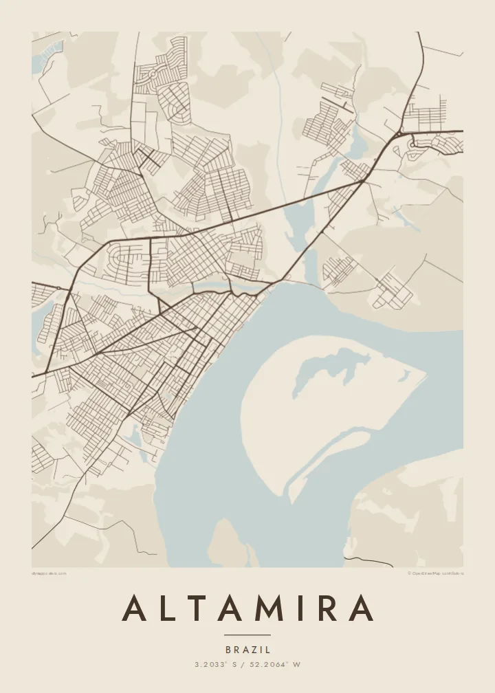
The river is broad and scattered with islands, filling a large part of the map with water and giving the city a strong natural edge.
Qeeqabak kaartah poster · Brazil
3.2033° S / 52.2064° W
A river city on the Xingu in the Brazilian Amazon, where a modest street grid meets a wide, island-scattered river.


Inki magaala, konoy gaba
Qande inkih tibbixeeh derre baguley table. Kulli qande missoowa caagid—daabbisimta, dirbaabu-le kaadu HD fayla akah.
 Cagalah pixels · 24 × 36″ daabbi fayla
Maxxaacah qeeqa
Tama usuk cagalah daabbi faylak 100% qambaala. Kulli poster — daabbisimta, dirbaabu-le kaadu download geytimta — ni-server-ittal 300 DPI-l ederimta, 7,200 × 10,800 pixels fanah, tokkel iyyi ellee catoy 24 × 36″ daabbi baxsi bahisak raaqu.
Gidarih


Kaarta
Altamira sits on the Xingu River in the state of Pará, deep in the Brazilian Amazon. The municipality is the largest in Brazil by area, yet the city itself is compact: a grid of streets set back from the riverbank, with the Xingu spreading wide beside it, broken by islands and channels that give the map an intricate watery edge.
The Trans-Amazonian Highway, built in the 1970s, passes through Altamira, and the city grew as a base along that road. More recently it became the nearest city to the Belo Monte hydroelectric project on the Xingu, which reshaped parts of the riverfront and pushed new neighbourhoods outward from the older centre.
An Altamira map poster places an orderly street plan beside one of the Amazon's great rivers. The water occupies much of the frame, and the roads leaving town head into the forest in long straight lines. It is a map about scale, about how small a city looks next to the landscape around it.
The river is broad and scattered with islands, filling a large part of the map with water and giving the city a strong natural edge.
Streets run in a fairly regular pattern back from the waterfront, with streams and low ground creating irregular gaps between the city's districts.
The highway leaves the city as a long, straight line into the interior, the road that first opened this part of Pará to settlement.
Kok tanim ab
Ayro, migaq hinnay kok tan xagar osis; gaba, ballaqa hinnay xiqa soorris.
Free preview qansarissi kee watermark-le. Daabbisimtaan kee HD fayla 300 DPI-l, 7,200 × 10,800 px fanah, watermark maleh ederimta.
Macah Altamira
Altamira means something specific to the people who live there, who arrived with the highway or the dam, or who grew up on the Xingu. The map records a frontier city that has changed quickly, and it holds up well as a large print where the river can dominate.
Name it as you like in the title, add a subtitle with a year, and keep the coordinates as a quiet reference. The five styles include Blueprint and Sand, both well suited to river maps. Printed posters ship from partners in more than 30 countries.
Altamira poster orme| Maxxaacah ballaqa | Qeeqa | Faylal |
|---|---|---|
| 30 × 40 cm11.8 × 15.7″ | 3,543 × 4,724 px | PNG · PDF |
| 29.7 × 42 cm (A3)11.7 × 16.5″ | 3,508 × 4,961 px | PNG · PDF |
| 42 × 59.4 cm (A2)16.5 × 23.4″ | 4,961 × 7,016 px | PNG · PDF |
| 45.7 × 61 cm18 × 24″ | 5,400 × 7,200 px | PNG · PDF |
| 50 × 70 cm19.7 × 27.6″ | 5,906 × 8,268 px | PNG · PDF |
| 61 × 91.4 cm24 × 36″ | 7,200 × 10,800 px | PNG · PDF |
Tabbaltah, limo-wayta xaqqa-le ablo 900 px ballaqa le, asta le, iskiriinih keh tan. HD faylal gexsoh inkih addal 8× fanah qeeqa le, poster ballaqa inkih addal meqeh maxxaacimta.
Baxxaqqa qari le qandiy dooriy, tohuk lakal Daabbisimtah Poster — kutuk kee, faxximek, dirbaabu — hinnay HD Digital Fayla dooru. Checkout inki wagitti geytima, kaadu ku-orme page keenih adissa akke waqdi caagoy kummite.
Usuk 200 gsm-le catam kutuk warqatal, lica katiy caagitte $39-ik hane ayta 30 × 40 cm-ik 24 × 36″ fanah, xaagu keenil warreeh.
Ee. Sarrah-le dirbaabu doori — bad, gudduc, oak-le hinnay bad-madabuy. Usuk finqisiimam ellee sange qarab-le kaadu qari umukku iyya keenih taagu. Dirbaabu-le poster $99-ik hane, xaagu keenil warreeh.
Dirsa 60+ baaxoh bilsa. Poster kasa 30+ baaxoh nel print kaadu yan kee dirgeh kaxxa kee tanah printa, kee 3–7 xaqu ayyaamah yaaxigeeh. Xaaloo kee tracking "Ac Order" gexsitam. Kaadu baaxo 2–5 isbuuc yaaxigeeh, nanu dirsi yanin baaxoh sajiitah site ku kalah tekkeh.
Geytimeek 14 ayróy addal foto naah rubbaay, cisab-le daabbisiynah hinnay ku-lacay gacisnaah.
Ee. Tama page-l edito addal, migaaq, subtitle kee coordinates sarrah faxxem fanah badal, kaadu qande kee katiy doori. Daabbisimtah, dirbaabu-le kaadu digital orme inkih ku-design cagalah yekkelen.
$9 bacisak 300 DPI PNG kee daabbisimtah adissime PDF fayla lica katiy inkih, watermark maleh, ayyi meki daabbisimtah geeytitta. Cisab makkoysemty ana? Awqak, watermark-le free preview download-eh.
