Zlatni Rat
Near Bol, a narrow pebble spit projects into the sea from the south coast, creating one of the most recognisable small shapes in the Adriatic.
Qeeqabak kaartah poster · Croatia
43.3239° N / 16.6538° E
A broad, stony Adriatic island facing Split, with harbour villages on its edges and a famous spit of beach to the south
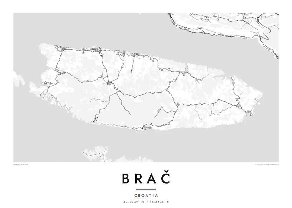


Inki magaala, konoy gaba
Qande inkih tibbixeeh derre baguley table. Kulli qande missoowa caagid—daabbisimta, dirbaabu-le kaadu HD fayla akah.
 Cagalah pixels · 24 × 36″ daabbi fayla
Maxxaacah qeeqa
Tama usuk cagalah daabbi faylak 100% qambaala. Kulli poster — daabbisimta, dirbaabu-le kaadu download geytimta — ni-server-ittal 300 DPI-l ederimta, 7,200 × 10,800 pixels fanah, tokkel iyyi ellee catoy 24 × 36″ daabbi baxsi bahisak raaqu.
Gidarih


Kaarta
Brač is the largest island in Dalmatia and one of the largest in Croatia, lying just across a narrow channel from Split. Its main town, Supetar, on the north coast, is where most ferries from the mainland arrive. The island is known across the region for its white limestone, quarried here since antiquity and used in buildings around the Adriatic, including Diocletian's Palace in Split.
From above, Brač is a wide, elongated shape running east to west, with settlements mostly around its edges. Small harbour towns sit in coves along the north coast, while the interior is a high plateau of stone, pines, olive groves and dry-stone walls. Vidova Gora, near the south coast, is the highest point on any Adriatic island.
A Brač map poster also shows the island's most famous shape: Zlatni Rat, near the town of Bol on the southern coast. This beach extends into the sea as a long, narrow spit of pebbles whose tip shifts with the wind and currents. On a black-and-white print, it reads as a small, precise point on the island's outline.
Near Bol, a narrow pebble spit projects into the sea from the south coast, creating one of the most recognisable small shapes in the Adriatic.
Supetar and a string of smaller villages sit in coves along the north coast, looking across the channel towards Split.
The interior is a high, open landscape of limestone, olive groves and dry-stone walls, crossed by only a few roads.
Kok tanim ab
Ayro, migaq hinnay kok tan xagar osis; gaba, ballaqa hinnay xiqa soorris.
Free preview qansarissi kee watermark-le. Daabbisimtaan kee HD fayla 300 DPI-l, 7,200 × 10,800 px fanah, watermark maleh ederimta.
Macah Brač
Brač is a summer island for many families, a first stop for travellers from Split and home to people with deep ties to its villages and quarries. A map of the island holds all of that in one clear, balanced shape.
Change the title, subtitle and coordinates line to mark a village, a boat or a summer, and choose from Classic black & white, Noir, Paper, Blueprint and Sand. Paper evokes the pale Brač stone especially well.
Brač poster orme| Maxxaacah ballaqa | Qeeqa | Faylal |
|---|---|---|
| 30 × 40 cm (11.8 × 15.7″) | 3,543 × 4,724 px | PNG · PDF |
| 29.7 × 42 cm (A3, 11.7 × 16.5″) | 3,508 × 4,961 px | PNG · PDF |
| 42 × 59.4 cm (A2, 16.5 × 23.4″) | 4,961 × 7,016 px | PNG · PDF |
| 45.7 × 61 cm (18 × 24″) | 5,400 × 7,200 px | PNG · PDF |
| 50 × 70 cm (19.7 × 27.6″) | 5,906 × 8,268 px | PNG · PDF |
| 61 × 91.4 cm (24 × 36″) | 7,200 × 10,800 px | PNG · PDF |
Tabbaltah, limo-wayta xaqqa-le ablo 900 px ballaqa le, asta le, iskiriinih keh tan. HD faylal gexsoh inkih addal 8× fanah qeeqa le, poster ballaqa inkih addal meqeh maxxaacimta.
Baxxaqqa qari le qandiy dooriy, tohuk lakal Daabbisimtah Poster — kutuk kee, faxximek, dirbaabu — hinnay HD Digital Fayla dooru. Checkout inki wagitti geytima, kaadu ku-orme page keenih adissa akke waqdi caagoy kummite.
Usuk 200 gsm-le catam kutuk warqatal, lica katiy caagitte {printFrom}-ik hane ayta 30 × 40 cm-ik 24 × 36″ fanah, xaagu keenil warreeh.
Ee. Sarrah-le dirbaabu doori — bad, gudduc, oak-le hinnay bad-madabuy. Usuk finqisiimam ellee sange qarab-le kaadu qari umukku iyya keenih taagu. Dirbaabu-le poster {framedFrom}-ik hane, xaagu keenil warreeh.
Xaagu addunyal inkih cisab-le. Kulli poster 30+ ummattak ni-daabbi-mara mananih xayyoysa kaadu 3–7 caagu-ayróh fanah geeytima. Ku-orme kee xaagu tarikiy My Orders addal ablitta.
Geytimeek 14 ayróy addal foto naah rubbaay, cisab-le daabbisiynah hinnay ku-lacay gacisnaah.
Ee. Tama page-l edito addal, migaaq, subtitle kee coordinates sarrah faxxem fanah badal, kaadu qande kee katiy doori. Daabbisimtah, dirbaabu-le kaadu digital orme inkih ku-design cagalah yekkelen.
$9 bacisak 300 DPI PNG kee daabbisimtah adissime PDF fayla lica katiy inkih, watermark maleh, ayyi meki daabbisimtah geeytitta. Cisab makkoysemty ana? Awqak, watermark-le free preview download-eh.
Xayyo
