Highway 101 diagonal
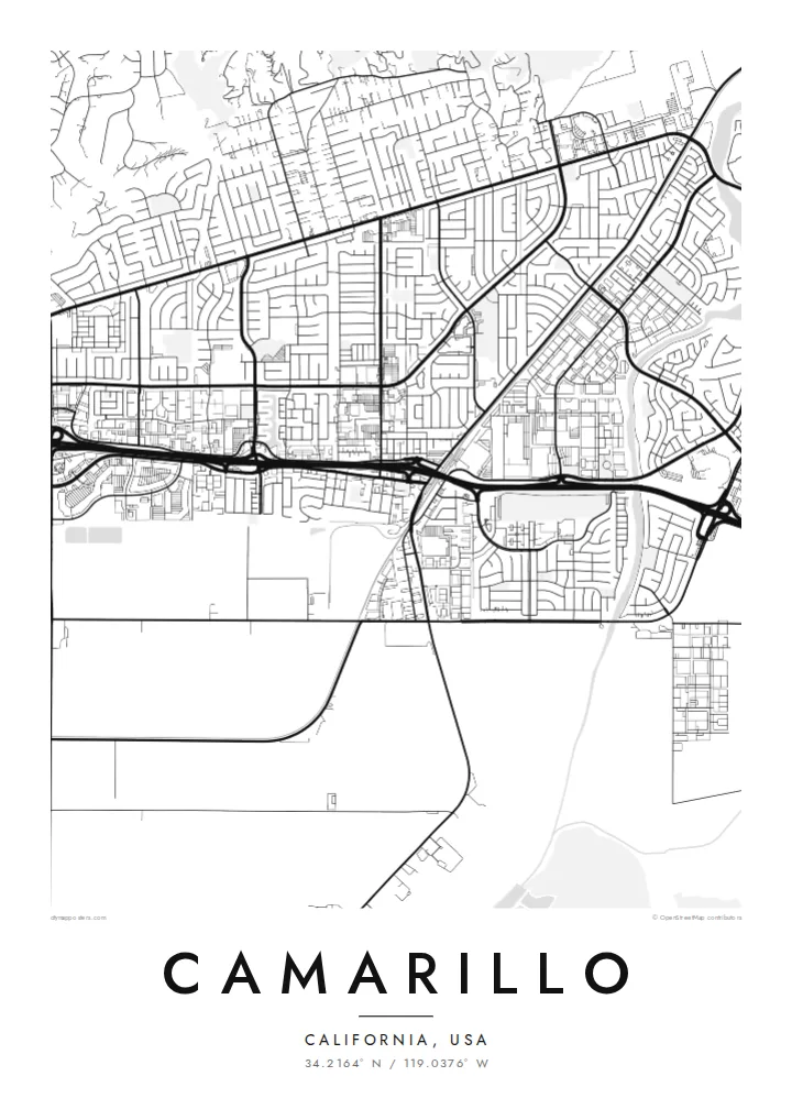
The freeway crosses the city from northwest to southeast. Its interchanges and frontage roads make the strongest geometric marks on the poster.
Qeeqabak kaartah poster · United States
34.2164° N / 119.0376° W
Curving suburban streets on the Oxnard Plain, cut by Highway 101 and bounded by hills to the east


Inki magaala, konoy gaba
Qande inkih tibbixeeh derre baguley table. Kulli qande missoowa caagid—daabbisimta, dirbaabu-le kaadu HD fayla akah.
 Cagalah pixels · 24 × 36″ daabbi fayla
Maxxaacah qeeqa
Tama usuk cagalah daabbi faylak 100% qambaala. Kulli poster — daabbisimta, dirbaabu-le kaadu download geytimta — ni-server-ittal 300 DPI-l ederimta, 7,200 × 10,800 pixels fanah, tokkel iyyi ellee catoy 24 × 36″ daabbi baxsi bahisak raaqu.
Gidarih


Kaarta
Camarillo sits where the flat Oxnard Plain rises into the Santa Monica Mountains and the Conejo Grade. On the map you can see that shift clearly. In the west and south the streets form straight farm-country lines and a large airport, while to the north and east the neighbourhoods curve with the slopes into cul-de-sacs and loops.
The city is named after the Camarillo family, whose ranch covered much of this land in the nineteenth century. Adolfo Camarillo's white horses are still a local emblem. The airport started as a military airfield. Just south of the city, the former Camarillo State Hospital has become the campus of California State University Channel Islands.
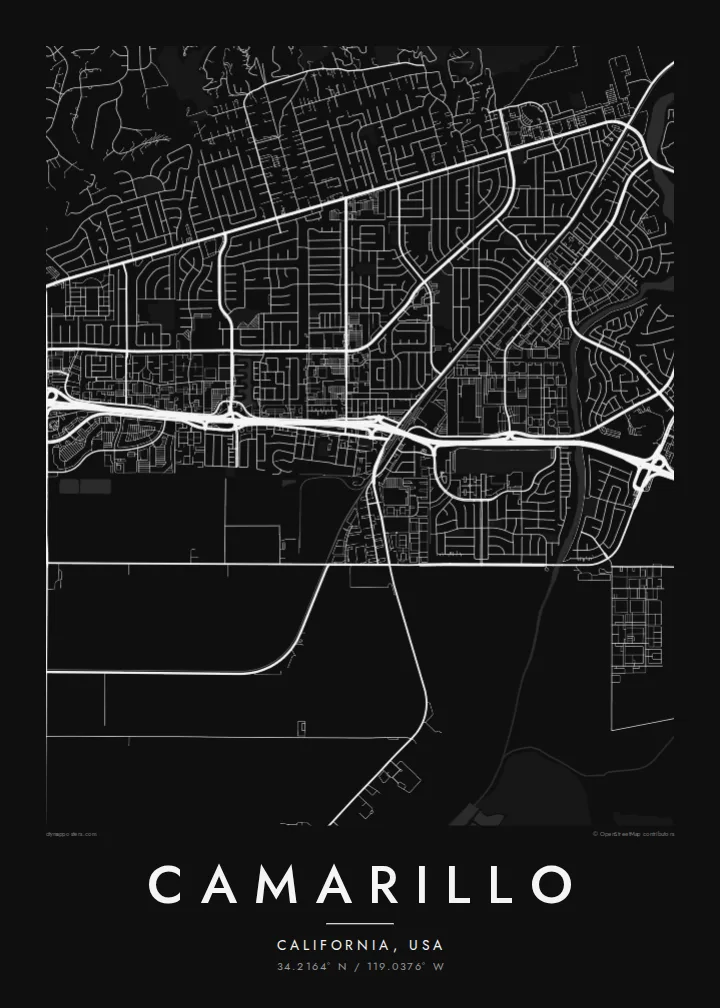
A Camarillo map poster centres on Highway 101, which crosses the city diagonally and draws a firm line through the suburban pattern. On one side sit the outlets and business parks, on the other the older town centre. Around both, a quiet border of fields and ridgelines closes the frame.
The freeway crosses the city from northwest to southeast. Its interchanges and frontage roads make the strongest geometric marks on the poster.
On the western plain, the long straight runway of Camarillo Airport stands out against the curving residential streets. It is a leftover from the field's military past.
In the northern and eastern neighbourhoods the streets follow the rising ground in arcs and dead ends. That gives this part of the map a softer, contour-like texture.
Kok tanim ab
Ayro, migaq hinnay kok tan xagar osis; gaba, ballaqa hinnay xiqa soorris.
Free preview qansarissi kee watermark-le. Daabbisimtaan kee HD fayla 300 DPI-l, 7,200 × 10,800 px fanah, watermark maleh ederimta.
Macah Camarillo
Camarillo attracts people who wanted a quieter base between Los Angeles and Santa Barbara, including families, veterans, students and commuters. A clean map of their neighbourhood is a restrained way to mark where their life in Ventura County took root.
You can personalise the title with a street name, a move-in date or the coordinates of a first home, and print it in Classic black & white, Noir, Paper, Blueprint or Sand. There is a free watermarked preview before you buy the $9 HD files.
Camarillo poster orme| Maxxaacah ballaqa | Qeeqa | Faylal |
|---|---|---|
| 30 × 40 cm11.8 × 15.7″ | 3,543 × 4,724 px | PNG · PDF |
| 29.7 × 42 cm (A3)11.7 × 16.5″ | 3,508 × 4,961 px | PNG · PDF |
| 42 × 59.4 cm (A2)16.5 × 23.4″ | 4,961 × 7,016 px | PNG · PDF |
| 45.7 × 61 cm18 × 24″ | 5,400 × 7,200 px | PNG · PDF |
| 50 × 70 cm19.7 × 27.6″ | 5,906 × 8,268 px | PNG · PDF |
| 61 × 91.4 cm24 × 36″ | 7,200 × 10,800 px | PNG · PDF |
Tabbaltah, limo-wayta xaqqa-le ablo 900 px ballaqa le, asta le, iskiriinih keh tan. HD faylal gexsoh inkih addal 8× fanah qeeqa le, poster ballaqa inkih addal meqeh maxxaacimta.
Baxxaqqa qari le qandiy dooriy, tohuk lakal Daabbisimtah Poster — kutuk kee, faxximek, dirbaabu — hinnay HD Digital Fayla dooru. Checkout inki wagitti geytima, kaadu ku-orme page keenih adissa akke waqdi caagoy kummite.
Usuk 200 gsm-le catam kutuk warqatal, lica katiy caagitte $39-ik hane ayta 30 × 40 cm-ik 24 × 36″ fanah, xaagu keenil warreeh.
Ee. Sarrah-le dirbaabu doori — bad, gudduc, oak-le hinnay bad-madabuy. Usuk finqisiimam ellee sange qarab-le kaadu qari umukku iyya keenih taagu. Dirbaabu-le poster $99-ik hane, xaagu keenil warreeh.
Dirsa 60+ baaxoh bilsa. Poster kasa 30+ baaxoh nel print kaadu yan kee dirgeh kaxxa kee tanah printa, kee 3–7 xaqu ayyaamah yaaxigeeh. Xaaloo kee tracking "Ac Order" gexsitam. Kaadu baaxo 2–5 isbuuc yaaxigeeh, nanu dirsi yanin baaxoh sajiitah site ku kalah tekkeh.
Geytimeek 14 ayróy addal foto naah rubbaay, cisab-le daabbisiynah hinnay ku-lacay gacisnaah.
Ee. Tama page-l edito addal, migaaq, subtitle kee coordinates sarrah faxxem fanah badal, kaadu qande kee katiy doori. Daabbisimtah, dirbaabu-le kaadu digital orme inkih ku-design cagalah yekkelen.
$9 bacisak 300 DPI PNG kee daabbisimtah adissime PDF fayla lica katiy inkih, watermark maleh, ayyi meki daabbisimtah geeytitta. Cisab makkoysemty ana? Awqak, watermark-le free preview download-eh.
