The Gond ramparts
The historic wall and its gates still shape the street pattern, leaving a clear ring of older, tighter lanes at the centre of the modern city.
Qeeqabak kaartah poster · India
19.9508° N / 79.2952° E
An old walled town between two small rivers, its stone circuit still traced by roads that loop the historic core.


Inki magaala, konoy gaba
Qande inkih tibbixeeh derre baguley table. Kulli qande missoowa caagid—daabbisimta, dirbaabu-le kaadu HD fayla akah.
 Cagalah pixels · 24 × 36″ daabbi fayla
Maxxaacah qeeqa
Tama usuk cagalah daabbi faylak 100% qambaala. Kulli poster — daabbisimta, dirbaabu-le kaadu download geytimta — ni-server-ittal 300 DPI-l ederimta, 7,200 × 10,800 pixels fanah, tokkel iyyi ellee catoy 24 × 36″ daabbi baxsi bahisak raaqu.
Gidarih


Kaarta
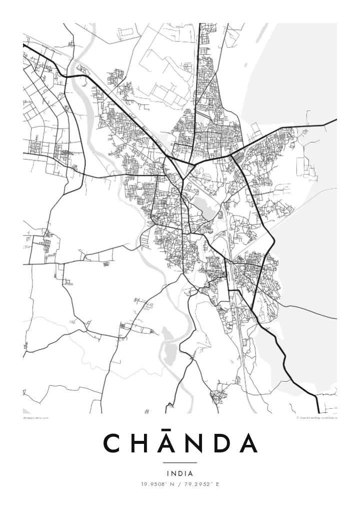
Chānda, officially Chandrapur, grew up inside a long stone wall built under the Gond kings who ruled this part of eastern Maharashtra. On a map the old town still shows that outline: a rough loop of roads following the line of the ramparts, with gateways where traffic squeezes through and denser lanes packed inside. Newer districts spread outward in looser blocks on every side.
Water frames the town to the west and east. The Erai River runs down its western edge and the smaller Zarpat stream passes the eastern side, so the built-up area sits on the higher ground between two thin blue lines. Rail tracks and highways cut across the plain, and broad industrial sites mark the power station and coal workings that made the district's name.
A Chānda map poster reduces all of this to line and space: the curve of the old wall, the river channels, the rail spur and the grid of the newer colonies. Beyond the frame lies the teak forest of Tadoba-Andhari Tiger Reserve, one of Maharashtra's best-known wildlife areas, which gives the town a reputation that reaches well past its coal and cement.
The historic wall and its gates still shape the street pattern, leaving a clear ring of older, tighter lanes at the centre of the modern city.
The Erai runs along the western side of town, a narrow river line that gives the map a firm boundary and a sense of direction.
Large rectangular footprints of the thermal power station and mining areas sit on the fringes, contrasting sharply with the fine grain of the old town.
Kok tanim ab
Ayro, migaq hinnay kok tan xagar osis; gaba, ballaqa hinnay xiqa soorris.
Free preview qansarissi kee watermark-le. Daabbisimtaan kee HD fayla 300 DPI-l, 7,200 × 10,800 px fanah, watermark maleh ederimta.
Macah Chānda
People from Chandrapur often carry the old town in their heads as a set of gates and turns. A framed map puts that memory on the wall, whether it marks a family home, a first posting, or a stop on the way to the tiger reserve.
The title, subtitle and coordinates line can be changed to a name, a date or a phrase. Choose Classic black & white, Noir, Paper, Blueprint or Sand, download the HD files for $9, or order a matte print with an optional wooden frame.
Chānda poster orme| Maxxaacah ballaqa | Qeeqa | Faylal |
|---|---|---|
| 30 × 40 cm (11.8 × 15.7″) | 3,543 × 4,724 px | PNG · PDF |
| 29.7 × 42 cm (A3, 11.7 × 16.5″) | 3,508 × 4,961 px | PNG · PDF |
| 42 × 59.4 cm (A2, 16.5 × 23.4″) | 4,961 × 7,016 px | PNG · PDF |
| 45.7 × 61 cm (18 × 24″) | 5,400 × 7,200 px | PNG · PDF |
| 50 × 70 cm (19.7 × 27.6″) | 5,906 × 8,268 px | PNG · PDF |
| 61 × 91.4 cm (24 × 36″) | 7,200 × 10,800 px | PNG · PDF |
Tabbaltah, limo-wayta xaqqa-le ablo 900 px ballaqa le, asta le, iskiriinih keh tan. HD faylal gexsoh inkih addal 8× fanah qeeqa le, poster ballaqa inkih addal meqeh maxxaacimta.
Baxxaqqa qari le qandiy dooriy, tohuk lakal Daabbisimtah Poster — kutuk kee, faxximek, dirbaabu — hinnay HD Digital Fayla dooru. Checkout inki wagitti geytima, kaadu ku-orme page keenih adissa akke waqdi caagoy kummite.
Usuk 200 gsm-le catam kutuk warqatal, lica katiy caagitte {printFrom}-ik hane ayta 30 × 40 cm-ik 24 × 36″ fanah, xaagu keenil warreeh.
Ee. Sarrah-le dirbaabu doori — bad, gudduc, oak-le hinnay bad-madabuy. Usuk finqisiimam ellee sange qarab-le kaadu qari umukku iyya keenih taagu. Dirbaabu-le poster {framedFrom}-ik hane, xaagu keenil warreeh.
Xaagu addunyal inkih cisab-le. Kulli poster 30+ ummattak ni-daabbi-mara mananih xayyoysa kaadu 3–7 caagu-ayróh fanah geeytima. Ku-orme kee xaagu tarikiy My Orders addal ablitta.
Geytimeek 14 ayróy addal foto naah rubbaay, cisab-le daabbisiynah hinnay ku-lacay gacisnaah.
Ee. Tama page-l edito addal, migaaq, subtitle kee coordinates sarrah faxxem fanah badal, kaadu qande kee katiy doori. Daabbisimtah, dirbaabu-le kaadu digital orme inkih ku-design cagalah yekkelen.
$9 bacisak 300 DPI PNG kee daabbisimtah adissime PDF fayla lica katiy inkih, watermark maleh, ayyi meki daabbisimtah geeytitta. Cisab makkoysemty ana? Awqak, watermark-le free preview download-eh.
